From Gordon’s Weather Center (2/6/20):
Well, just how much rain did we get in the 48 hour period – Tuesday Feb. 4th to Thursday Feb. 6th? It was impressive…
Tillamook 6.95″
Tierra Del Mar 5.91″
Manzanita 4.46″
Pacific City 4.37″
Astoria 3.06″
Oceanside 2.75
In the Coast Range:
Nehalem 6.69″
Mt. Hebo 3.66″
Lees Camp 3.10″
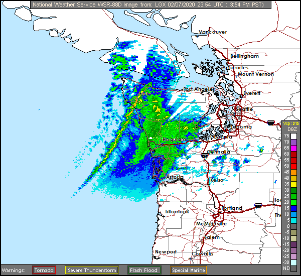
And the rain has continued with some breaks, and as Gordon’s most recent satellite picture shows, above the next front is poised off the coast. It will be another wet night.
The FLOOD WARNING continues, and a HIGH SURF WARNING (King Tides) have been issued as well.
There are multiple slides and street closures due to high water:
Tillamook County Roads – Public Works
UPDATE 7:30AM 02/07/2020: Slide blocking one lane on Lommen Road, Sandlake Road at MP 9 one lane due to high water. Still areas with high water throughout the county road system. Thank you.
UPDATE 4:00AM 02/07/2020: Slides cleared on Trask River Road, Bayocean and Upper Nestucca Road (Blaine). Still areas with high water throughout the county road system. Thank you.
County Roads as of 10:15am 02/06/2020.
Slide on Bayocean Road blocking both lanes by the boat launch; Kilchis River Road small slide by the Kilchis Park. Tillamook River Road by the Blaser Bridge to State Hwy 101 is closed due to high water as is Weber Road. High water reported on Miami River Road, Trask River Road, Burton Fraser Road, Hughey Lane, Hummingbird Lane, McCormick Loop Road, Marolf Loop Road/12th Street, Sandlake Road by Reneke Creek, Brickyard Road by Long Prairie Road, Vaughn Road, Alderbrook Loop, Beeswax and Fairview Road.
Update 10:35am 02/06/2020: Slide on Trask River Road by MP 6 blocking one lane.
Update 3:00pm 02/06/2020: Slide on Upper Nestucca Road (Blaine) at MP 12 blocking both lanes.
Coastal Flood Advisory until 07:00PM Saturday
* WHAT….High surf and tidal overflow flooding expected.
* WHERE…North Oregon Coast.
* WHEN…Until 7 PM PST Saturday.
* IMPACTS…A total tide approaching 10 ft will occur at high tide. This will generate flooding of low areas near the coast. Historically, similar conditions in the past have resulted in the minor flooding of Highway 101 near Seaside, Nehalem, and/or Tillamook. Water has covered parts of Frazier Rd, Miami Foley Rd at milepost 1, as well as the intersection near Alderbrook and Possetti road.
* ADDITIONAL DETAILS…Keep away from large logs on the beach. Sneaker waves can run up on the beach lifting or rolling these extremely heavy logs. People have been injured after being caught under these logs from sneaker wave action.
* AFFECTED AREAS: NORTH OREGON COAST
Instructions:
A High Surf Advisory means that high surf will affect beaches in the advisory area, producing rip currents, sneaker waves and localized beach erosion. A Coastal Flood Advisory means that tidal overflow flooding is expected. Coastal residents in the warned area should be alert for rising water, and take appropriate action to protect life and property.
High Surf Advisory until 07:00PM Saturday
* WHAT….High surf and tidal overflow flooding expected.
* WHERE…North Oregon Coast.
* WHEN…Until 7 PM PST Saturday.
* IMPACTS…A total tide approaching 10 ft will occur at high tide. This will generate flooding of low areas near the coast. Historically, similar conditions in the past have resulted in the minor flooding of Highway 101 near Seaside, Nehalem, and/or Tillamook. Water has covered parts of Frazier Rd, Miami Foley Rd at milepost 1, as well as the intersection near Alderbrook and Possetti road.
* ADDITIONAL DETAILS…Keep away from large logs on the beach. Sneaker waves can run up on the beach lifting or rolling these extremely heavy logs. People have been injured after being caught under these logs from sneaker wave action.
* AFFECTED AREAS: NORTH OREGON COAST
Instructions:
A High Surf Advisory means that high surf will affect beaches in the advisory area, producing rip currents, sneaker waves and localized beach erosion. A Coastal Flood Advisory means that tidal overflow flooding is expected. Coastal residents in the warned area should be alert for rising water, and take appropriate action to protect life and property.