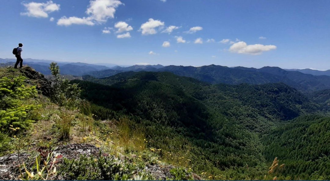
In Tillamook County, the problem isn’t finding a place to enjoy the outdoors but rather that there are too many places to choose from. With hundreds of beach access points, dozens of parks and day use areas, over 40 boat launches, and over 200 miles of trails, how do you find the right park or the right trail for you?
Most people look for recreation information on the internet. However, in Tillamook County, it’s usually not that simple to find what you’re looking for. Multiple land management agencies, each with their own website and map, offer different types of recreation in different places. Anyone looking for a trail to hike must check 4 or 5 different websites to get a good idea of what is available. Trying to dig up all the facts on parking, entry fees, and restrooms could make anyone feel like they need a degree in investigative journalism. Even finding the local park in your own town can be difficult without a knowledgeable neighbor to share local information.
In fact, this is a problem for more than just visitors and locals. It’s also a problem for the towns, the county, and even the state and federal land management agencies. The Access to Physical Activity Committee (APAC) was formed as part of Tillamook County Wellness to focus on bringing the benefits of movement and physical health to more people. The committee brought together a wide variety of community, industry, and agency partners to try to understand and overcome the challenges that people in Tillamook County face when they are trying to be more physically active.
APAC recognized three major problems with lack of information in Tillamook County:
- Recreation information was scattered and separated by type, land owner, and availability. Each agency or organization had separate websites and separate maps. Trying to find a trail required searching through multiple sites.
- Recreation information was incomplete and not available online. Local resources had never been added to websites. Details such as parking, restrooms, and pet-friendliness were not included in descriptions of parks and trails.
- Recreation information is outdated and incorrect. Without regular updates, information on many websites was not always current.
Tillamook County needed a comprehensive, interactive map that would show all of the recreation and trail resources in the entire county; including every agency, landowner, and land manager. The map would be an all-inclusive experience that would give visitors and locals all of the information they needed with a simple click; restrooms, parking, pet-friendliness, fees, amenities, and more. This map would have the most accurate and up-to-date information about the recreation opportunities available in Tillamook County.
In the fall of 2019, TCW, together with Visit Tillamook Coast, The Northwest Youth Corps (NYC), and the USFS Siuslaw National Forest had put together the funding and the cooperative network necessary to hire an intern specifically to work on their ambitious mapping project for 6 months. In January of 2020, the Access to Physical Activity Committee welcomed me as their new intern to the project. I began work on the project right away and together we planned to finish it in a year, an ambitious but achievable goal.
The working theme of the map project was “More information is always better,” and it made sense to apply that to the data collection process. I had to consider what kind of information would be needed to make this map useful to outdoor enthusiasts as well as to agency land managers. What questions would people be asking when they looked to this new map for answers?
Some things were easy to guess such as noting which recreation sites had a restroom, how much parking was available, and whether dogs were allowed. However, we decided to gather even more information about each site and to include high-quality pictures to help people know what to expect. In the end, the list of attributes to include in the data collection was long and encompassed every type of recreation we could imagine. Attributes included categories such as Status (open, closed, unknown, etc.), Features (ocean view, old growth forest, sand dunes, etc.), Facilities (picnic table, fire ring, bench, etc.), Activities, (camping, hiking, beach access, etc.) and many more.
In the spring of 2020, I began identifying all of the recreation sites and trails located in Tillamook County. I would need to personally visit each one to gather data for the map project. Using the data I’d received from several agencies back at the beginning of 2020 as a baseline, I added new trails, new recreation sites, and new information to the map. It was exciting to see the visual representation of how our knowledge about Tillamook County was increasing.
The map had so much potential to help the county improve its recreation and trails projects and to improve access to outdoor recreation for everyone that APAC decided to advocate for a new full-time position to keep the momentum going; Outdoor Recreation Community Coordinator. This would create a dedicated position to manage and update the map, maintain and increase communication and coordination between the partners, and work towards creating a balanced and fully-realized recreation network in Tillamook County that would provide improved access to everyone.
The future of the Community Coordinator role is still under consideration, but APAC is confident that it will go forward. The map will be fully transformed into its new web format and publicly available by early summer of 2021, just in time for everyone to get outdoors and enjoy the sunshine on the beautiful Oregon Coast in Tillamook County.
The new map will be featured on the Tillamookcoast.com website soon. In the meantime, you can discover great places to get active on the Tillamook County Wellness website under the Move Well tab.
And for more details and photos, check out the full story written by Samantha Goodwin, “Tillamook; Outdoors (A Summary): How A Map Brought A Community Together”
For more local health and wellness information, follow Tillamook County Wellness on Facebook, Instagram and Twitter or the website at www.tillamookcounthywellness.org.