Menu
  • Home
  • Breaking News
  • Feature
    • Arts
    • Astrology
    • Business
    • Community
    • Employment
    • Event Stories
    • From the Pioneer
    • Government
    • Letters to the Editor
    • Non Profit News
    • Obituary
    • Public Safety
    • Podcast Interview Articles
    • Pioneer Pulse Podcast: Politics, Palette, and Planet – the Playlist
  • Weather
  • Guest Column
    • Perspectives
    • Don Backman Photos
    • Ardent Gourmet
    • Kitchen Maven
    • I’ve been thinking
    • Jim Heffernan
    • The Littoral Life
    • Neal Lemery
    • View From Here
    • Virginia Carrell Prowell
    • Words of Wisdom
  • Things to do
    • Calendar
    • Tillamook County Parks
    • Tillamook County Hikes
    • Whale Watching
    • Tillamook County Library
    • SOS Community Calendar
  • About
    • Contribute
    • Advertise
    • Subscribe
    • Opt-out preferences
  • Post Submission Test
  • Search...
Menu

New online GIS-enabled map details Tillamook County’s trails and outdoor recreation areas

Posted on June 15, 2021June 15, 2021 by Editor

EDITOR’s NOTE: A collaborative project between Tillamook County Wellness, the U.S. Forest Service/Hebo Ranger Station and Tillamook Coast Visitors Association has produced an interactive, live map of all types of outdoor recreation assets to provide better access and information. Be sure to check out the Pioneer’s local hiking enthusiast, “Outback with Backman” as he checks out this new option for exploring in Tillamook County.

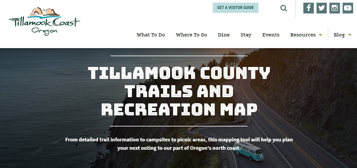
Tillamook County offers a bounty of outdoor recreation – fishing, hiking, kayaking, camping, surfing, birdwatching, horseback riding, mountain biking, even just hanging out on the beach. Now, with a new online GIS trails and recreation map, it’s easy to plan a trip, do the things you love, and discover new places to do them.

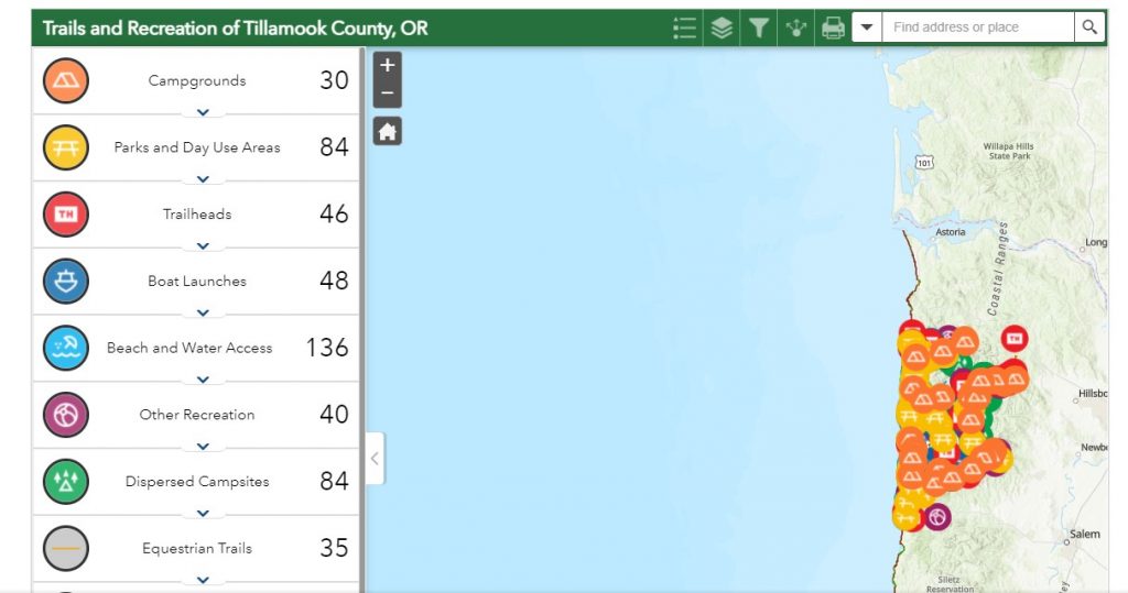
The GIS map is at https://tillamookcoast.com/recreation-map and includes downloadable area maps if a person will be in an area without cell service. The GIS map lists more than 800 locations in 13 categories: campgrounds, parks and day use areas, trailheads, boat launches, beach and water access, dispersed campsites, equestrian trails, mountain bike trails, hiking trails, community trails, the Oregon Coast Trail, water trails, and other recreation.

“This recreation map is a ‘live map,’ one we’ll be updating with new features and data,” said Nan Devlin, executive director of Tillamook Coast Visitors Association. “We will also regularly gather information from our land managers and first responders throughout the county to keep the public informed of events, such as fires, trail changes or closures, King Tides and floods.”

The GIS project is a collaborative effort of Tillamook County Wellness, Mt. Hebo Ranger Station, Tillamook County, Tillamook Coast Visitors Association, and New Youth Corps, which oversaw the intern, Samantha Goodwin, who gathered the database. Cardwell Creative of Salem transformed the data into a user-friendly website page.

Just click on an area of the map and a pop-up window provides information about each recreation site. Additional features will be added in the next few months, and there is a form on the website where recreation users can provide information. There are also links to public transportation, beach wheelchair reservations, and a page about prime birdwatching areas.

For more trip planning ideas, order or download a visitor guide at https://tillamookcoast.com/gettheguide. And as you explore the great outdoors in Tillamook County, please do so safely, be sure to take our Tillamook Coast Pledge – go to https://tillamookcoast.com/caring-for-our-coast

Featured Video

Slide Contribute SUBSCRIBE

Tillamook Weather

Tides

Tillamook County Pioneer Podcast Series

Tillamook Church Search

Cloverdale Baptist Church
Nestucca Valley Presbyterian
Tillamook Ecumenical Service

Archives

  • Home
  • EULA Privacy Policy
  • Contact
  • Opt-out preferences
  • Search...
Share on facebook
Facebook
Share on pinterest
Pinterest
Share on twitter
Twitter
Share on linkedin
Linkedin
Catherine

Recent Posts

  • Tillamook FFA Excels in State Career Development Events: Two Teams Headed to Nationals

    May 12, 2025
  • Tillamook Police Department Invites Community for Coffee with a Cop May 14th

    May 12, 2025
  • GORDON'S WEEKLY WEATHER UPDATE 5/12/25: Showery Pattern Continues Through Week

    May 12, 2025
©2025 | Theme by SuperbThemes

Manage Cookie Consent
To provide the best experiences, we use technologies like cookies to store and/or access device information. Consenting to these technologies will allow us to process data such as browsing behavior or unique IDs on this site. Not consenting or withdrawing consent, may adversely affect certain features and functions.
Functional Always active
The technical storage or access is strictly necessary for the legitimate purpose of enabling the use of a specific service explicitly requested by the subscriber or user, or for the sole purpose of carrying out the transmission of a communication over an electronic communications network.
Preferences
The technical storage or access is necessary for the legitimate purpose of storing preferences that are not requested by the subscriber or user.
Statistics
The technical storage or access that is used exclusively for statistical purposes. The technical storage or access that is used exclusively for anonymous statistical purposes. Without a subpoena, voluntary compliance on the part of your Internet Service Provider, or additional records from a third party, information stored or retrieved for this purpose alone cannot usually be used to identify you.
Marketing
The technical storage or access is required to create user profiles to send advertising, or to track the user on a website or across several websites for similar marketing purposes.
Manage options Manage services Manage {vendor_count} vendors Read more about these purposes
View preferences
{title} {title} {title}