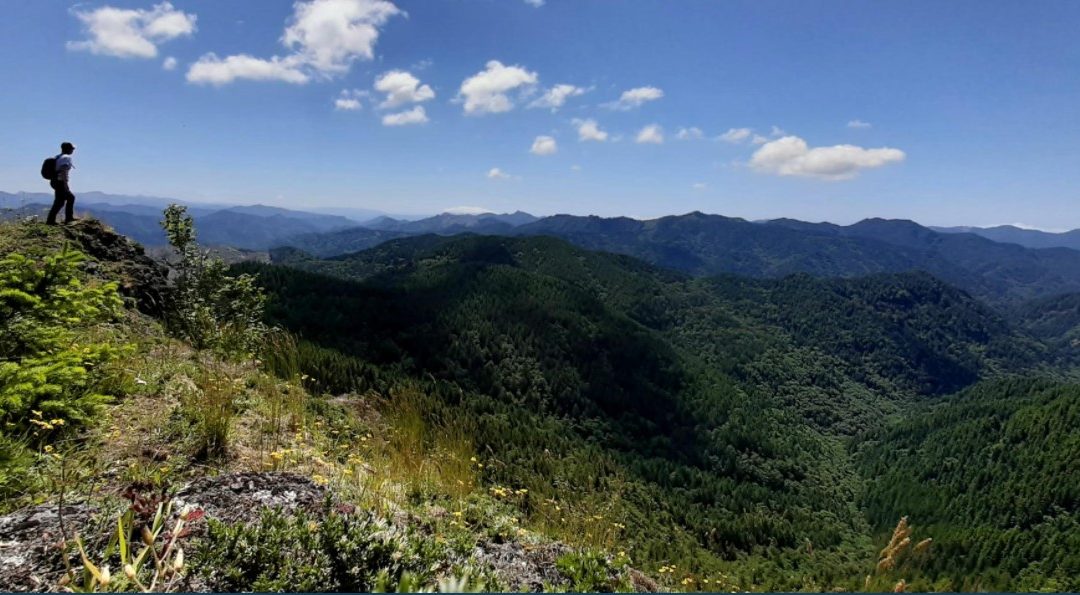
EDITOR’S NOTE: Here’s our local hiking expert’s review of the new Tillamook County Trails and Recreation map available on the Visit Tillamook Coast website, a collaborative effort with Tillamook County Wellness, the US Forest Service and Tillamook County that included mapping all the outdoor assets available in Tillamook County. The map also allows users to provide updates and will be regularly updated. Kudos to Samantha Goodwin and all those that helped make this amazing, valuable resource available.
 By Don Backman, for the Tillamook County Pioneer
Good news! The much-awaited Tillamook County Trails and Recreation Map is now live! This map a winner. For the first time, everything is in one place and easy to find. Instead of doing internet searching and having to look at multiple locations, you can find information on outdoor activities such as kayaking, camping, bird watching, picnicking, hiking, and more all in one location.
The beauty of this map is it simplifies finding where to go. For example, if one wanted a smooth water kayaking location, one can go to https://tillamookcoast.com/recreation-map/ and load the map, and there it is.
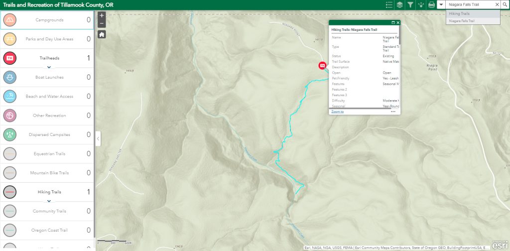
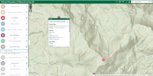
In order to evaluate the map, I used my laptop to search for a trail I hiked this spring. Clicking on Launch Map in Full Screen, located at the bottom of the embedded map, opens a second browser window with a larger map view. Quickly entering Niagara into the search box in the upper right-hand corner immediately produced choices between Niagara Falls Trail and the Niagara Falls trailhead. A click on Niagara Falls Trail sent the app zooming right up to the trail. Impressive.
Clicking on the trailhead icon opens an information box with information about the trail such as surface (dirt), status (open) percent grade (steepness), and length, among many items. It also has links to photos. A second click on the trail opened the same box but with slightly different into. It is worth looking at both the trailhead and trail information boxes.
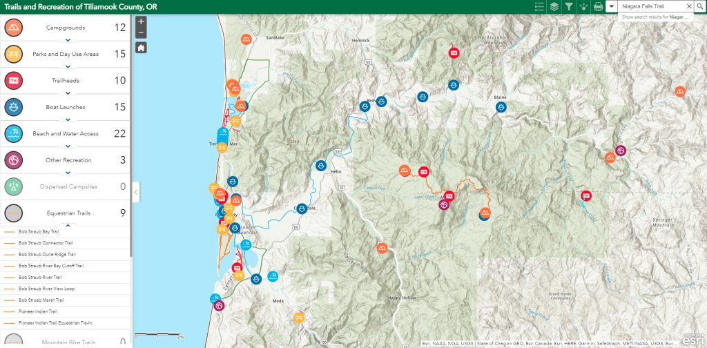
Another way of searching is to use the list in the left column to search for the activity you are looking for. This list only shows what is currently visible on the map, so you’ll have to zoom in a bit and click and drag the map to the area you’re looking in. On my Windows machine, the mouse scroll wheel controls zoom in and out, and click and drag moves the map area around.
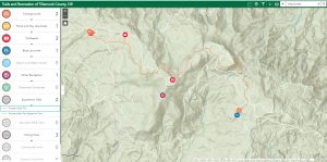
I zoomed into South County and clicked on equestrian trail. A list opened. The Pioneer Indian Trail Tie-In looked interesting. That link highlighted the trailhead on the map and opened the information box. Panning over and zooming is needed to see it closer. An easier option is to click on the Zoom To link in the information box. This will zoom right in. Once again, clicking on the trailhead and the trail produced relevant information. A click on the link to Mt. Hebo opened the relevant trail information page on the Forest Service website. Slick.
Next, I searched for Angora Peak but in this case, there were no results. Angora Peak is located in Clatsop County just over the county line. It would be nice if at some point an update could show nearby trails, but that is mere quibbling. This map is an amazingly complete work.
As part of evaluating the Tillamook County Trails and Recreation Map, I selected several trails and routes throughout the county. Everything appeared accurate. There were no glitches and the response was fast. The trails looked to be only the well-established and official trails. Other user trails such as Rogers Peak (highest peak in Tillamook County) and Kings Mountain Junior (an alternate route up Kings Mountain) are not listed, which is to be expected at this stage.
There is an enormous amount of information available. Clicking on the icon for Cape Kiwanda opened it up with a picnic table icon. That opened an info box with a link to the Cape Kiwanda website which provided additional info.
I tried to evaluate the website on my Samsung cell phone. The smaller screen meant closing the list box and zooming with my fingers, but otherwise, it operated seamlessly. The information boxes open with a touch on the arrow, and the information is presented in a more readable format. Once again this was impressive and worked smoothly and accurately. I have big fingers which create issues of their own not related to any app, but outside of user-caused problems, things worked very well.
As part of evaluating the cell phone interface, I tried it first on home WiFi and it was fast. Then, I shut off WiFi and used my cell service for data. It took a slight bit longer to load initially, possibly due to the phone switching over, but after that it was equally quick.
This website lets you print paper PDF maps. It also lets you export and save GPS-enabled PDF maps that can be imported and used in apps such as Avenza right on your phone. This means that with the right app, you can use the exported map to navigate with GPS right on that map! Another option is to create a plain PDF map, save it, and open it as needed on your phone to check your progress much as you’d use a paper map – without the weight. You won’t be able to navigate right on this map, but in many places that probably isn’t necessary.
The one area that could use some improvement is in providing information on the various exporting options, what they mean, and how to use them. For those who are familiar with using an app such as Avenza, this would be helpful. Once again, this is quibbling as it is unrealistic for the developers to instruct how to use other apps. However, info on the export options would be helpful to those who are relatively new to navigational and mapping apps.
The next step is to try the website out in the field. One will need to export a PDF or PDF-enabled map before going someplace without cell service as this website requires an active connection. I will be trying the website out as part of my regular hiking activities. It needs to be noted that this website is designed to grow as more items are developed or identified. There is a means to report issues with the data right on the website.
The Tillamook County Trails and Recreation Map is an incredibly handy resource. I have not seen a resource quite like it. All the established trails and outdoor recreation areas are included in one easily accessed place. This is amazing. Granted, there may be other locations that have this available but I haven’t experienced one. Kudos to Samantha Goodwin who hiked and GPS mapped these locations and kudos to everyone who put this together.
Here’s the article from Tillamook County Wellness by Samantha that provides the background on the new map. https://www.tillamookcountypioneer.net/tillamook-county-wellness-how-a-map-brought-a-community-together/