LISTEN HERE – Did you know the Pioneer has a Gordon’s Weather Podcast? Subscribe to the Pioneer’s YouTube channel to hear Gordon’s update every day.
By Gordon McCraw, Meteorologist for the Tillamook County Pioneer
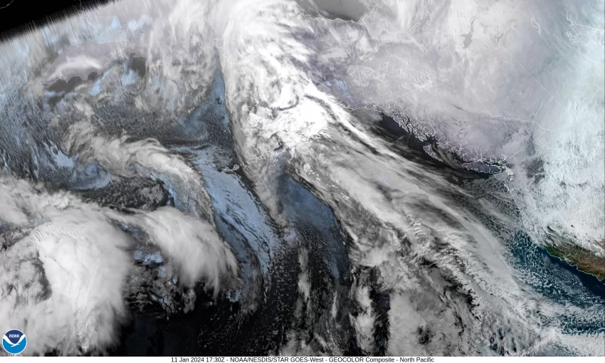
Looking at a looping satellite picture this morning revealed the trough dropping southward into British Columbia, behind which the Arctic Air was getting pulled down. Ahead of this area, including the Pacific Northwest, remains under a northwesterly flow that continues to push in scattered showers. The snow level is currently around 1600’ but will rise with daytime heating to near 2100’. The winds remain breezy today from the west 8-12 gusting to 25, and the afternoon high near 46.
Tonight, the cold air begins to pour in and some rain moves in, and the snow level begins to fall, down past the summit level before bottoming out at around 1100’ after midnight. The winds becoming northwesterly 10-15 gusting to 30, the low down to near 36. At this temperature, there could be some areas in the county that see a rain/snow mix overnight, but the accumulating snow should be above 1000’. Travel across the summits will start becoming more treacherous from this point on into next week.
Tomorrow, Friday, is when things get really interesting. We will have the Arctic Air spilling in from the northeast while a strong system pushes in from the west. Most of the models now agree that the Arctic Airmass, and this weather system, will cause wintery weather across nearly all of the Pacific Northwest. So, for Friday, Tillamook County can expect some rain and lowering snow with the snow level falling to near 600’ during the day, winds westerly 10-15 gusting to near 20, the high maybe to near 42.
Tomorrow night you see rain, then a rain/snow mix, though a little before midnight, then a chance of freezing rain as unfortunately the system moving in from the west, rides over the Arctic Air and could cause a mix everything — rain, sleet, snow, and freezing rain as the temperatures at the surface plummets below freezing, falling to near 22. The surface winds will be turning to easterly 10-15 gusting to 30 by around midnight which will help pull in the colder air. If you are outside, the windchill will make it feel even colder.
Saturday we still have a chance of rain, freezing rain, and sleet in the morning then a chance of rain and freezing rain as the high only makes it to near 33 in the afternoon. Add to this the winds being easterly 20-25 gusting to 35 and you have an even colder windchill, possible into the single digits, that will be affecting anyone outdoors. As for accumulating snow, this is likely at the summit level and above. Saturday night we still have a chance of rain, but that chance will be decreasing by around midnight, the snow level drops to around 400’, so lower level snow is possible in any remaining rain pockets as the temperature drops to a low of near 23.
By Sunday, a high pressure ridge settles in bringing mostly sunny skies, the high near 41, a few clouds Sunday night, the low near 26. Things do start to slowly warm starting Monday, still mostly sunny, the high near 43, then with the onshore flow returning by Monday night, we see a slight chance of rain or snow as the temperature drops to near 27 and some moisture returns under mostly cloudy skies.
Tuesday we could see some snow in the morning turning to rain by the afternoon as the temperature continues to moderate which pushes the snow level back up above the passes, afternoon highs up near 47. More rain Tuesday night, lows only dropping to near 37. Wednesday is looking rainy with a high near 50.
All this tells me, you want to go get your supplies today or early tomorrow as by tomorrow night, things will start to change. You should plan on just staying inside your warm house through the weekend as travel on the roads will become tricky and hazardous. Packed snow is bad enough but there is the ice that could be on or under the snow that makes things even more dangerous. When I was on the road as a deputy in the sheriff’s office during one of these events years ago, a truck went zooming past several of us writing accident reports for a bunch of accidents near Oretown. I stopped the vehicle who said he was ok as he had 4-wheel drive. I said, “Oh good, that means you will have all four wheels spinning around on the ice!” The moral of the story is to stay off the roads, only go out if you absolutely have to. You may be able to safely drive in these conditions, but what about the other guy?
Stay warm and safe, more on this tomorrow!