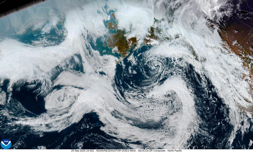
And just like that – it’s Fall. It looks like we will see multiple fronts passing through over the next few days. The first started pushing in some rain early this morning and that eased this afternoon. Tonight, we could still see a few widely scattered showers with some relatively light and variable winds, the low near 49.
We can expect another stronger front to bring in another round of rain later tomorrow morning along with some increasing southerly winds becoming 18-24 gusting to 30, except gusting to near 50 at the beaches as that front moves through. We’ll also be seeing Gale Force Winds offshore which has led to the National Weather Service issuing a Gale Warning from 11am Tuesday through 2am Wednesday. So, the rain becomes more showery tomorrow afternoon, and the scattered showers persist tomorrow night along with a slight chance of thunderstorms. It looks like the winds will ease some a little after midnight, becoming southerly 10-15 gusting to 20. The total rainfall for tomorrow looks to be in the range of ½ to 1” total. The afternoon high temperatures tomorrow near 61, and the overnight lows near 52.
We’re not done with the front action. On Wednesday, we see yet another one pushing across the area, so we can expect another increase in rain along with a chance of afternoon thunderstorms. It looks like the winds will also increase again, becoming southerly 10-15 gusting to 25, with gusts at the beaches up to near 35-40. More showers with possible thunderstorms are expected for Wednesday night, still breezy, highs again near 61, lows near 51. As far as rainfall totals for Wednesday, we could see another ½ to 1” of rain.
The models show a low pressure area dropping southward along the coast Thursday, so we continue to have a chance of showers along with a chance of afternoon and evening thunderstorms, highs near 60 and lows near 50.
Friday and Saturday weather is dependent on that low pressure area dropping south along the coast. As usual with these types of low pressure areas, it’s hard to say with certainty how strong they will be, or how fast they will be moving, so we keep a chance of rain and rainshowers for the area Friday and Saturday, with high temperatures in the mid 60s, and lows in the upper 40s.
Sunday, the weather is also somewhat up in the air, some of the models say a trough of low pressure will strengthen over the Pacific Northwest which would spell more showers for our area, while the other half of the models say it will deepen to the east, and we stay dry. But for now, let’s just flip a coin.
That’s it for this week, I hope yall all have a great week, and I’ll see ya again next Monday.


