By Gordon McCraw, Meteorologist for the Tillamook County Pioneer
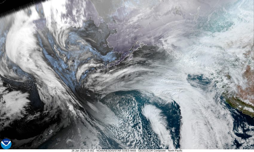
Another chilly morning but a pattern change is on the way, finally. It looks like that persistent high pressure ridge will finally lose the battle, weakening and getting pushed eastward by a trough of low pressure, allowing some warmer temperatures, along with some rain, to return to the area. We see mostly cloudy skies tonight with light southerly winds for a change, the low only dropping to near 41, nearly 10 degrees warmer than this morning’s low temperature.
Tomorrow, we have a front pushing in some rain starting a little before noon. We also see some easterly winds 5-10 but gusting to 30 as the front moves in. The rain continues tomorrow night as the associated trough approaches, the winds becoming southerly 5-10 gusting to 25, the low temperature only down to near 44.
Look for the rain to continue Wednesday, with the southerly winds 5-10 gusting to 20, the afternoon high temperature makes it up around 56, the low near 47.
Thursday, Friday, and on through the weekend, we see more disturbances impacting the coast, bringing periods of rain each day as the systems move across the area. The temperatures remain on the warmer side with afternoon highs in the upper 50, and morning low temperatures in the mid to upper 40s.
So, it looks like we can expect somewhere around 1” to 2” of rain, spread out from Tuesday through the end of the week, with a little more expected over the weekend, then the long range models show things starting to dry out next week with high pressure building over the area again, which likely brings warmer temperatures this time.
And there is your forecast Tillamook, it looks like you’ll need to dust off the umbrella today with a rainy period returning for the rest of January.


