Happy Birthday to Oregon and Happy Valentines Day to you’all …
Here’s a little update for next week:
-
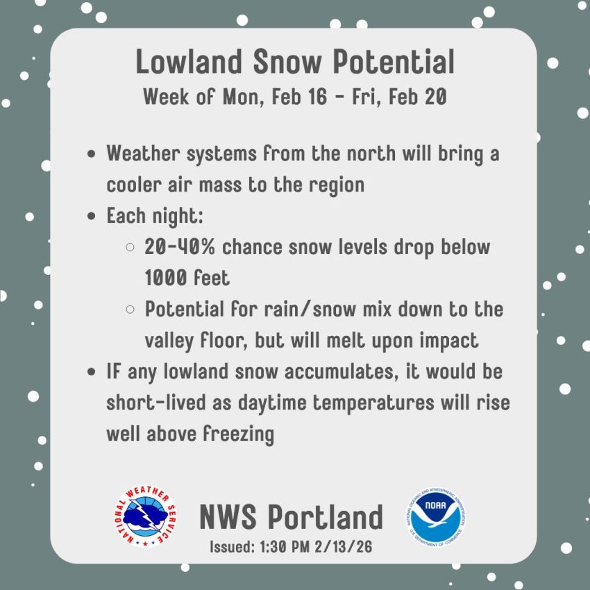
It is looking like the Coast Range will be getting some snow next week that could impact Hwy 6 and 26. The cooler and wetter pattern I spoke of in my Monday weekly forecast is looking like it will bring a chance of accumulating snow into the Coast Range. The snow in the higher elevations will see snow starting Monday, 2/16 through at least Thursday, 2/19, with the highest chance of snow in the passes being Thursday, especially Thursday night. Snow accumulations on Hwy 6 and 26 could reach 4” on the roadways in these areas which could cause some hazardous travel at times.
-
Overnight low temperatures next week in Tillamook are expected to be down in the low to mid 30s, and near freezing each morning Monday and Tuesday, so a low level rain/snow mix is possible at times Monday and Tuesday night in the early morning hours through around 10am.
-
If you have travel plans over in the valley next week, besides there being a chance of snow in the passes, there is also a slight chance of low level snow later next week in the early through mid-morning hours. Look at Tripcheck.com to “know before you go.”
-
Finally, there continues to be a Sneaker Wave concern at the beaches through Sunday evening, February 15.