Menu
  • Home
  • Feature
    • Breaking News
    • Arts
    • Astrology
    • Business
    • Community
    • Employment
    • Event Stories
    • From the Pioneer
    • Government
    • Letters to the Editor
    • Non Profit News
    • Obituary
    • Public Safety
    • Podcast Interview Articles
    • Pioneer Pulse Podcast: Politics, Palette, and Planet – the Playlist
  • Guest Column
    • Perspectives
    • Don Backman Photos
    • Ardent Gourmet
    • Kitchen Maven
    • I’ve been thinking
    • Jim Heffernan
    • The Littoral Life
    • Neal Lemery
    • View From Here
    • Virginia Carrell Prowell
    • Words of Wisdom
  • Weather
  • Post Submission
  • Things to do
    • Calendar
    • Tillamook County Parks
    • Tillamook County Hikes
    • Whale Watching
    • Tillamook County Library
    • SOS Community Calendar
  • About
    • Contribute
    • Advertise
    • Subscribe
    • Opt-out preferences
  • Search...
Menu

GORDON’S UPDATE: Weather 12/19/23 – Looking Like a Wet Christmas …

Posted on December 19, 2023 by Editor

By Gordon McCraw, Meteorologist for the Tillamook County Pioneer

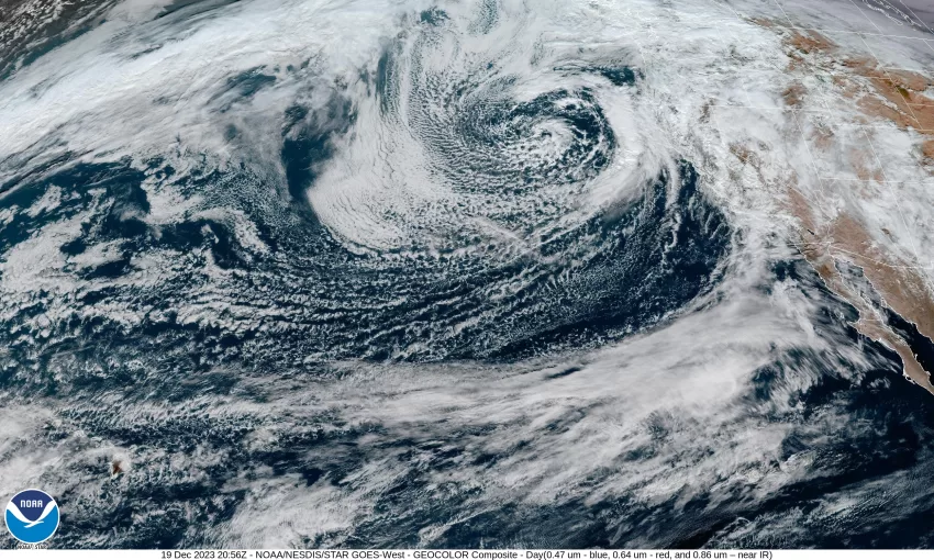
A low pressure area raced up the coast and to the north this morning and gave us a brief shot of moderate rain and winds. Things have calmed down this afternoon with only a few scattered showers around that will become widely scattered tonight. The winds will further ease this evening as the low continues northward and by tonight the winds will become light from the east with the low near 43.

Conditions improve tomorrow morning as high pressure settles in but does bring us some morning fog, otherwise, tomorrow looks sunny with light northerly winds, the high near 57. With partly cloudy skies tomorrow night and light winds, the patchy fog returns with a low near 41.

By Thursday, we see another low pressure area moving to the west of California again where it stops for a while. This brings us partly sunny skies after the patchy morning fog clears, with light southerly winds, the high near 54. We do start to see a slight chance of rain that evening with the chance increasing overnight as a cold front takes aim at our area, lows near 41.

Friday the cold front brings rain with some breezy winds, then a chance of thunderstorms as the front moves through, sometime around noon. We transition to showers but still with that chance of thunderstorms in the colder, unstable air moving in, the high near 50. The showers and thunderstorm threat continues that night until around midnight, then we just see scattered showers with the snow level dropping to near 2600’, the low falls to near 36.

The chance of showers continues Saturday, the snow level down near 2500’, highs only near 49, a slight chance of rain starts Saturday night with another approaching system, the snow level now down near 2200’, the low near 35.

There is a chance of rain Sunday, the snow level starts out around 2000’ that morning but starts to rise with the approaching warmer system, highs near 50, a chance of rain still that night, the snow level up around 3000’ for Santa’s arrival, lows near 37.

And sorry folks, Christmas Day looks mostly cloudy and rainy, but the high is up near 52.

The long range models suggest the rest of next week will be active also.

Slide Slide Slide Slide Slide Slide Slide Slide Subscribe Contribute

Ads

Featured Video

Tillamook Weather

Tides

Tillamook County Pioneer Podcast Series

Tillamook Church Search

Cloverdale Baptist Church
Nestucca Valley Presbyterian
Tillamook Ecumenical Service

Archives

  • Home
  • EULA Privacy Policy
  • Contact
  • Opt-out preferences
  • Search...
Share on facebook
Facebook
Share on pinterest
Pinterest
Share on twitter
Twitter
Share on linkedin
Linkedin
Catherine

Recent Posts

  • ROCKAWAY BEACH READIES FOR JULY 4TH FESTIVITIES - HONORS VOLUNTEER OF YEAR & PARADE GRAND MARSHAL

    June 30, 2025
  • NEWS UPDATE FROM STATE REPRESENTATIVE DAVID GOMBERG: It's a Session Wrap!

    June 30, 2025
  • GORDON'S WEEKLY WEATHER UPDATE 6/30/25: Back to Normal Summer Weather This Week - Fair, Dry & Mild; Holiday Weekend Weather Looks Good

    June 30, 2025
©2025 | Theme by SuperbThemes

Manage Cookie Consent
To provide the best experiences, we use technologies like cookies to store and/or access device information. Consenting to these technologies will allow us to process data such as browsing behavior or unique IDs on this site. Not consenting or withdrawing consent, may adversely affect certain features and functions.
Functional Always active
The technical storage or access is strictly necessary for the legitimate purpose of enabling the use of a specific service explicitly requested by the subscriber or user, or for the sole purpose of carrying out the transmission of a communication over an electronic communications network.
Preferences
The technical storage or access is necessary for the legitimate purpose of storing preferences that are not requested by the subscriber or user.
Statistics
The technical storage or access that is used exclusively for statistical purposes. The technical storage or access that is used exclusively for anonymous statistical purposes. Without a subpoena, voluntary compliance on the part of your Internet Service Provider, or additional records from a third party, information stored or retrieved for this purpose alone cannot usually be used to identify you.
Marketing
The technical storage or access is required to create user profiles to send advertising, or to track the user on a website or across several websites for similar marketing purposes.
Manage options Manage services Manage {vendor_count} vendors Read more about these purposes
View preferences
{title} {title} {title}