Menu
  • Home
  • Feature
    • Breaking News
    • Arts
    • Astrology
    • Business
    • Community
    • Employment
    • Event Stories
    • From the Pioneer
    • Government
    • Letters to the Editor
    • Non Profit News
    • Obituary
    • Public Safety
    • Podcast Interview Articles
    • Pioneer Pulse Podcast: Politics, Palette, and Planet – the Playlist
  • Guest Column
    • Perspectives
    • Don Backman Photos
    • Ardent Gourmet
    • Kitchen Maven
    • I’ve been thinking
    • Jim Heffernan
    • The Littoral Life
    • Neal Lemery
    • View From Here
    • Virginia Carrell Prowell
    • Words of Wisdom
  • Weather
  • Post Submission
  • Things to do
    • Calendar
    • Tillamook County Parks
    • Tillamook County Hikes
    • Whale Watching
    • Tillamook County Library
    • SOS Community Calendar
  • About
    • Contribute
    • Advertise
    • Subscribe
    • Opt-out preferences
  • Search...
Menu

GORDON’S UPDATE: Weather 2/22/23 – Cold Temps

Posted on February 22, 2023 by Editor

By Gordon McCraw, Meteorologist for the Tillamook County Pioneer
Wednesday, February 22, 2023
Weather

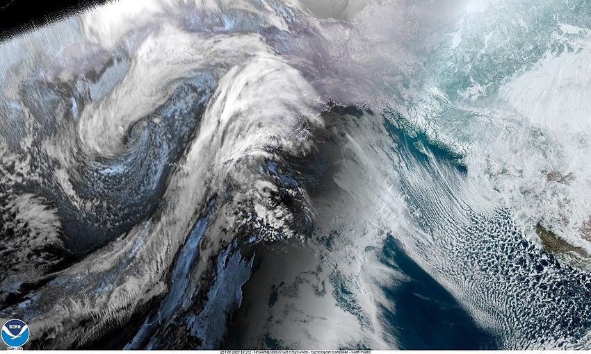
Well, many folks saw a dusting of snow overnight, but you didn’t have to go far in elevation to see sticking snow with tripcheck reporting 6” of roadside snow this morning at the Coast Range Summit. This evening we are watching a low pressure area sliding southward that will pull the shower activity southward though we can still see some wraparound showers across our area tonight.

So tonight looks wet and cold with some rain then snow shower later tonight as the temperature lowers. Again, the snow amounts will be variable, depending on where the showers are. Winds tonight becoming easterly 10-15 gusting to 25, the low drops to around 23 so the windchill will be in the low teens.

The activity will move south with the low tomorrow so we see only widely scattered showers that diminish by the afternoon, still breezy with east winds 20-25 gusting to 35, the high only near 35, so again, with the winds it will feel much colder. Tomorrow night looks to be the coldest, with mostly clear skies the low drops to 19, but the persistent east winds 15-25 gusting to near 40 will put the windchill temperature down near zero.

Friday looks sunny with east winds only 5-10, the high warms to near 43 but with mostly clear skies Friday night, the low dips to 23.

The rain returns Saturday night with the next approaching trough of low pressure. The good news is the temperatures will be moderating so while there is a chance of a low rain/snow mix to start, the snow level will be rising overnight to possibly above the summit level by midnight. The high Saturday near 46, the low near 33.

It looks cloudy, rainy and breezy Sunday and Monday, highs near 45, lows near 34 with more rain likely Tuesday as well, the high up near 46, lows near 35. It looks like we will see more snow in the Coast Range.

Slide Slide Slide Slide Slide Slide Slide Slide Subscribe Contribute

Ads

Featured Video

Tillamook Weather

Tides

Tillamook County Pioneer Podcast Series

Tillamook Church Search

Cloverdale Baptist Church
Nestucca Valley Presbyterian
Tillamook Ecumenical Service

Archives

  • Home
  • EULA Privacy Policy
  • Contact
  • Opt-out preferences
  • Search...
Share on facebook
Facebook
Share on pinterest
Pinterest
Share on twitter
Twitter
Share on linkedin
Linkedin
Catherine

Recent Posts

  • 4th of July Happenings throughout Tillamook County

    July 3, 2025
  • WHAT DOES FREEDOM MEAN TO YOU? I've been thinking ... Liberty to me

    July 3, 2025
  • INDIVISIBLE TILLAMOOK COAST: The largest betrayal of the American people.  Period.

    July 3, 2025
©2025 | Theme by SuperbThemes

Manage Cookie Consent
To provide the best experiences, we use technologies like cookies to store and/or access device information. Consenting to these technologies will allow us to process data such as browsing behavior or unique IDs on this site. Not consenting or withdrawing consent, may adversely affect certain features and functions.
Functional Always active
The technical storage or access is strictly necessary for the legitimate purpose of enabling the use of a specific service explicitly requested by the subscriber or user, or for the sole purpose of carrying out the transmission of a communication over an electronic communications network.
Preferences
The technical storage or access is necessary for the legitimate purpose of storing preferences that are not requested by the subscriber or user.
Statistics
The technical storage or access that is used exclusively for statistical purposes. The technical storage or access that is used exclusively for anonymous statistical purposes. Without a subpoena, voluntary compliance on the part of your Internet Service Provider, or additional records from a third party, information stored or retrieved for this purpose alone cannot usually be used to identify you.
Marketing
The technical storage or access is required to create user profiles to send advertising, or to track the user on a website or across several websites for similar marketing purposes.
Manage options Manage services Manage {vendor_count} vendors Read more about these purposes
View preferences
{title} {title} {title}