Menu
  • Home
  • Feature
    • Breaking News
    • Arts
    • Astrology
    • Business
    • Community
    • Employment
    • Event Stories
    • From the Pioneer
    • Government
    • Letters to the Editor
    • Non Profit News
    • Obituary
    • Public Safety
    • Podcast Interview Articles
    • Pioneer Pulse Podcast: Politics, Palette, and Planet – the Playlist
  • Guest Column
    • Perspectives
    • Don Backman Photos
    • Ardent Gourmet
    • Kitchen Maven
    • I’ve been thinking
    • Jim Heffernan
    • The Littoral Life
    • Neal Lemery
    • View From Here
    • Virginia Carrell Prowell
    • Words of Wisdom
  • Weather
  • Post Submission
  • Things to do
    • Calendar
    • Tillamook County Parks
    • Tillamook County Hikes
    • Whale Watching
    • Tillamook County Library
    • SOS Community Calendar
  • About
    • Contribute
    • Advertise
    • Subscribe
    • Opt-out preferences
  • Search...
Menu

GORDON’S UPDATE: Weather 2/7/24

Posted on February 7, 2024February 8, 2024 by Editor

LISTEN HERE:

By Gordon McCraw, Meteorologist for the Tillamook County Pioneer

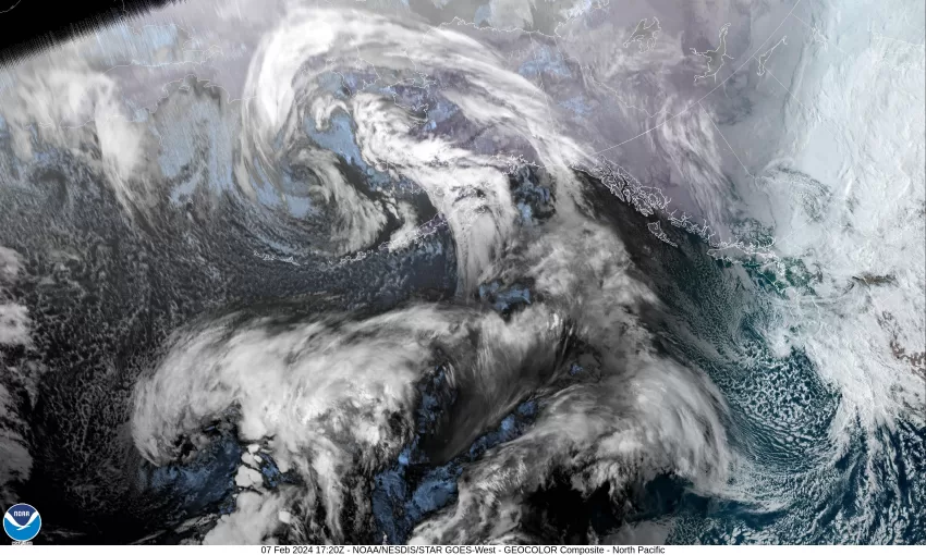
So, this morning the radar and satellite picture shows a long trough of low pressure still off the coast that has spun up a couple of low pressure area west of Oregon. The larger of the two is pumping moisture into northern California, who has already seen the lions share of rain over the past 7 days, especially in southern California but now it looks like it is northern California’s turn. These lows are getting pushed southward in the flow. As far as here locally, there is some patchy wrap-around light rain in the area.

We will continue to have some occasional periods of light rain today as more disturbances pop up and affect the area. It looks like the snow level will be around 2500’ today, and I just looked at Tripcheck and the temperatures on Hwy 6 are above freezing still early this morning. We don’t see much change in the weather pattern tonight so still a chance of seeing another weak disturbance bringing a period of light rain overnight with variable winds, the low near 38, the snow level still around 2500.’

Not much changes tomorrow so we are still looking at about a 50/50 shot of seeing more spotty light rain or drizzle, the winds westerly 4-8 and the high near 49 with the snow level around 2200’ by sunup tomorrow. Tomorrow night more rain is likely as that trough gets pushed eastward, we still see some light winds, the low only down to near 40.

We see a rainy morning still Friday, then the rain starts to ease and becomes more patchy in the afternoon as the trough continues to move east, the winds becoming southerly 4-8, highs near 49. There is only a slight chance of rain still Friday night as a ridge of high pressure builds near the coast, light winds, the low near 41.

Unfortunately, the models show the ridge weakening over the weekend and that would allow more disturbances to ride in on the flow, bring back the periods of light rain through the weekend, and as the pattern changes little, this chance of rain extends into the start of next week. The afternoon highs remain in the mid 50s and the overnight lows in the low 40s for the period also.

Now, for our boaters and beach combers. The rivers are all low and continuing to slowly fall but we are coming into a period of King Tides that peaks on the 11th, and 12th. Add to this the fact that the weather offshore has impacted the seas and we are seeing 9-12’ seas that are pushing in the swells that are increasing the tide levels today, and adding about a 1’ anomaly to the tide levels. This means that we will be seeing an increasing risk of tidal overflow flooding in all the usual places in Nehalem, west Tillamook, and Pacific City during the higher tide times from around 10am through 2pm each day. This may eventually close some roads as these levels increase daily through the weekend. Also, with the increased seas and the higher tides, the beach hazards increase with less beach to walk on plus the increased threat of sneaker waves, so please, please be extra alert and follow all the normal beach hazard safety rules!

Slide Slide Slide Slide Slide Slide Slide Slide Subscribe Contribute

Ads

Featured Video

Tillamook Weather

Tides

Tillamook County Pioneer Podcast Series

Tillamook Church Search

Cloverdale Baptist Church
Nestucca Valley Presbyterian
Tillamook Ecumenical Service

Archives

  • Home
  • EULA Privacy Policy
  • Contact
  • Opt-out preferences
  • Search...
Share on facebook
Facebook
Share on pinterest
Pinterest
Share on twitter
Twitter
Share on linkedin
Linkedin
Catherine

Recent Posts

  • TILLAMOOK PEOPLE’S UTILITY DISTRICT: July 2025 Meetings

    July 1, 2025
  • ROCKAWAY BEACH READIES FOR JULY 4TH FESTIVITIES - HONORS VOLUNTEER OF YEAR & PARADE GRAND MARSHAL

    June 30, 2025
  • NEWS UPDATE FROM STATE REPRESENTATIVE DAVID GOMBERG: It's a Session Wrap!

    June 30, 2025
©2025 | Theme by SuperbThemes

Manage Cookie Consent
To provide the best experiences, we use technologies like cookies to store and/or access device information. Consenting to these technologies will allow us to process data such as browsing behavior or unique IDs on this site. Not consenting or withdrawing consent, may adversely affect certain features and functions.
Functional Always active
The technical storage or access is strictly necessary for the legitimate purpose of enabling the use of a specific service explicitly requested by the subscriber or user, or for the sole purpose of carrying out the transmission of a communication over an electronic communications network.
Preferences
The technical storage or access is necessary for the legitimate purpose of storing preferences that are not requested by the subscriber or user.
Statistics
The technical storage or access that is used exclusively for statistical purposes. The technical storage or access that is used exclusively for anonymous statistical purposes. Without a subpoena, voluntary compliance on the part of your Internet Service Provider, or additional records from a third party, information stored or retrieved for this purpose alone cannot usually be used to identify you.
Marketing
The technical storage or access is required to create user profiles to send advertising, or to track the user on a website or across several websites for similar marketing purposes.
Manage options Manage services Manage {vendor_count} vendors Read more about these purposes
View preferences
{title} {title} {title}