Menu
  • Home
  • Feature
    • Breaking News
    • Arts
    • Astrology
    • Business
    • Community
    • Employment
    • Event Stories
    • From the Pioneer
    • Government
    • Letters to the Editor
    • Non Profit News
    • Obituary
    • Public Safety
    • Podcast Interview Articles
    • Pioneer Pulse Podcast: Politics, Palette, and Planet – the Playlist
  • Guest Column
    • Perspectives
    • Don Backman Photos
    • Ardent Gourmet
    • Kitchen Maven
    • I’ve been thinking
    • Jim Heffernan
    • The Littoral Life
    • Neal Lemery
    • View From Here
    • Virginia Carrell Prowell
    • Words of Wisdom
  • Weather
  • Post Submission
  • Things to do
    • Calendar
    • Tillamook County Parks
    • Tillamook County Hikes
    • Whale Watching
    • Tillamook County Library
    • SOS Community Calendar
  • About
    • Contribute
    • Advertise
    • Subscribe
    • Opt-out preferences
  • Search...
Menu

GORDON’S UPDATE: Weather 3/21/23 – The “S” word in the forecast, and it’s not Spring …

Posted on March 21, 2023 by Editor

By Gordon McCraw, Meteorologist for the Tillamook County Pioneer
Tuesday, March 21, 2023

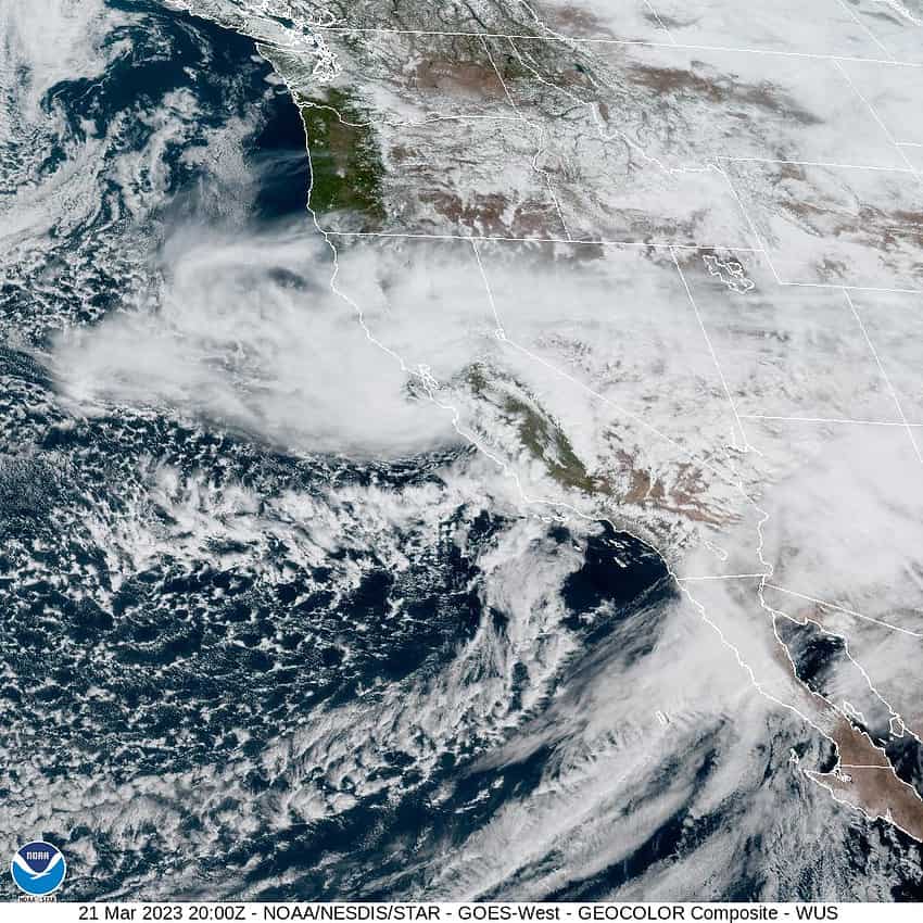
A foggy, misty start of the day was followed by a mild sunny day with a weak ridge of high pressure over the area, which will be followed by a mostly clear, cool night tonight with the winds becoming northerly 5-10, the low drops to near 39.

Tomorrow starts out dry and mild, but by the afternoon there is a slight chance of showers as the northerly flow becomes more westerly at 5-10, the high near 55, then the chance of showers increases tomorrow night with the winds becoming more southwesterly after around midnight, the lows dropping to near 39. Also, the snow levels will be dropping down to near 2400’ so the higher Coast Range mountains will be seeing snow once again.

More showers Thursday with a trough of low pressure dropping down towards the area that brings breezy southwesterly winds 14-18 gusting to 30, the high only near 46. This trough will be pushing in colder air aloft so the snow level will be dropping to near 1800’ in the afternoon. With the upper atmospheric levels being less stable, more showers are expected with possible thunderstorms Thursday night, and the heavier showers could be giving us some small hails also. Add to this the snow level will be dropping to below the summit levels that night so Hwy 6 and 26 could see some snow as low as 1200’ after midnight Thursday.

On Friday, the showers, hail, and thunderstorms threat persist, especially in the afternoon, still on the breezy side, the snow level down around 1100’. The chance of showers continues Friday night, still breezy, and with the low dropping to near 33, low level flurries are not out of the question but accumulating snow will be above 500’ in the early morning hours.

The low pressure trough stays parked over the area thru the weekend so look for mostly cloudy to cloudy skies with the showers along with the below average temperatures remaining across the area with highs around 47, lows around 34. The snow level will linger between 1200-1700’ so there may be times that travel across the passes could be hazardous. It looks like accumulation levels will be low, but this is always subject to change…without notice!

The low pressure area moves southeastward which decreases the activity Monday and the temperatures start to moderate again with the high up near 51 and the snow level climbing back above 1800’.

Slide Slide Slide Slide Slide Slide Slide Slide Subscribe Contribute

Ads

Featured Video

Tillamook Weather

Tides

Tillamook County Pioneer Podcast Series

Tillamook Church Search

Cloverdale Baptist Church
Nestucca Valley Presbyterian
Tillamook Ecumenical Service

Archives

  • Home
  • EULA Privacy Policy
  • Contact
  • Opt-out preferences
  • Search...
Share on facebook
Facebook
Share on pinterest
Pinterest
Share on twitter
Twitter
Share on linkedin
Linkedin
Catherine

Recent Posts

  • 4th of July Happenings throughout Tillamook County

    July 3, 2025
  • WHAT DOES FREEDOM MEAN TO YOU? I've been thinking ... Liberty to me

    July 3, 2025
  • INDIVISIBLE TILLAMOOK COAST: The largest betrayal of the American people.  Period.

    July 3, 2025
©2025 | Theme by SuperbThemes

Manage Cookie Consent
To provide the best experiences, we use technologies like cookies to store and/or access device information. Consenting to these technologies will allow us to process data such as browsing behavior or unique IDs on this site. Not consenting or withdrawing consent, may adversely affect certain features and functions.
Functional Always active
The technical storage or access is strictly necessary for the legitimate purpose of enabling the use of a specific service explicitly requested by the subscriber or user, or for the sole purpose of carrying out the transmission of a communication over an electronic communications network.
Preferences
The technical storage or access is necessary for the legitimate purpose of storing preferences that are not requested by the subscriber or user.
Statistics
The technical storage or access that is used exclusively for statistical purposes. The technical storage or access that is used exclusively for anonymous statistical purposes. Without a subpoena, voluntary compliance on the part of your Internet Service Provider, or additional records from a third party, information stored or retrieved for this purpose alone cannot usually be used to identify you.
Marketing
The technical storage or access is required to create user profiles to send advertising, or to track the user on a website or across several websites for similar marketing purposes.
Manage options Manage services Manage {vendor_count} vendors Read more about these purposes
View preferences
{title} {title} {title}