Menu
  • Home
  • Feature
    • Breaking News
    • Arts
    • Astrology
    • Business
    • Community
    • Employment
    • Event Stories
    • From the Pioneer
    • Government
    • Letters to the Editor
    • Non Profit News
    • Obituary
    • Public Safety
    • Podcast Interview Articles
    • Pioneer Pulse Podcast: Politics, Palette, and Planet – the Playlist
  • Guest Column
    • Perspectives
    • Don Backman Photos
    • Ardent Gourmet
    • Kitchen Maven
    • I’ve been thinking
    • Jim Heffernan
    • The Littoral Life
    • Neal Lemery
    • View From Here
    • Virginia Carrell Prowell
    • Words of Wisdom
  • Weather
  • Post Submission
  • Things to do
    • Calendar
    • Tillamook County Parks
    • Tillamook County Hikes
    • Whale Watching
    • Tillamook County Library
    • SOS Community Calendar
  • About
    • Contribute
    • Advertise
    • Subscribe
    • Opt-out preferences
  • Search...
Menu

GORDON’S UPDATE: Weather 6/15/23 – Showers expected on Sunday

Posted on June 15, 2023 by Editor

By Gordon McCraw, Meteorologist for the Tillamook County Pioneer
Well, it continues to look like we will have one more fair and mild day before a bit of a pattern change happens. The ridge of high pressure will remain just off the coast this evening then tomorrow an upper level disturbance moves across to the north, only giving us some increased cloudiness. So, tonight we see mostly cloudy skies with the winds becoming light and variable, the low tonight near 47.

Tomorrow, we see more mid and high clouds rolling in, the winds becoming northwesterly 5-10, the high tomorrow near 63, more of the same tomorrow night, lows near 48.

Saturday starts out about the same with mostly cloudy skies and the northwesterly winds 5-10, a little cooler with the high only near 59. That night we have a slight chance of rain starting after around midnight as a front approaches, lows near 47.

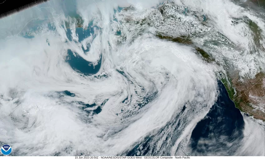
Sunday the models start to make forecasting more fun as they do not agree on how to handle a developing low pressure area to our northwest, and just how much rain this system will bring to the area. It looks like this slow-moving low-pressure area will be dropping down the coast near Vancouver Island by Sunday, pushing bands of rain into our area. So, the “official” Father’s Day forecast is for a cloudy, rainy day Sunday, the high near 58, then we transition over to showers Sunday night, lows near 45.

By Monday, the low will have dropped down to the Oregon/Washington border so we will still be seeing showers, the afternoon high only near 57, the low that night near 46.

It looks like the low pushes across northern Oregon into Idaho Tuesday so we should be seeing decreasing showers activity with only a slight chance of any showers by Tuesday night, the high near 59, lows near 48.

By Wednesday we see partly sunny skies with a slight chance of a shower, the high back up to near 63.

Because of the humor, I have to share a paragraph from the Portland National Weather Service Forecast Discussion:

“Now who had `snow in June` on their BINGO card? If you did, mark that one off. Snow is forecast along the Cascades above pass level – the `tippy tops of the mountains` if you will. Lower elevations though are not at risk. Those who may be climbing or camping this weekend though should prepare for much colder and possibly snowy conditions. Accumulation wise, just looking at a few inches.”

Slide Slide Slide Slide Slide Slide Slide Slide Subscribe Contribute

Ads

Featured Video

Tillamook Weather

Tides

Tillamook County Pioneer Podcast Series

Tillamook Church Search

Cloverdale Baptist Church
Nestucca Valley Presbyterian
Tillamook Ecumenical Service

Archives

  • Home
  • EULA Privacy Policy
  • Contact
  • Opt-out preferences
  • Search...
Share on facebook
Facebook
Share on pinterest
Pinterest
Share on twitter
Twitter
Share on linkedin
Linkedin
Catherine

Recent Posts

  • ROCKAWAY BEACH READIES FOR JULY 4TH FESTIVITIES - HONORS VOLUNTEER OF YEAR & PARADE GRAND MARSHAL

    June 30, 2025
  • NEWS UPDATE FROM STATE REPRESENTATIVE DAVID GOMBERG: It's a Session Wrap!

    June 30, 2025
  • GORDON'S WEEKLY WEATHER UPDATE 6/30/25: Back to Normal Summer Weather This Week - Fair, Dry & Mild; Holiday Weekend Weather Looks Good

    June 30, 2025
©2025 | Theme by SuperbThemes

Manage Cookie Consent
To provide the best experiences, we use technologies like cookies to store and/or access device information. Consenting to these technologies will allow us to process data such as browsing behavior or unique IDs on this site. Not consenting or withdrawing consent, may adversely affect certain features and functions.
Functional Always active
The technical storage or access is strictly necessary for the legitimate purpose of enabling the use of a specific service explicitly requested by the subscriber or user, or for the sole purpose of carrying out the transmission of a communication over an electronic communications network.
Preferences
The technical storage or access is necessary for the legitimate purpose of storing preferences that are not requested by the subscriber or user.
Statistics
The technical storage or access that is used exclusively for statistical purposes. The technical storage or access that is used exclusively for anonymous statistical purposes. Without a subpoena, voluntary compliance on the part of your Internet Service Provider, or additional records from a third party, information stored or retrieved for this purpose alone cannot usually be used to identify you.
Marketing
The technical storage or access is required to create user profiles to send advertising, or to track the user on a website or across several websites for similar marketing purposes.
Manage options Manage services Manage {vendor_count} vendors Read more about these purposes
View preferences
{title} {title} {title}