Menu
  • Home
  • Breaking News
  • Feature
    • Arts
    • Astrology
    • Business
    • Community
    • Employment
    • Event Stories
    • From the Pioneer
    • Government
    • Letters to the Editor
    • Non Profit News
    • Obituary
    • Public Safety
    • Podcast Interview Articles
    • Pioneer Pulse Podcast: Politics, Palette, and Planet – the Playlist
  • Weather
  • Guest Column
    • Perspectives
    • Don Backman Photos
    • Ardent Gourmet
    • Kitchen Maven
    • I’ve been thinking
    • Jim Heffernan
    • The Littoral Life
    • Neal Lemery
    • View From Here
    • Virginia Carrell Prowell
    • Words of Wisdom
  • Things to do
    • Calendar
    • Tillamook County Parks
    • Tillamook County Hikes
    • Whale Watching
    • Tillamook County Library
    • SOS Community Calendar
  • About
    • Contribute
    • Advertise
    • Subscribe
    • Opt-out preferences
  • Post Submission Test
  • Search...
Menu

GORDON’S WEATHER UPDATE 3/18/24: Foggy start, clouds, front approaching

Posted on March 18, 2024 by Editor

A very foggy start to the morning with temperatures in the upper 30s in some areas dense fog, otherwise, with the high pressure ridge continuing to dominate the weather pattern, we saw another sunny day after the fog and stratus burned off, with highs in the low 60s.

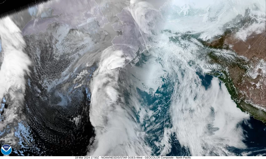
The broad ridge shifts east tonight as a trough of low pressure and its associated front pushes eastward off the coast, which will increase the marine push which in turn increases the clouds tonight, and with light winds, the low only drops to near 45.

We see more clouds pushing in tomorrow as the front continues to move towards the coast, we likely see some more patchy morning fog that persists until later in the morning, the winds becoming westerly 4-8, and the afternoon high up around 60. The clouds will continue to thicken tomorrow night with southerly winds of 5-10, lows near 45.

By Wednesday the relatively weak front is pushing rain into the area late morning, winds becoming southerly 8-12, highs only near 55, then Wednesday night looks cloudy and rainy, the low near 45.

It looks like by Thursday the ridge has moved east of the area as a trough of low pressure moves in and gives us mostly cloudy skies with a chance of rain that persists into Friday, highs near 57, lows near 44. Given how weak the front is, the amount of rain we will see from this system is uncertain. The models are currently showing anything from none to a half an inch.

As for the weekend, unfortunately not as nice as this last weekend, Saturday and Sunday are looking cloudy and breezy this time, with scattered showers rotating across the area as a low pressure area moves down the Oregon coast towards California. The weekend’s temperatures look to be in the low 50s for afternoon highs with the low 40s overnight.

Featured Video

Ads

Slide Contribute SUBSCRIBE

Tillamook Weather

Tides

Tillamook County Pioneer Podcast Series

Tillamook Church Search

Cloverdale Baptist Church
Nestucca Valley Presbyterian
Tillamook Ecumenical Service

Archives

  • Home
  • EULA Privacy Policy
  • Contact
  • Opt-out preferences
  • Search...
Share on facebook
Facebook
Share on pinterest
Pinterest
Share on twitter
Twitter
Share on linkedin
Linkedin
Catherine

Recent Posts

  • GORDON'S WEEKEND WEATHER UPDATE 6/20/25: First Day of Summer - Rain with more rain through weekend

    June 20, 2025
  • Tillamook People's Utility District REGULAR MEETING NOTICE May 27, 2025 in Rockaway Beach

    May 13, 2025
  • Tillamook FFA Excels in State Career Development Events: Two Teams Headed to Nationals

    May 12, 2025
©2025 | Theme by SuperbThemes

Manage Cookie Consent
To provide the best experiences, we use technologies like cookies to store and/or access device information. Consenting to these technologies will allow us to process data such as browsing behavior or unique IDs on this site. Not consenting or withdrawing consent, may adversely affect certain features and functions.
Functional Always active
The technical storage or access is strictly necessary for the legitimate purpose of enabling the use of a specific service explicitly requested by the subscriber or user, or for the sole purpose of carrying out the transmission of a communication over an electronic communications network.
Preferences
The technical storage or access is necessary for the legitimate purpose of storing preferences that are not requested by the subscriber or user.
Statistics
The technical storage or access that is used exclusively for statistical purposes. The technical storage or access that is used exclusively for anonymous statistical purposes. Without a subpoena, voluntary compliance on the part of your Internet Service Provider, or additional records from a third party, information stored or retrieved for this purpose alone cannot usually be used to identify you.
Marketing
The technical storage or access is required to create user profiles to send advertising, or to track the user on a website or across several websites for similar marketing purposes.
Manage options Manage services Manage {vendor_count} vendors Read more about these purposes
View preferences
{title} {title} {title}