")

By Gordon McCraw, Meteorologist for the Tillamook County Pioneer
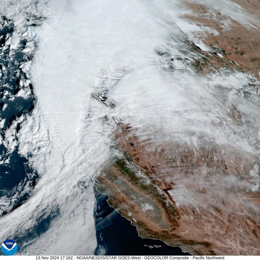
I guess we can say … this is the strongest storm so far this season, the airport recorded winds 20-25 gusting to 35-55. The 55mph gust was at 4:35AM this morning. As far as rain, the Tillamook area received between 1” and a little over 1.5” while the Coast Range saw 1.82” to 2.08”, which has pushed the rivers up. With the backside of this front now pushing onto the coast, the rain should be ending in the next hour or so, this would put an end to any river flooding concerns as they will all crest well below Action Stage.
The air behind the front is very unstable so you can expect to see scattered rainshowers with a chance of thunderstorms the rest of the day and into the night. The breezy southerly winds will continue 15-20 gusting to 25-30. In any heavy downpours, straight line winds could gust even higher, briefly.
Look for continued scattered showers with possible thunderstorms tomorrow, Thursday, the winds will have eased, becoming westerly 5-10, then the thunderstorms threat ends by tomorrow night so expect just scattered showers.
Now, as the river levels are somewhat elevated, and the anomalies are +0.7 right now, let’s throw in some astronomical high tides (King Tides) and see if we can have some Tidal Overflow Flooding. The higher tide today is 9.14’ at 10:12am (Garibaldi), then at 9.67’ at 10:52 tomorrow morning. My experience is that when the level reaches around 10’ we can start to see some Overflow Flooding from the Tillamook River over on Fraser Rd, west of Tillamook, around high tide time. Down south, the Pacific City area can see some flooding near the Nestucca River, and Nehalem can start to see some water intruding on Hwy 101. With the tidal levels being up close to the magic 10’ level, any positive anomalies can aggravate the level and we could start to see the minor effects. Moving on to the 15th (Friday), the Tide Forecast is at 10.01 at 11:33am so we will likely see some minor flooding in those areas, for a couple of hours around the high tide. On Saturday (16th) the high tide is at 10.12’ at 12:15, or just after noon! This is the peak and from this point on, the levels lower some each day, cresting below 10’ each afternoon, and below 9’ by the middle of next week.
Now, let’s move back to the weather for this weekend, for Friday, the showers become more scattered, but with that cooler northerly flow associated with a trough of low pressure moving across, the temperatures at night will be falling into the upper 30s. The next front moves more rain in Saturday night through Sunday, with a transition to showers again by Monday.
Public Information Statement
National Weather Service Portland OR
421 PM PST Tue Nov 12 2024
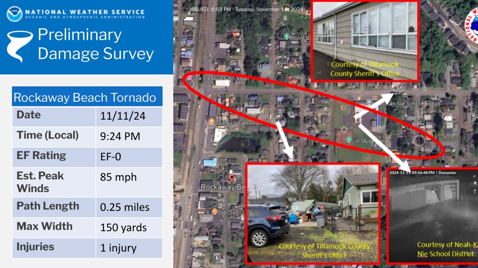
…NWS Damage Survey for 11/11/24 Tornado Event at Rockaway Beach…
Overview…A waterspout moved onshore late in the evening, resulting in minor damage to buildings, trees, and fences. Security footage confirmed a tornado at Neah-Kah-Nie School District. Photos of tornado damage showed broken windows, downed trees, and roofing
damage.
Rating: EF-0
Estimated Peak Wind: 85 mph
Path Length /statute/: 0.25 miles
Path Width /maximum/: 150 yards
Fatalities: 0
Injuries: 1
Start Date: 11_11_2024
Start Time: 924 PM PST
Start Location: N Miller St and N 3rd Ave
Start Lat/Lon: 45.61530 / -123.94387
End Date: 11_11_2024
End Time: 926 PM PST
End Location: N Juniper St and N First Ave
End Lat/Lon: 45.61376 / -123.93721
EF Scale: The Enhanced Fujita Scale classifies tornadoes into the
following categories:
EF0…..65 to 85 mph
EF1…..86 to 110 mph
EF2…..111 to 135 mph
EF3…..136 to 165 mph
EF4…..166 to 200 mph
EF5…..>200 mph
NOTE:
The information in this statement is preliminary and subject to change pending final review of the event and publication in NWS Storm Data.