")

By Gordon McCraw, Meteorologist for the Tillamook County Pioneer
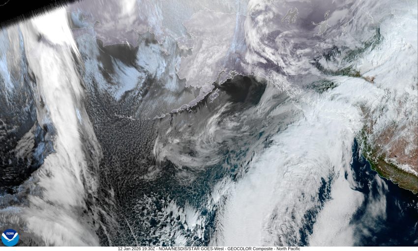
The good news for this mild Monday is that there is a strong high pressure ridge over the area, because in the satellite picture you can clearly see an atmosphere river pointed up into northern Washington and the Vancouver Island area, and it appears this strong ridge will dominate the weather pattern for pretty much the entire week. We do see occasional disturbances riding over the ridge that bring a slight chance of light showers around the Oregon/Washington border area, otherwise for us, we see fair, dry, and mild conditions dominating our weather all week. So, we can expect some fog and stratus to move in tonight with calm winds, the overnight low temperature down near 43.
We see a mostly sunny day tomorrow after the fog and stratus burn off by mid-morning, and we keep the calm winds, tomorrow’s high temperature up around 60. The fog returns tomorrow night under the partly cloudy skies, the low again dips to near 41.
Wednesday becomes mostly sunny after the fog clears, likely a little sooner than it did Tuesday morning, still with calm winds, Wednesday’s high temperature remains a little warm for this time of year, up around 56. The fog is more patchy Wednesday night, the low near 42.
With a deep trough of low pressure to the east and another to our west, the ridge of high pressure over our region only gets stronger into Thursday, pushing northward all the way into Alaska, leaving us with sunny skies, with highs around 60 each day through Saturday, lows remain in the low to mid 40s at least through Saturday.
It looks like the ridge does weaken a little by Sunday as disturbances ride over the ridge, still well north of our area, but the afternoon high eases a little, only peaking in the mid-50s, overnight lows remain in the low 40s.
One thing we will need to look out for though is a degrading of the Air Quality this week. With the long period of subsidence or sinking air, associated with this high pressure ridge, along with the extended period of calm winds, it is likely that there will be an increase in the pollutants down at the surface. The stagnant air will be most noticeable over in the valley where it gets trapped by the mountains. As a result, there is an Air Quality Advisory in effect through 4am Friday for the valley from north of Portland, southward to past Eugene. It is recommended that anyone with respiratory issues follow this closely this week and should follow their physician advice for dealing with conditions like this.
And that’s it, so try to enjoy this prolonged period of nice weather and I’ll see ya again next week.