Tillamook County Pioneer

News & People of Tillamook County. Every Day.

Menu
  • Home
  • Feature
    • Breaking News
    • Arts
    • Astrology
    • Business
    • Community
    • Employment
    • Event Stories
    • From the Pioneer
    • Government
    • Letters to the Editor
    • Non Profit News
    • Obituary
    • Public Safety
    • Podcast Interview Articles
    • Pioneer Pulse Podcast: Politics, Palette, and Planet – the Playlist
  • Guest Column
    • Perspectives
    • Don Backman Photos
    • Ardent Gourmet
    • Kitchen Maven
    • I’ve been thinking
    • Jim Heffernan
    • The Littoral Life
    • Neal Lemery
    • View From Here
    • Virginia Carrell Prowell
    • Words of Wisdom
    • Chuck McLaughlin – 1928 to 2025
  • Weather
  • Post Submission
  • Things to do
    • Calendar
    • Tillamook County Parks
    • Tillamook County Hikes
    • Whale Watching
    • Tillamook County Library
    • SOS Community Calendar
  • About
    • Contribute
    • Advertise
    • Subscribe
    • Opt-out preferences
  • Search...
Menu

GORDON’S WEEKLY WEATHER UPDATE 12/22/25: Yep, it’s Winter Folks – keep a keen eye on upcoming forecasts as things could get breezy, hang on to your hats or they might just blow into another state Wednesday!

Posted on December 22, 2025 by Editor

By Gordon McCraw, Meteorologist for the Tillamook County Pioneer
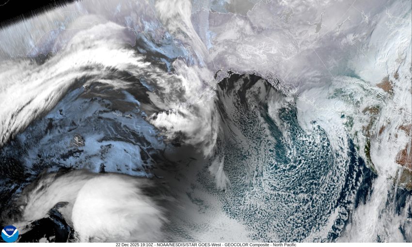
Welcome to Winter folks, the start of winter, the winter solstice, and the shortest day of the year, all happened yesterday. So, after another wet weekend, we can expect the active weather to continue with a low pressure area near British Columbia combining with an associated trough of low pressure in the Pacific. This combination will steer a series of disturbances across the region. We saw one today that gave us the rain and breezy winds that continue tonight, though the winds do ease a little, becoming southerly 5-10 gusting to 20, tonight’s low drops to near 39.

The rain diminishes later tomorrow morning though we could still see a widely scattered shower as a weak ridge of high pressure moves across, which also brings calm winds, and a high temperature of around 48 degrees. The rain returns later tomorrow night with another approaching disturbance that could be a problem on Christmas Eve, but more on that in a minute, as far as tomorrow night goes, rainy with light winds, the low near 48.

Now, Wednesday has turned into a very difficult day to forecast. The models all paint a different picture that ranges from a little wet to a little wet and very windy. Just to put you in the panic mode, but to show you the difference, one model has moderate rain with the winds at the coast and possibly inland, gusting from 60 to 80 mph. The National Weather Service points out this would not be as bad as the Columbus Day 1962 storm, but, would be the strongest since the 2007 storm. Some of the other models say light to moderate rain with little wind. All this depends on the track of the developing low pressure area, which the models historically have a hard time with. If the low tracks further offshore, then the coast might see some decent gusts. If the low is closer to the coast then we see the worst-case scenario, with the very high winds. If the low tracks further inland, like over the Cascades, the impact would be minimal.

If the worst case were to develop, then we are looking at those high winds moving up the coast Wednesday morning, into Southern Oregon around 9am, then move quickly up the coast and be northwest of Washington by around 4pm. This would mean we see increasing wind that morning, that peak early afternoon, then eases that evening. On the positive side, we had previously expected that the area could see heavy rain and heavy Cascade snow over the Holidays, but it now appears that threat is diminishing.

The National Weather Service will wait until the next model run for better consistency, then have a meeting to look at updating the forecast and possibly start issuing any Advisories, Watches and Warnings that are necessary. If the high wind scenario does develop, we are looking at some likely significant impacts including lots of downed trees, power outages and more. This event would not only impact the coast, but inland as well. If you have travel plans, as I do, over the holiday period, it is important to look at weather.gov/Portland for the lasted forecasts, and at Tripcheck.com for road impacts. Also know that being a holiday, and the large coverage of possible impacts, tripcheck.com will be very busy and may have a hard time keeping up with the many changes. All these impacts will be on top of the current landslide issues we have on the county and State roads, making travel even more hazardous. I will try to send out a brief update tomorrow.

After all this fun, it looks like we will continue to have the southwesterly flow pushing in periods of disturbed weather, brings on again, off again, rain through the area the rest of the week, and maybe the weekend, high temperatures remain around 50, lows around 40.

So, stay tuned, have a plan, stay safe, and Merry Christmas to all.

Slide Slide Slide Slide Slide Slide Slide Slide Subscribe Contribute

Ads

Featured Video

Tillamook Weather

Tides

Tillamook County Pioneer Podcast Series

Tillamook Church Search

Cloverdale Baptist Church
Nestucca Valley Presbyterian
Tillamook Ecumenical Service

Archives

  • Home
  • EULA Privacy Policy
  • Contact
  • Opt-out preferences
  • Search...
Share on facebook
Facebook
Share on pinterest
Pinterest
Share on twitter
Twitter
Share on linkedin
Linkedin
Catherine

Recent Posts

  • GORDON'S WEEKLY WEATHER UPDATE 12/22/25: Yep, it's Winter Folks - keep a keen eye on upcoming forecasts as things could get breezy, hang on to your hats or they might just blow into another state Wednesday!

    December 22, 2025
  • OREGON HEALTH AUTHORITY: Coverage, savings, peace of mind - Oregon encourages health plan enrollment for 2026

    December 22, 2025
  • OREGON PARKS & RECREATION DEPT.: OPRD SEEKS PUBLIC INPUT ON PROPOSED RULES FOR UNMANNED AIRCRAFT SYSTEMS (UAS) USE IN OREGON STATE PARKS

    December 22, 2025
©2025 Tillamook County Pioneer | Theme by SuperbThemes

Manage Cookie Consent
To provide the best experiences, we use technologies like cookies to store and/or access device information. Consenting to these technologies will allow us to process data such as browsing behavior or unique IDs on this site. Not consenting or withdrawing consent, may adversely affect certain features and functions.
Functional Always active
The technical storage or access is strictly necessary for the legitimate purpose of enabling the use of a specific service explicitly requested by the subscriber or user, or for the sole purpose of carrying out the transmission of a communication over an electronic communications network.
Preferences
The technical storage or access is necessary for the legitimate purpose of storing preferences that are not requested by the subscriber or user.
Statistics
The technical storage or access that is used exclusively for statistical purposes. The technical storage or access that is used exclusively for anonymous statistical purposes. Without a subpoena, voluntary compliance on the part of your Internet Service Provider, or additional records from a third party, information stored or retrieved for this purpose alone cannot usually be used to identify you.
Marketing
The technical storage or access is required to create user profiles to send advertising, or to track the user on a website or across several websites for similar marketing purposes.
  • Manage options
  • Manage services
  • Manage {vendor_count} vendors
  • Read more about these purposes
View preferences
  • {title}
  • {title}
  • {title}