")

By Gordon McCraw, Meteorologist for the Tillamook County Pioneer
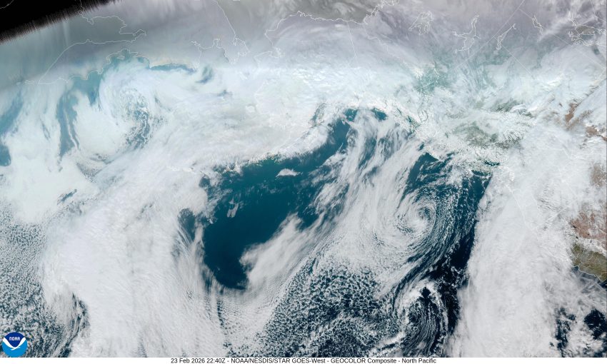
And here we are into the last week of February already. Now today, there is a large low-pressure area in the eastern Pacific that has been pushing rain in, off and on, over the weekend and will continue to bring more rain today. As I write this forecast, the area has seen about 1 ¾” of rain. We also have a broad upper-level trough resting over our area that is bringing us a weak atmosphere river but even with the rain and the snow melting, river flooding concerns remain very low. This means tonight’s forecast is for continued cloudy skies, with the rain, calm winds, and the low dropping to near 38.
The front remains over us tomorrow, but the rainfall rates are not as high as they have been, the winds becoming northwesterly 4-8, the high near 51. The front finely starts to drift southward tomorrow night, so the rain eases some more, the low near 37.
Wednesday the front and trough have slid off to the east and south, so we likely only just have some on and off light rain under mostly cloudy skies, the high near 51 again. Then only a 40% chance of rain still Wednesday night, the low near 36.
By Thursday, we see a zonal flow with partly sunny skies, but with the flow potentially pushing in a disturbance or two, there is still a chance of seeing on and off rain into Friday, highs near 53 but cooling Saturday into the low 30s with the partly cloudy nighttime skies.
The models get mixed over the weekend, with a few showing that low pressure area still off to our west that could wrap some moisture up across the area. Some of the models have it moving east as a trough toward the coast, so there is a slight chance of seeing some more rain later Saturday into Sunday. For now, we go with partly sunny skies over the weekend with a chance of rain, the highs near 53, the lows still around 32.