")

By Gordon McCraw, Meteorologist for the Tillamook County Pioneer
Happy Labor Day you’all!
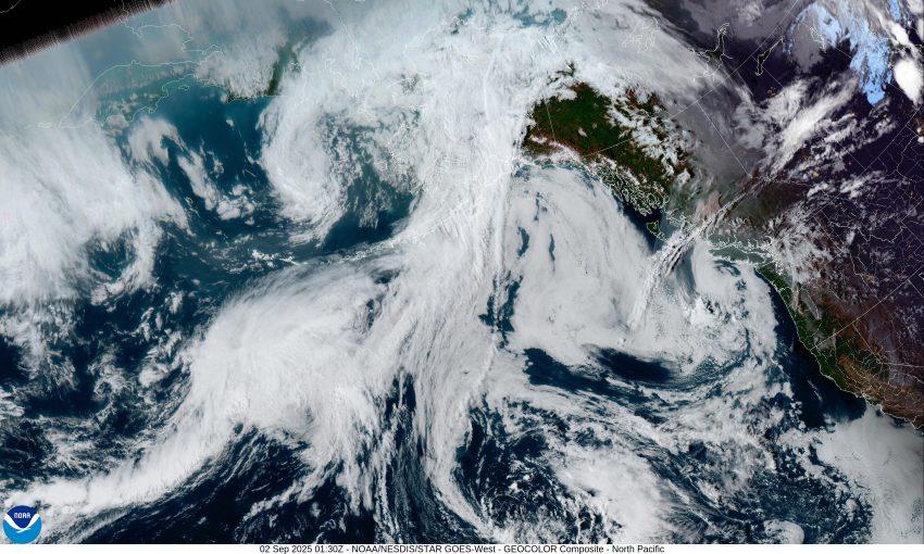
A look at the satellite picture shows several low pressure areas in the eastern Pacific. There is one currently spinning west of northern Washington that will end up getting pushed westward as a ridge of high pressure builds in over us from the southeast. The current pattern helped to bring another fair and mild day today. So, the marine clouds and patchy fog return tonight with light winds, the low near 54.
The ridge continues to build in tomorrow, and this will heat things up some. It brings us a mostly cloudy afternoon tomorrow, the winds becoming northwesterly 5-10, the high temperature creeps up to near 72. Look for increasing clouds again tomorrow night, calm winds, the low near 56.
The other weak low pressure area, currently spinning west of southern California, will likely drift northeastward into northern California Wednesday then into south central Oregon Wednesday morning, pushing some showers with possible thunderstorms across the Cascades. Here along the coast though, we see a return of the mostly sunny skies that afternoon with the afternoon winds becoming northwesterly 5-10, the high near 69. Then, yep, we see increasing clouds again Wednesday night, and the patchy fog, and the calm winds, and the overnight low near 56 again.
Thursday things become a little more uncertain thanks to the changing models. It looks like the third of three low pressure areas that I mentioned earlier, will be drifting northeastward towards the Gulf of Alaska, with its associated trough of low pressure lingering off the west coast. The pending change does not affect the Thursday weather though, we can expect the clouds to again slowly burn back leaving a mostly sunny afternoon with the high up near 70, then another cloudy night, the low near 55.
With the trough lingering off the coast, Friday looks to become mostly sunny again in the afternoon, the high is slightly cooler at 69, then we stay mostly cloudy Saturday and Sunday, the highs near 67, still mostly cloudy both nights, lows near 55.
For now, it looks like next week will be highlighted by that trough which would suggest cooler and wetter conditions for the coast. My usual caveat though, subject to change the next model run. In my favor though, the Climate Prediction Center suggests we look wetter also, though it says likely above average temperatures in their 8-14 day forecast issued yesterday.
That’s it for this week Tillamook, here’s hoping you all have a great week. See ya next Monday.