By Gordon McCraw, Meteorologist for the Tillamook County Pioneer
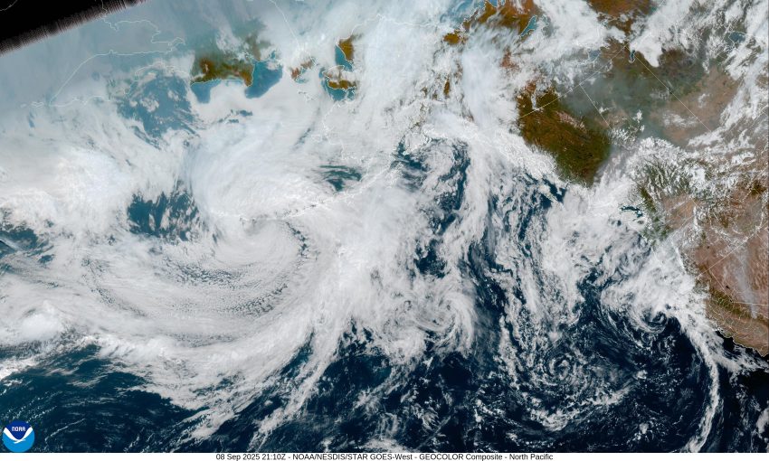
Hey, Tillamook, so for the next few days our weather will be affected by an upper level cut-off low pressure area that is drifting towards the coast, and then will drift across the area. Here is a little meteorological lesson for ya, in case you are wondering what a cut-off low pressure system is. It simply means it is a low pressure system that has become detached from the jet stream that normally pushes these lows from west to east. With no real steering currents, the low usually stalls or just drifts over an area leading to longer periods of rain or other types of weather for the folks below that system. The problem with this type of system is that without any real steering, the models have a hard time forecasting its movement. So now you know why we have a hard time forecasting the weather associated with these types of systems.
Now that I have explained what we are forecasting, let’s talk about what we are thinking. This morning the low was off the coast of northern California spinning some showers and thunderstorms northward towards Eugene. Fortunately for us forecasters, the models are in pretty much agreement that the showers will become more frequent, and pushing northward. So look for shower activity to become more frequent this evening and persist through later tonight, the overnight low near 55. Unfortunately, the bulk of the rain will be from the Coast Range eastward so total rainfall for the coast is likely less than ¼”.
The shower activity becomes a little more scattered tomorrow, so under mostly cloudy skies there is a 50-50 shot of seeing more showers, the winds becoming northwesterly 4-8, the high near 65, then the activity becomes more widely scattered by tomorrow night, with calm winds the low down near 53.
Wednesday is likely dry with only a slight chance of a light shower somewhere so look for mostly cloudy skies with light westerly winds, highs near 64, lows near 54, then by Thursday it looks like that closed low will have drifted off to the east allowing a weak ridge to build in over the area. This ends any remaining showers so Thursday and Friday look mostly cloudy but dry with highs near 64, lows near 54.
It appears there will be a trough of low pressure moving in over the weekend that will bring us another round of showers with measurable precipitation possible Saturday and Sunday, highs near 67, lows near 55.
I took a peek at the Climate Prediction Center’s 8 to 14 day Outlook issued yesterday, and it appears to be leaning towards above average precipitation with slightly above average temperatures as we approach the first day of Fall.
And, in case you missed it, yesterday was a full moon, also know as the Corn Moon as it is the times when corn is traditionally harvested. So, if things felt a little strange, now you know why.
Until next week, I hope everyone stays safe and have a great week.


