")

The time is 220 years ago. It was in January 1806 (January 6th through 10th) that Captain William Clark and a party of twelve or thirteen conducted the side exploration over the rugged geologic landmark we know as Tillamook Head. They were the first white men to visit this area on today’s Oregon coast between the communities of Seaside and Cannon Beach. Earlier in the month, they had received reports from the Indians, as well as from their
saltmakers stationed on the coast near present-day Seaside, of a large whale on the beach south of the high mountainous headland. The visit of January 1806, however, occurred nearly two months after the first sighting. Clark records seeing Tillamook Head from the north shore of the Columbia River mouth on Cape Disappointment, now in the state of Washington, on the previous November 18th.
At 11 a.m., Friday, January 3rd, some Clatsops visited the expedition’s members at their fort named after these local Indians. The Clatsops, Clark wrote: “.. brought for Sale Some roots berries and 3 Dogs also a Small quantity of fresh blubber, this blubber they informed us they had obtained from their neighbours the Cal la mox who inhabit the coast to the S.E. near one of their villages a whale had recently perished. This blubber the Indians eat and esteem it excellent food.” (Thwaites, Vol. 3, p 310)
On Sunday, January 5th, Alexander Willard and Peter Wiser returned from their saltmaking, bringing blubber with them. Clark wrote: “…it was white and not unlike the fat of pork, tho’ the texture was more spungey and Somewhat Coarser. we had part of it cooked and found it very pallitable and tender, it resembles the Beaver in flavour.” (Thwaites, Vol. 3, p. 314-) . Lewis noted it also tasted like dog meat which he liked. As we know Clark could not “become reconsiled” (Thwaites, Vol. 3, p. 310)to dog meat. Later that same evening Clark readied himself. “I determine to Set out early tomorrow with two canoes & 12 men in quest of the whale, or at all events to purchase from the indians a parcel of the blubber, for this purpose I made up a Small assortment of merchandize, and directed the men to hold themselves in readiness &c.” (Thwaites, Vol.- 3, p. 314).
Clark and the party of twelve or thirteen left the fort the next morning, Monday, January 6th. It seems virtually impossible to determine exactly the number or positive identification of the party. We know for certain that Captain Clark led the group and that Lewis did not accompany them. Clark notes that Charbonneau and Sacagawea came along. “The last evening Shabono and his Indian woman was very impatient to be permitted to go with me, and was therefore indulged; She observed that She had traveled a long way with us to See the great waters, and that now that monstrous fish was also to be Seen, She thought it verry hard that She could not be permitted to See either (She had never yet been to the Ocian).” (Thwaites, Vol. 3, p. 316)
We can safely assume both the child Baptiste Charbonneau and Clark’s servant York went along. The journeys also record the presence of Bratton, McNeal, Pryor and Frazier, bringing the total to seven men and the Indian woman and her baby. Ten other expedition members can be ruled out because the journal accounts place them elsewhere, and three (Willard, Wiser and Colter) probably did not go.
This leaves eleven of the thirty-three men unaccounted for, and any four or five of them could have made up the balance of Clark’s party.
Clark’s journal for January 6th reports a pleasant evening after a supper of elk meat: “…a butiful Clear moon Shiney night, and the 1st fair night
which we have had for 2 months.” (Thwaites, Vol. 3, p 317)
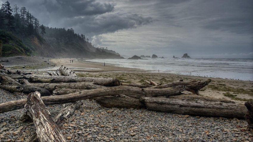
On Tuesday, January 7th, after traveling south along the beach for two miles, they encountered the saltmakers “. within 100 paces of the Ocian ”
(Thwaites, Vol. 3, p. 320). The Clatsop and Tillamook Indians lived close by and Clark hired one to assist the party in locating the beached whale. He writes: “We proceeded on the round Slipery Stones under a high hill which projected into the ocian about 4 miles.” (Thwaites, Vol. 3, p 320).
The “high hill” is located immediate south of the Seaside city limits and topographic maps show its highest point to be 1136 feet above sea level. Clark’s remarkable ability to judge heights and distances is again proven. He tells of the difficulty of the crossing: “…I thought more than probable that the assent might be torerably easy and therefore proceeded on, I soon found that the [path] become much worst as I assended, and at one place we were obliged to Support and draw our selves up by the bushes & roots for near 100 feet, and after about 2 hours labour and fatigue we reached the top of this high mountain, from the top of which I looked down with astonishment to behold the hight which we had assended, which appeared to be 10 or 12 hundred feet up a mountain which appeared to be almost perpindicular,…” (Thwaites, Vol. 3, p. 321).
Their campsite for that night was near the headwaters of a small stream, probably Canyon Creek. Captain Clark ends his day’s report: “…all much
fatiagued.” (Thwaites, Vol. 3, p. 321).
On the morning of Wednesday, January 8th, good weather favored the party. From the most westerly point on the prominence a most remarkable view was
theirs: “…from this point,” wrote the Captain,” I beheld the grandest and most pleasing prospects which my eyes ever surveyed, in my frount a boundless Ocean; to the N. and N.E. the coast as far as my sight could be extended, the Seas rageing with emence wave[s] and brakeing with great force from the rocks of Cape Disappointment as far as I could See to the N.W….and on the other side I have a view of the coast for an emence distance to the S.E. by S…from this point of View My guide pointed to a Village at the mouth of a small river near which place he Said the whale was…” (Thwaites, Vol. 3, p. 323).
The name “Clark’s Point of View” for Tillamook Head was given by the members of the exploring party, not by the Captain himself. It was in Lewis’s
journal for January 10th, as he details Clark’s report, that he records: “…this Mout i have taken the liberty of naming Clark’s Mountain and point
of view.” (Thwaites, Vol. 3, p. 333). The name did not persist.
As they continued their journey Clark described both the canoe burial custom of the Tillamook Indians and the geographic phenomena of the coastal
hillsides. “The Coast in the neighborhood of this old village is slipping from the Sides of the high hills, in emence masses; fifty or a hundred acres at a time give way and a great proportion of [in] an instant precipitated into the Ocean, those hills and mountains are principally composed of a yellow clay; their Slipping off or Spliting assunder at this time is no doubt caused by the incessant rains which has fallen within the last two months ” (Thwaites, Vol 3, p. 323-4).
An article by Lisa Paterson in the Oregon Journal dated May 24, 1973 and entitled “Storm by Storm, Ecola Park Slips into Sea,” described the park’s
geographic changes, especially the massive 1961 landslide. After traversing some rather rugged and rocky points Clark came to “…a butifull Sand Shore on which we continued for 2 miles…” This was very likely today’s Indian Beach. They then came to and crossed what was until recently Elk Creek and is now again named Ecola Creek, near Ecola State Park and the community of Cannon Beach. Captain Clark originally named the stream Ecola
or Whale Creek, from the Chinook Indian word ekoli meaning whale. At the mouth of Ecola Creek they found the whale–or what was left of it. The Tillamooks had been rendering oil from the blubber for some time. Clark wrote that the party: “…found only the Skelleton of this Monster on the Sand between [2 of] the Villages of the Kil a mox nation; the whale was already pillaged of every valuable part…” (Thwaites, Vol. 3, p. 324).
Clark described the method used by the Indians to render the oil and their reluctance to part with any of it or the blubber. The party did manage to trade for about 300 pounds of blubber and several gallons of oil. Clark noted: “Small as this stock is I prise it highly; and thank providence for
directing the whale to us; and think him much more kind to us than he was to jonah, having Sent this Monster to be Swallowed by us in Sted of Swallowing of us as Jonah’s did.” (Thwaites, Vol. 3, p 325).
Because Clark began his report for January 8th with an unclear reference “to .the top of the mountain next to the [former?] which is much the highest part…” (Thwaites, Vol. 3, p. 322), the location of the beached whale and the route to it have since been misinterpreted—first in the 1814 Biddle/Allen narrative, then by Elliott Coues in 1893, Reuben Thwaites and Olin Wheeler in 1904- and Milo Quaife in 1916. Today’s maps correctly designate the location of Tillamook Head and other points, and it is clear the whale was not beached near the Nehalem River as so many scholars had indicated.
The side exploration had accomplished its goal. It was time to return to Fort Clatsop. On the morning of Thursday, January 9th, Clark wrote: “…we
have now to look back and shudder at the dreadfull road on which we have to return [a distance] of 45 miles S E of Point adams & 35 miles from Fort Clatsop. I had the blubber & oil divided among’the party and set out about Sunrise….” (Thwaites, Vol. 3, p. 329). They reached Fort Clatsop at 10 p.m. the next evening, Friday, January 10th.
Today, a good portion of Tillamook Head is a part of Oregon’s Ecola State Park. The trail, much of it the same traversed on the January 1806 journey, was dedicated in April, 1972, as the “Tillamook Head National Recreation Trail,” the only trail to date to achieve this designation in the state of Oregon.
An Interpretive Talk at Ecola State Park Monday, August 11, 1974
Sixth Annual Meeting, Lewis and Clark Trail
Heritage Foundation, Seaside, Oregon
Prepared by Mrs. Mary Ann Amacker
References:
Lange, Robert E. (editor/compiler) “Historical Anecdotes Concerning The Lewis
And Clark Expedition And The Members Of The Exploring Party, And Lewis And
Clark News Notes.” Vol. 1, No. 1, January 1973.
Lange, Robert E. (ed) “Lewis & Clark Subject Finder Guides”—on Tillamook Head
McArthur, Lewis A. Oregon Geographic Names. 3rd edition, 1952.
Thwaites, Reuben Gold. Original Journals Of The Lewis And Clark Expedition,
1804-1806. Volume 3.