")
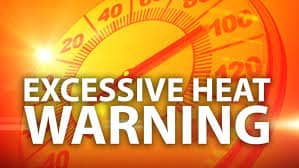

(EDITOR’S NOTE: Nearly the entire state, except for the coastline, will be under an excessive heat warning starting tomorrow, Thursday, July 4th through the weekend.)
National Weather Service Portland OR
1240 PM PDT Tue Jul 2 2024
North Oregon Coast Range Lowlands-Central Oregon Coast Range Lowlands-North Oregon Coast Range-Central Oregon Coast Range- Lower Columbia River-Tualatin Valley-Portland West Hills and Chehalem Mountain-Inner Portland Metro-East Portland Metro-Outer Southeast Portland Metro-West Central Willamette Valley-East Central Willamette Valley-Benton County Lowlands-Linn County Lowlands-Lane County Lowlands-West Columbia River Gorge of Oregon above 500 ft-West Columbia River Gorge I-84 Corridor-Upper Hood River Valley-Central Columbia River Gorge I-84 Corridor-Clackamas County Cascade Foothills-Cascade Foothills of Marion and Linn Counties-Lane County Cascade Foothills-Willapa and Wahkiakum Lowlands-Willapa Hills-Cowlitz County Lowlands-North Clark County Lowlands-Inner Vancouver Metro-East Clark County Lowlands-South Washington Cascade Foothills-West Columbia River Gorge SR 14 Corridor-Central Columbia River Gorge SR 14 Corridor- Including the cities of Silver Falls, Happy Valley, Mary`s Peak, Clatskanie, Odell, Hockinson, Wilsonville, Salmon Creek, McKenzie Bridge, Hoskins, Dallas, Washougal, Keizer, Eagle Creek, Welches, Lebam, Beacon Rock SP, Cathlamet, Rhododendron, McMinnville, Rosburg, Hillsboro, Troutdale, Sunset Summit, Sellwood, Evergreen, Estacada, Woodburn, Vida, Cottage Grove, Vancouver, Molalla, Multnomah Falls, Detroit, Philomath, Brightwood, Springfield, Battle Ground, Rainier, Junction City, Willapa, Cherryville, Castle Rock, Underwood, Grand Ronde Indian
Reservation, Monroe, La Center, Sherwood, Corvallis, Scappoose, Toutle, Brooklyn, Rockcreek, Horton, Brush Prairie, Creswell, Necanicum, Fairview, Grand Ronde, Longview, Kalama, North Bonneville, Sylvan Hill, Stevenson, Corbett, Vernonia, Lake Oswego, Camas, Alma, Wilson River Summit, Monmouth, Hood River, Sheridan, Brownsville, Albany, Jewell, Newberg, Knappa, Yacolt, Valsetz, Glenwood, Kelso, Forest Grove, Oregon City, Cascade Locks, Rooster Rock, Salem, Sandy, Carson, Harrisburg, Ridgefield, Bonneville, Woodland, Lake Merwin, Wyeth, Mapleton, Lebanon, Eugene, Mill City, Stayton, Skyline Drive, Cape Horn, Amboy, Chehalem Mountain, Silverton, Gresham, Portland, Oakridge, Boring, St. Helens, Parkdale, Tigard, and Alsea
…EXCESSIVE HEAT WARNING IN EFFECT FROM NOON THURSDAY TO 11 PM PDT SUNDAY…
* WHAT…Dangerously hot conditions with temperatures 100 to 105 expected. Overnight temperatures will also be very warm and limit chances to recover from the heat, with lows ranging from the mid 60s to low 70s.
* WHERE…Portions of northwest and west central Oregon and southwest Washington.
* WHEN…From noon Thursday to 11 PM PDT Sunday. The hottest temperatures are expected Friday through Sunday, peaking on Saturday.
* IMPACTS…Heat related illnesses increase significantly during extreme heat events.
* ADDITIONAL DETAILS…There is a 25-35 percent chance that temperatures will exceed 110 degrees on Saturday, and a 10-15 percent chance that temperatures will exceed 110 degrees Friday and Sunday.
PRECAUTIONARY/PREPAREDNESS ACTIONS…
Drink plenty of fluids, stay in an air-conditioned room, stay out of the sunshine, and check up on relatives and neighbors.
Do not leave young children and pets in unattended vehicles. Car interiors will reach lethal temperatures in a matter of minutes.
Take extra precautions when outside. Wear lightweight and loose fitting clothing. Try to limit strenuous activities to early morning or evening. Take action when you see symptoms of heat exhaustion and heat stroke.
Those seeking relief from the heat in area rivers and lakes should
take water safety precautions. Wear a life jacket and don`t venture
into the water alone.
To reduce risk during outdoor work, the Occupational Safety and Health Administration recommends scheduling frequent rest breaks inshaded or air conditioned environments. Anyone overcome by heat should be moved to a cool and shaded location. Heat stroke is an emergency! Call 9 1 1.
For sheltering information and other human services, dial 2 1 1
during business hours or visit 211info.org in Oregon