")

The second series of king tides, the highest high tides of the year, will happen from December 13-15, 2023. If you are on Oregon’s coast, you are invited to take photos of these high-water events. The Oregon King Tides Photo Project is part of a worldwide project to understand how sea levels are changing. Anyone with a camera can join in and help us catch a glimpse of what might happen with rising sea levels in our region. Everyone can participate, just pick a place, take a photo when the tide is at its highest, and share it online. The third and fourth series of winter king tides will occur on January 11 to 13, 2024, and February 8 to 10, 2024.
Oregon has participated in this international citizen science effort for thirteen years. The Oregon Coastal Management Program (OCMP), the CoastWatch Program of the Oregon Shores Conservation Coalition, and local partners, including the Oregon Coast Visitors Association, Oregon Sea Grant and others support this project. The OCMP, part of the Oregon Department of Land Conservation and Development, works in partnership with coastal local governments, state and federal agencies, and other stakeholders to manage, conserve, and develop Oregon’s coastal and ocean resources.
 A ‘king tide’ isn’t a scientific term, but it means a very high tide caused when the sun, moon, and earth line up, causing higher tides than usual. Sometimes king tides, especially when combined with heavy rain or storms, can cause flooding, erosion, and other impacts to buildings and roads, as we saw in several locations during previous king tides seasons.
King Tide events let us see what sea level rise might look like in our coastal communities. Even a small rise in sea levels could make winter storms worse, increase problems like erosion and flooding, and make beaches smaller. Seeing these high tides can help planners, resource agencies, conservationists, and coastal citizens get ready for these changes. You can see photos from past King Tides on the project’s Flickr site, https://www.flickr.com/people/orkingtide/.
Join the King Tides Photo Project on December 13 to 15, 2023; January 11 to 13, 2024; and February 8 to 11, 2024. Helpful king tide photos show water levels near things like pilings, seawalls or bridge supports. These fixed features help us see how high the water really is and track the change over time. Make sure to include where, when, and which way you took the picture. It’s also helpful to take two photos taken from the same place: one during peak king tide and the other during a normal high tide. You can find tide tables and photo instructions on the King Tides website: www.oregonkingtides.net.
For more information about the project, contact Rhiannon Bezore, Coastal Shores Specialist with the Oregon Department of Land Conservation and Development, (971)375-7336, rhiannon.bezore@dlcd.oregon.gov ; or Jesse Jones, CoastWatch Volunteer Coordinator, at (503) 989–7244, jesse@oregonshores.org
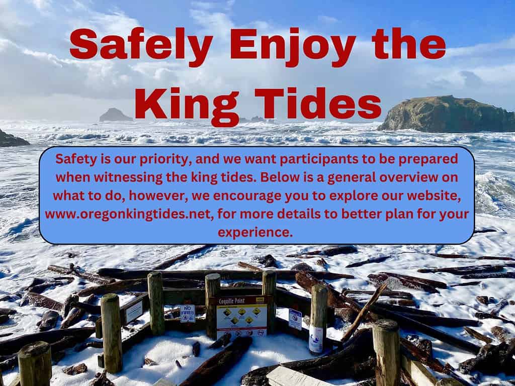
** Whenever you are on the Oregon Coast it is imperative that you keep an eye on the ocean at all times. Never put yourself in danger. Be very cautious of rising water, eroding shorelines, flooded roadways, and high winds during any extreme high tide events. **
<iframe width=”560″ height=”315″ src=”https://www.youtube.com/embed/V_AnBmN1qzw?si=AkZYs0dKw6kNUkIa” title=”YouTube video player” frameborder=”0″ allow=”accelerometer; autoplay; clipboard-write; encrypted-media; gyroscope; picture-in-picture; web-share” allowfullscreen></iframe>
 Oregon’s statewide land use planning program —originated in 1973 under Senate Bill 100 — protects farm and forest lands, conserves natural resources, promotes livable communities, facilitates orderly and efficient development, helps coordination among local governments, and enables community engagement.
The program affords all Oregonians predictability and sustainability to the development process by ensuring allocation of urban land for industrial, commercial, and housing development. The Department of Land Conservation and Development (DLCD) administers the program. A seven-member volunteer citizen board known as the Land Conservation and Development Commission (LCDC) guides DLCD.
Under the program, all cities and counties have adopted comprehensive plans that meet mandatory state standards. The standards are 19 Statewide Planning Goals that address land use, development, housing, transportation, and conservation of natural resources. Technical assistance in the form of grants to local jurisdictions is a key element of the program.