Menu
  • Home
  • Feature
    • Breaking News
    • Arts
    • Astrology
    • Business
    • Community
    • Employment
    • Event Stories
    • From the Pioneer
    • Government
    • Letters to the Editor
    • Non Profit News
    • Obituary
    • Public Safety
    • Podcast Interview Articles
    • Pioneer Pulse Podcast: Politics, Palette, and Planet – the Playlist
  • Guest Column
    • Perspectives
    • Don Backman Photos
    • Ardent Gourmet
    • Kitchen Maven
    • I’ve been thinking
    • Jim Heffernan
    • The Littoral Life
    • Neal Lemery
    • View From Here
    • Virginia Carrell Prowell
    • Words of Wisdom
  • Weather
  • Post Submission
  • Things to do
    • Calendar
    • Tillamook County Parks
    • Tillamook County Hikes
    • Whale Watching
    • Tillamook County Library
    • SOS Community Calendar
  • About
    • Contribute
    • Advertise
    • Subscribe
    • Opt-out preferences
  • Search...
Menu

Friday, December 22, 2023 Weather by Gordon McCraw

Posted on December 22, 2023 by Cara Mico, Assistant Editor

By Gordon McCraw

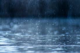
We had that fast moving cold front zip through early this morning, bringing rain and gusty winds with between ¼ and 3/4” of rain. We saw some scattered showers behind the front that will persist tonight though becoming more widely scattered before diminishing before midnight as a high pressure ridge moves in. The front is ushering in colder air that pushed down the snow level to around 2500 during the day today which will continue to drop to near 2000’ tonight.

Speaking of tonight, we see partly cloudy skies moving in overnight with the winds becoming easterly 4-8, maybe some patchy early morning fog, the low drops to near 30. Any remaining moisture on the roads may freeze so stay alert for black ice, especially on the bridges.

With the ridge moving in we can expect partly sunny skies tomorrow, winds still easterly 4-8, the high only near 49. We will see increasing clouds tomorrow night ahead of the next system that will start giving us a slight chance of rain in the early morning hours, the winds easterly 4-8, the snow level still near 2000’. Depending on the timing of all this, the summit may see some flurries in the morning hours until the temperature climbs with the incoming, warmer system.

It looks like a flat, or zonal west to east flow, will develop by Sunday that will persist through most of next week. This will also be accompanied by a strong jet stream that will push a series of systems across the area that will bring rain across the region through the holiday period through most of next week. These systems will be ushering in breezy, sometimes windy, conditions as they push across.

So, Sunday looks like it will become rainy by midmorning, winds becoming southerly 5-10, highs up near 50, the snow level will be climbing up to near 4500’, rainy still that night, lows near 41. Christmas Day looks cloudy, rainy, and breezy, highs near 55, lows near 47.

As I mentioned, Tuesday and Wednesday will see more rain with breezy conditions, highs near 56, lows near 46. Things still look rainy Thursday, but a little cooler with the high near 53, lows near 40.

If you plan to travel eastward, you will want to keep a close eye on the weather and road reports. Saturday and Sunday the Gorge and Hood River areas may see snow or maybe even some freezing rain as they will be slower to warm, especially Sunday, in fact, after that there is a slight chance that they may have snow and ice issues all the way through midweek. Like I said previously, even the Coast Range passes could see some snow Sunday morning before the temperature starts rising from the incoming southerly winds. Obviously the Cascade passes may be seeing some snow today then some more Sunday, a mix on Monday above around 5500-6500’. The precipitation looks to be just snow by around Thursday when things start to cool down.

Lastly, it looks like the heaviest of rain will be to the south towards California with an atmospheric river impacting that area more, so for now, hydrological issues appear to be of minimal concern.

So, from me to all of you, have a safe and very Merry Christmas!

Listen to the forecast here:

  • Gordon McCraw Weather
  • Slide Slide Slide Slide Slide Slide Slide Slide Subscribe Contribute

    Ads

    Featured Video

    Tillamook Weather

    Tides

    Tillamook County Pioneer Podcast Series

    Tillamook Church Search

    Cloverdale Baptist Church
    Nestucca Valley Presbyterian
    Tillamook Ecumenical Service

    Archives

    • Home
    • EULA Privacy Policy
    • Contact
    • Opt-out preferences
    • Search...
    Share on facebook
    Facebook
    Share on pinterest
    Pinterest
    Share on twitter
    Twitter
    Share on linkedin
    Linkedin
    Catherine

    Recent Posts

    • ROCKAWAY BEACH READIES FOR JULY 4TH FESTIVITIES - HONORS VOLUNTEER OF YEAR & PARADE GRAND MARSHAL

      June 30, 2025
    • NEWS UPDATE FROM STATE REPRESENTATIVE DAVID GOMBERG: It's a Session Wrap!

      June 30, 2025
    • GORDON'S WEEKLY WEATHER UPDATE 6/30/25: Back to Normal Summer Weather This Week - Fair, Dry & Mild; Holiday Weekend Weather Looks Good

      June 30, 2025
    ©2025 | Theme by SuperbThemes

    Manage Cookie Consent
    To provide the best experiences, we use technologies like cookies to store and/or access device information. Consenting to these technologies will allow us to process data such as browsing behavior or unique IDs on this site. Not consenting or withdrawing consent, may adversely affect certain features and functions.
    Functional Always active
    The technical storage or access is strictly necessary for the legitimate purpose of enabling the use of a specific service explicitly requested by the subscriber or user, or for the sole purpose of carrying out the transmission of a communication over an electronic communications network.
    Preferences
    The technical storage or access is necessary for the legitimate purpose of storing preferences that are not requested by the subscriber or user.
    Statistics
    The technical storage or access that is used exclusively for statistical purposes. The technical storage or access that is used exclusively for anonymous statistical purposes. Without a subpoena, voluntary compliance on the part of your Internet Service Provider, or additional records from a third party, information stored or retrieved for this purpose alone cannot usually be used to identify you.
    Marketing
    The technical storage or access is required to create user profiles to send advertising, or to track the user on a website or across several websites for similar marketing purposes.
    Manage options Manage services Manage {vendor_count} vendors Read more about these purposes
    View preferences
    {title} {title} {title}