Menu
  • Home
  • Feature
    • Breaking News
    • Arts
    • Astrology
    • Business
    • Community
    • Employment
    • Event Stories
    • From the Pioneer
    • Government
    • Letters to the Editor
    • Non Profit News
    • Obituary
    • Public Safety
    • Podcast Interview Articles
    • Pioneer Pulse Podcast: Politics, Palette, and Planet – the Playlist
  • Guest Column
    • Perspectives
    • Don Backman Photos
    • Ardent Gourmet
    • Kitchen Maven
    • I’ve been thinking
    • Jim Heffernan
    • The Littoral Life
    • Neal Lemery
    • View From Here
    • Virginia Carrell Prowell
    • Words of Wisdom
  • Weather
  • Post Submission
  • Things to do
    • Calendar
    • Tillamook County Parks
    • Tillamook County Hikes
    • Whale Watching
    • Tillamook County Library
    • SOS Community Calendar
  • About
    • Contribute
    • Advertise
    • Subscribe
    • Opt-out preferences
  • Search...
Menu

GAM WEATHER CENTER: Winter Weather through Weekend, Cold Temperatures – 12/23/21

Posted on December 23, 2021December 23, 2021 by Editor

By Gordon McCraw, GAM Weather Center
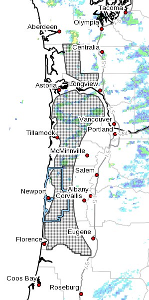
Because the next few days will be getting interesting, I provide you the following: Let’s just go with we know there will be a series of systems moving across the area the next seven days that will bring showery precipitation across the area each day with lowering temperatures also. Because it is scattered showers, we cannot say when, exactly, you will see the rain because of the hit and miss nature of showers, one area gets the rain from this shower while the neighbors don’t. So, the most impact from all this is the temperatures and snow levels. Here is what we see:
One front went through this morning pushing the snow level down to 2000’, todays high near 45, showers with possible thunderstorms tonight, winds becoming southwesterly 10-15 gusting to 25 tonight with another system, lows near 38, remember the windchill will make it feel like the upper 20s.
Tomorrow more showers, still breezy with westerly winds, the high near 45, snow level 1800’. Showers and possible thunderstorms tomorrow night, lows near 35, windchill in the 20s, snow level 1500’ so the summits start to be impacted.

Winter Storm Watch Area – 12/23/21
Christmas Day, showers, gusty winds, snow level 1000’ with the high near 43. Christmas night, rain, then a rain/snow mix after sunset, then snow after midnight, the low near 32. The Coast Range passes will see snow impacts with travel across the summit more difficult.
Sunday on, daytime highs in the mid to upper 30s means a rain/snow mix during the day, the actual snow level 300-500’, the temperatures drop into the 20s at night spells icy roads with snow showers all night causing significant impacts on nearly all roads and highways, snow on top of ice.
The models are suggesting Arctic Air moves in Wednesday so the daytime highs and the nighttime lows will actually drop some more. We could see daytime highs in the low 30s and nighttime lows in the low 20s. Also remember in all this that not all of the snow will melt during the day so each day could add to the accumulation totals making travel even more treacherous.

Featured Video

Ads

Slide Contribute SUBSCRIBE

Tillamook Weather

Tides

Tillamook County Pioneer Podcast Series

Tillamook Church Search

Cloverdale Baptist Church
Nestucca Valley Presbyterian
Tillamook Ecumenical Service

Archives

  • Home
  • EULA Privacy Policy
  • Contact
  • Opt-out preferences
  • Search...
Share on facebook
Facebook
Share on pinterest
Pinterest
Share on twitter
Twitter
Share on linkedin
Linkedin
Catherine

Recent Posts

  • Noland Arbaugh’s Neuralink Journey Unveiled

    June 21, 2025
  • WORDS OF WISDOM: Thinking About Fathers’ Day

    June 21, 2025
  • Nestucca High School heroes showed courage, compassion, and wisdom when it mattered most; Their quick action save Coach's life

    June 21, 2025
©2025 | Theme by SuperbThemes

Manage Cookie Consent
To provide the best experiences, we use technologies like cookies to store and/or access device information. Consenting to these technologies will allow us to process data such as browsing behavior or unique IDs on this site. Not consenting or withdrawing consent, may adversely affect certain features and functions.
Functional Always active
The technical storage or access is strictly necessary for the legitimate purpose of enabling the use of a specific service explicitly requested by the subscriber or user, or for the sole purpose of carrying out the transmission of a communication over an electronic communications network.
Preferences
The technical storage or access is necessary for the legitimate purpose of storing preferences that are not requested by the subscriber or user.
Statistics
The technical storage or access that is used exclusively for statistical purposes. The technical storage or access that is used exclusively for anonymous statistical purposes. Without a subpoena, voluntary compliance on the part of your Internet Service Provider, or additional records from a third party, information stored or retrieved for this purpose alone cannot usually be used to identify you.
Marketing
The technical storage or access is required to create user profiles to send advertising, or to track the user on a website or across several websites for similar marketing purposes.
Manage options Manage services Manage {vendor_count} vendors Read more about these purposes
View preferences
{title} {title} {title}