Menu
  • Home
  • Breaking News
  • Feature
    • Arts
    • Astrology
    • Business
    • Community
    • Employment
    • Event Stories
    • From the Pioneer
    • Government
    • Letters to the Editor
    • Non Profit News
    • Obituary
    • Public Safety
    • Podcast Interview Articles
    • Pioneer Pulse Podcast: Politics, Palette, and Planet – the Playlist
  • Weather
  • Guest Column
    • Perspectives
    • Don Backman Photos
    • Ardent Gourmet
    • Kitchen Maven
    • I’ve been thinking
    • Jim Heffernan
    • The Littoral Life
    • Neal Lemery
    • View From Here
    • Virginia Carrell Prowell
    • Words of Wisdom
  • Things to do
    • Calendar
    • Tillamook County Parks
    • Tillamook County Hikes
    • Whale Watching
    • Tillamook County Library
    • SOS Community Calendar
  • About
    • Contribute
    • Advertise
    • Subscribe
    • Opt-out preferences
  • Post Submission Test
  • Search...
Menu

GORDON’S UPDATE: Weather 10/10/23 – Thunderstorms, Winds, Sneaker Waves

Posted on October 10, 2023 by Editor

By Gordon McCraw, Meteorologist for the Tillamook County Pioneer

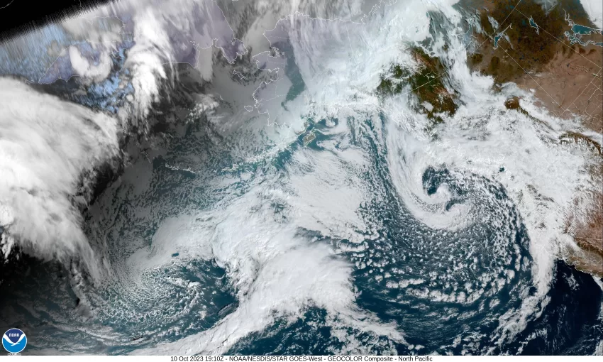
We had a front march through this morning that gave us about 1/4” or less of light rain with relatively light winds. Its associated low pressure center then headed toward Washington, increasing the winds and pushing in some showers with a thunderstorm threat. The low will continue to push into Washington tonight and brings a threat of moderate to heavy showers with small hail as well as the thunderstorm threat. Winds will become southerly 10-15 gusting to 30, with gusts to 40-50 possible at the beaches, especially in and around any thunderstorms as they push through, the low temperature tonight near 48.

The low pushes inland tomorrow morning so we continue to see moderate to heavy showers rotating across the area, some with hail, along with that chance of thunderstorms. It will also continue to give us some breezy westerly winds as it moves inland, then some more northerly winds as it moves northeast of our area. Winds will be around 10-15 gusting to 30. The showers and winds will ease tomorrow night and the thunderstorm chance diminishes, winds westerly 5-10 becoming southerly after midnight, lows near 49.

By Thursday we see a weak ridge moving in, so the shower chance ends but there is a chance of some patchy morning fog, otherwise we see partly sunny skies with east winds 4-8, highs up around 65. Still a mostly cloudy night, lows near 50.

Friday on through the weekend we see a trough of low pressure inching in which gives us a chance of rain or rainshowers each day through Monday, the highs in the lows 60s, lows in the low 50s.

Just a heads up to the beach walkers, and potential fishermen. Because of the strong westerly winds developing offshore associated with the low pressure area that will move into Washington tomorrow, I am seeing in the forecast the potential for some significantly high seas, in the area of 20 to 30’; building well offshore tonight into tomorrow morning, and the wave forecasts show this getting pushed towards the coast though they will ease some before reaching the coast. It suggests the waves will still be in the 15-18’ range near the coast tomorrow morning from near Tillamook southward, lower as you go north along the coast. They will then start to fall and be in the 7-10’ range by Thursday morning. Think “Sneaker Wave” as a result!

Featured Video

Slide Contribute SUBSCRIBE

Tillamook Weather

Tides

Tillamook County Pioneer Podcast Series

Tillamook Church Search

Cloverdale Baptist Church
Nestucca Valley Presbyterian
Tillamook Ecumenical Service

Archives

  • Home
  • EULA Privacy Policy
  • Contact
  • Opt-out preferences
  • Search...
Share on facebook
Facebook
Share on pinterest
Pinterest
Share on twitter
Twitter
Share on linkedin
Linkedin
Catherine

Recent Posts

  • Tillamook FFA Excels in State Career Development Events: Two Teams Headed to Nationals

    May 12, 2025
  • Tillamook Police Department Invites Community for Coffee with a Cop May 14th

    May 12, 2025
  • GORDON'S WEEKLY WEATHER UPDATE 5/12/25: Showery Pattern Continues Through Week

    May 12, 2025
©2025 | Theme by SuperbThemes

Manage Cookie Consent
To provide the best experiences, we use technologies like cookies to store and/or access device information. Consenting to these technologies will allow us to process data such as browsing behavior or unique IDs on this site. Not consenting or withdrawing consent, may adversely affect certain features and functions.
Functional Always active
The technical storage or access is strictly necessary for the legitimate purpose of enabling the use of a specific service explicitly requested by the subscriber or user, or for the sole purpose of carrying out the transmission of a communication over an electronic communications network.
Preferences
The technical storage or access is necessary for the legitimate purpose of storing preferences that are not requested by the subscriber or user.
Statistics
The technical storage or access that is used exclusively for statistical purposes. The technical storage or access that is used exclusively for anonymous statistical purposes. Without a subpoena, voluntary compliance on the part of your Internet Service Provider, or additional records from a third party, information stored or retrieved for this purpose alone cannot usually be used to identify you.
Marketing
The technical storage or access is required to create user profiles to send advertising, or to track the user on a website or across several websites for similar marketing purposes.
Manage options Manage services Manage {vendor_count} vendors Read more about these purposes
View preferences
{title} {title} {title}