Menu
  • Home
  • Feature
    • Breaking News
    • Arts
    • Astrology
    • Business
    • Community
    • Employment
    • Event Stories
    • From the Pioneer
    • Government
    • Letters to the Editor
    • Non Profit News
    • Obituary
    • Public Safety
    • Podcast Interview Articles
    • Pioneer Pulse Podcast: Politics, Palette, and Planet – the Playlist
  • Guest Column
    • Perspectives
    • Don Backman Photos
    • Ardent Gourmet
    • Kitchen Maven
    • I’ve been thinking
    • Jim Heffernan
    • The Littoral Life
    • Neal Lemery
    • View From Here
    • Virginia Carrell Prowell
    • Words of Wisdom
  • Weather
  • Post Submission
  • Things to do
    • Calendar
    • Tillamook County Parks
    • Tillamook County Hikes
    • Whale Watching
    • Tillamook County Library
    • SOS Community Calendar
  • About
    • Contribute
    • Advertise
    • Subscribe
    • Opt-out preferences
  • Search...
Menu

GORDON’S UPDATE: Weather 11/16/23 – Pattern Change Coming, After Couple Dry Days

Posted on November 16, 2023 by Editor

By Gordon McCraw, Meteorologist for the Tillamook County Pioneer

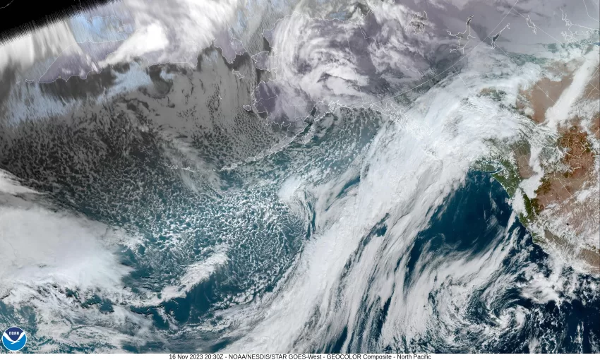
So, we continue to see a blocking ridge of high pressure to the northwest, and the cutoff low pressure area to the southwest off of California. This left us with another chilly, foggy start to the day with a light northerly flow, and now, with little pattern change, we see another chilly, foggy night once again, with light easterly winds, the low down around 39.

Tomorrow the pattern finally starts to change as the blocking ridge weakens and the low off of California starts to finally get pushed inland to the east. We start out with mostly sunny skies after the morning fog and stratus clears, the winds still easterly 4-8, highs near 62. That night the clouds roll in ahead of a fast moving front that will push rain into the area in the early morning hours Saturday. We still see the light easterly winds Friday night with the lows near 44.

Sorry folks, the weekend looks wet, Saturday is cloudy and rainy with the winds becoming southerly 5-10, highs near 56, rainy Saturday night, then the front pushes though late night and we transition to scattered showers with breezy westerly winds 15-20 gusting to 30, lows near 42.

The showers continue into Sunday morning, then dissipate in the afternoon, highs near 53. With another ridge of high pressure building in, it looks like we have partly cloudy skies Sunday night, with diminishing winds, the lows near 38.

If your weekend travel plans include heading over the Santiam and Willamette Passes, you will likely have to contend with accumulating snow above 3500’, so plan accordingly as they could see 3-6” of snow Saturday evening into Sunday morning.

The ridge gives us a partly sunny and dry Monday, the high near 57, but the dry is short lived as a trough of low pressure will bring back a slight chance of rain Monday night with an increasing chance on Tuesday, then scattered showers on Wednesday. High temperatures next week will hang around 57 while the lows warm into the low to mid 40s.

Slide Slide Slide Slide Slide Slide Slide Slide Subscribe Contribute

Ads

Featured Video

Tillamook Weather

Tides

Tillamook County Pioneer Podcast Series

Tillamook Church Search

Cloverdale Baptist Church
Nestucca Valley Presbyterian
Tillamook Ecumenical Service

Archives

  • Home
  • EULA Privacy Policy
  • Contact
  • Opt-out preferences
  • Search...
Share on facebook
Facebook
Share on pinterest
Pinterest
Share on twitter
Twitter
Share on linkedin
Linkedin
Catherine

Recent Posts

  • ROCKAWAY BEACH READIES FOR JULY 4TH FESTIVITIES - HONORS VOLUNTEER OF YEAR & PARADE GRAND MARSHAL

    June 30, 2025
  • NEWS UPDATE FROM STATE REPRESENTATIVE DAVID GOMBERG: It's a Session Wrap!

    June 30, 2025
  • GORDON'S WEEKLY WEATHER UPDATE 6/30/25: Back to Normal Summer Weather This Week - Fair, Dry & Mild; Holiday Weekend Weather Looks Good

    June 30, 2025
©2025 | Theme by SuperbThemes

Manage Cookie Consent
To provide the best experiences, we use technologies like cookies to store and/or access device information. Consenting to these technologies will allow us to process data such as browsing behavior or unique IDs on this site. Not consenting or withdrawing consent, may adversely affect certain features and functions.
Functional Always active
The technical storage or access is strictly necessary for the legitimate purpose of enabling the use of a specific service explicitly requested by the subscriber or user, or for the sole purpose of carrying out the transmission of a communication over an electronic communications network.
Preferences
The technical storage or access is necessary for the legitimate purpose of storing preferences that are not requested by the subscriber or user.
Statistics
The technical storage or access that is used exclusively for statistical purposes. The technical storage or access that is used exclusively for anonymous statistical purposes. Without a subpoena, voluntary compliance on the part of your Internet Service Provider, or additional records from a third party, information stored or retrieved for this purpose alone cannot usually be used to identify you.
Marketing
The technical storage or access is required to create user profiles to send advertising, or to track the user on a website or across several websites for similar marketing purposes.
Manage options Manage services Manage {vendor_count} vendors Read more about these purposes
View preferences
{title} {title} {title}