Menu
  • Home
  • Breaking News
  • Feature
    • Arts
    • Astrology
    • Business
    • Community
    • Employment
    • Event Stories
    • From the Pioneer
    • Government
    • Letters to the Editor
    • Non Profit News
    • Obituary
    • Public Safety
    • Podcast Interview Articles
    • Pioneer Pulse Podcast: Politics, Palette, and Planet – the Playlist
  • Weather
  • Guest Column
    • Perspectives
    • Don Backman Photos
    • Ardent Gourmet
    • Kitchen Maven
    • I’ve been thinking
    • Jim Heffernan
    • The Littoral Life
    • Neal Lemery
    • View From Here
    • Virginia Carrell Prowell
    • Words of Wisdom
  • Things to do
    • Calendar
    • Tillamook County Parks
    • Tillamook County Hikes
    • Whale Watching
    • Tillamook County Library
    • SOS Community Calendar
  • About
    • Contribute
    • Advertise
    • Subscribe
    • Opt-out preferences
  • Post Submission Test
  • Search...
Menu

GORDON’S UPDATE: Weather 12/26/23 – A Break Today, More Rain on the Way …

Posted on December 26, 2023 by Editor

By Gordon McCraw, Meteorologist for the Tillamook County Pioneer

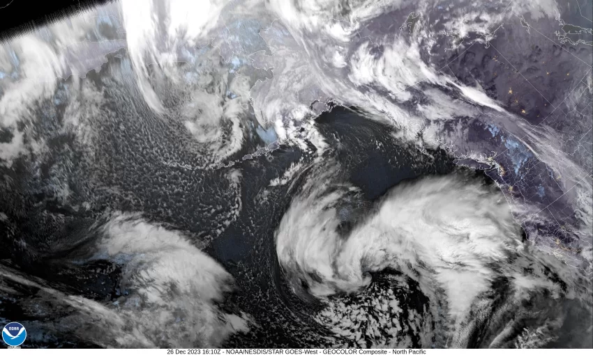
Well, the Christmas front was not as bad as it appeared it was going to be. It looks like the area saw between ½” to 1″ of rain in the past 24 hours and the winds were not that bad either with gusts in town 20-30, and gusts at the beaches 30-40 with isolated gusts to 50. A look at the satellite picture shows the system has already pushed off through Idaho. Now today, things are calming down as we are between systems, but the next one is already knocking on the door. It looks like we will see part of a weak warm front that will give us a chance of some light rain this evening with rain chance continuing to increase tonight with easterly winds 8-12, and highs near 45.

We see more rain tomorrow with the associated cold front moving in, then the front passes around noon and we transition over to scattered showers, becoming breezy again with southeasterly winds 14-18 gusting to 25, the high near 55. Tomorrow night we will continue to see scattered showers with a chance of thunderstorms moving in late tomorrow night, the winds increasing to southerly 20-25 gusting to near 40, lows near 47. This would put the windchill in the mid 30s.

Thursday, we continue to see some isolated showers that become more widely scattered in the afternoon and evening, the winds Thursday southeasterly 8-12 gusting to 20, highs near 58. Then low pressure areas to the west and northwest in a long trough will occasionally jetting disturbances out that ride the flow up into our area. The winds Thursday night southeasterly 8-12 with gusts to 20 starting around midnight, lows near 46.

It looks like another disturbance will increase the rain threat Friday and Saturday, highs near 56, lows near 43. Another system brings more rain on Sunday with a chance still on New Years Day, highs down near 54, lows near 40.

Featured Video

Slide Contribute SUBSCRIBE

Tillamook Weather

Tides

Tillamook County Pioneer Podcast Series

Tillamook Church Search

Cloverdale Baptist Church
Nestucca Valley Presbyterian
Tillamook Ecumenical Service

Archives

  • Home
  • EULA Privacy Policy
  • Contact
  • Opt-out preferences
  • Search...
Share on facebook
Facebook
Share on pinterest
Pinterest
Share on twitter
Twitter
Share on linkedin
Linkedin
Catherine

Recent Posts

  • ARDENT GOURMET: Stunning Szechuan Garden in Hillsboro

    May 19, 2025
  • South County Candidates Forum: Nestucca Valley School District Candidates say, “Get Out the Vote!”

    May 19, 2025
  • REPRESENTATIVE CYRUS JAVADI TOWN HALL MAY 21ST IN TILLAMOOK AT TBCC

    May 19, 2025
©2025 | Theme by SuperbThemes

Manage Cookie Consent
To provide the best experiences, we use technologies like cookies to store and/or access device information. Consenting to these technologies will allow us to process data such as browsing behavior or unique IDs on this site. Not consenting or withdrawing consent, may adversely affect certain features and functions.
Functional Always active
The technical storage or access is strictly necessary for the legitimate purpose of enabling the use of a specific service explicitly requested by the subscriber or user, or for the sole purpose of carrying out the transmission of a communication over an electronic communications network.
Preferences
The technical storage or access is necessary for the legitimate purpose of storing preferences that are not requested by the subscriber or user.
Statistics
The technical storage or access that is used exclusively for statistical purposes. The technical storage or access that is used exclusively for anonymous statistical purposes. Without a subpoena, voluntary compliance on the part of your Internet Service Provider, or additional records from a third party, information stored or retrieved for this purpose alone cannot usually be used to identify you.
Marketing
The technical storage or access is required to create user profiles to send advertising, or to track the user on a website or across several websites for similar marketing purposes.
Manage options Manage services Manage {vendor_count} vendors Read more about these purposes
View preferences
{title} {title} {title}