Menu
  • Home
  • Breaking News
  • Feature
    • Arts
    • Astrology
    • Business
    • Community
    • Employment
    • Event Stories
    • From the Pioneer
    • Government
    • Letters to the Editor
    • Non Profit News
    • Obituary
    • Public Safety
    • Podcast Interview Articles
    • Pioneer Pulse Podcast: Politics, Palette, and Planet – the Playlist
  • Weather
  • Guest Column
    • Perspectives
    • Don Backman Photos
    • Ardent Gourmet
    • Kitchen Maven
    • I’ve been thinking
    • Jim Heffernan
    • The Littoral Life
    • Neal Lemery
    • View From Here
    • Virginia Carrell Prowell
    • Words of Wisdom
  • Things to do
    • Calendar
    • Tillamook County Parks
    • Tillamook County Hikes
    • Whale Watching
    • Tillamook County Library
    • SOS Community Calendar
  • About
    • Contribute
    • Advertise
    • Subscribe
    • Opt-out preferences
  • Post Submission Test
  • Search...
Menu

GORDON’S UPDATE: Weather 12/29/23 – Rain, then Showers, mostly Dry New Year’s Day

Posted on December 29, 2023 by Editor
www.tillamookcountypioneer.net

By Gordon McCraw, Meteorologist for the Tillamook County Pioneer

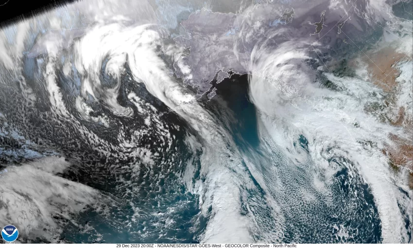
Another day and here comes another front. The morning satellite picture shows a large trough sitting off the coast with imbedded low pressure centers riding in the flow, bringing us periods of rain and breezy winds. I saw easterly winds this morning of 15-20 gusting to around 30 at the airport with similar winds down at the beaches. These low pressure areas are expected to drift northward today towards British Columbia, bringing periods of rain through early this evening when the rain and winds ease. There is also a slight chance that thunderstorms could pop up offshore near the beaches. Again, the rain and winds ease tonight, the easterly winds 8-12, lows near 47.

It looks like we will see some more light rain tomorrow with the winds now southerly 5-10, the high near 54, the light rain transitions to scattered showers later tomorrow evening, but these to start to slowly diminish, becoming widely scattered overnight, light southerly winds, lows near 39.

High pressure starts to build in New Year’s Eve which puts an end to any remaining showers Sunday morning, then we see some partly sunny skies with light easterly winds still, highs near 54. With some breaks in the clouds Sunday night, the low dips to near 38.

The models start to get mixed New Year’s Day, but we are going with a mostly dry day under partly sunny skies again, you could still see a rogue light shower by the afternoon, the high near 54. That night the models are sending increasingly mixed signals with some saying the ridge will continue to influence our weather while several other models show a trough of low pressure will move close enough to bring back some rain. Given the recent pattern history, we are opting for the chance of rain returning Monday night, lows near 40.

Given all this, we think the rain will return Tuesday with a chance of rain still on Wednesday and Thursday as well, daytime highs near 52, nighttime lows near 39.

LISTEN HERE to Gordon’s regional forecast:

Featured Video

Slide Contribute SUBSCRIBE

Tillamook Weather

Tides

Tillamook County Pioneer Podcast Series

Tillamook Church Search

Cloverdale Baptist Church
Nestucca Valley Presbyterian
Tillamook Ecumenical Service

Archives

  • Home
  • EULA Privacy Policy
  • Contact
  • Opt-out preferences
  • Search...
Share on facebook
Facebook
Share on pinterest
Pinterest
Share on twitter
Twitter
Share on linkedin
Linkedin
Catherine

Recent Posts

  • ARDENT GOURMET: Stunning Szechuan Garden in Hillsboro

    May 19, 2025
  • South County Candidates Forum: Nestucca Valley School District Candidates say, “Get Out the Vote!”

    May 19, 2025
  • REPRESENTATIVE CYRUS JAVADI TOWN HALL MAY 21ST IN TILLAMOOK AT TBCC

    May 19, 2025
©2025 | Theme by SuperbThemes

Manage Cookie Consent
To provide the best experiences, we use technologies like cookies to store and/or access device information. Consenting to these technologies will allow us to process data such as browsing behavior or unique IDs on this site. Not consenting or withdrawing consent, may adversely affect certain features and functions.
Functional Always active
The technical storage or access is strictly necessary for the legitimate purpose of enabling the use of a specific service explicitly requested by the subscriber or user, or for the sole purpose of carrying out the transmission of a communication over an electronic communications network.
Preferences
The technical storage or access is necessary for the legitimate purpose of storing preferences that are not requested by the subscriber or user.
Statistics
The technical storage or access that is used exclusively for statistical purposes. The technical storage or access that is used exclusively for anonymous statistical purposes. Without a subpoena, voluntary compliance on the part of your Internet Service Provider, or additional records from a third party, information stored or retrieved for this purpose alone cannot usually be used to identify you.
Marketing
The technical storage or access is required to create user profiles to send advertising, or to track the user on a website or across several websites for similar marketing purposes.
Manage options Manage services Manage {vendor_count} vendors Read more about these purposes
View preferences
{title} {title} {title}