Menu
  • Home
  • Breaking News
  • Feature
    • Arts
    • Astrology
    • Business
    • Community
    • Employment
    • Event Stories
    • From the Pioneer
    • Government
    • Letters to the Editor
    • Non Profit News
    • Obituary
    • Public Safety
    • Podcast Interview Articles
    • Pioneer Pulse Podcast: Politics, Palette, and Planet – the Playlist
  • Weather
  • Guest Column
    • Perspectives
    • Don Backman Photos
    • Ardent Gourmet
    • Kitchen Maven
    • I’ve been thinking
    • Jim Heffernan
    • The Littoral Life
    • Neal Lemery
    • View From Here
    • Virginia Carrell Prowell
    • Words of Wisdom
  • Things to do
    • Calendar
    • Tillamook County Parks
    • Tillamook County Hikes
    • Whale Watching
    • Tillamook County Library
    • SOS Community Calendar
  • About
    • Contribute
    • Advertise
    • Subscribe
    • Opt-out preferences
  • Post Submission Test
  • Search...
Menu

GORDON’S UPDATE: Weather 2/1/24

Posted on February 1, 2024 by Editor

By Gordon McCraw, Meteorologist for the Tillamook County Pioneer
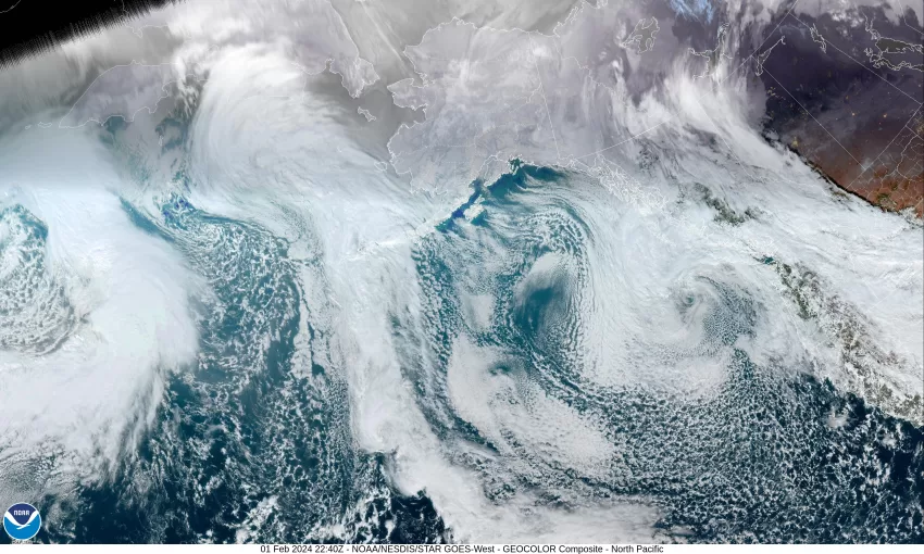
Well, that pesky low pressure area continues to spin out off the Washington coast this morning, spinning some showers that are staying mainly offshore and to the east, over the Cascades. The low is expected to just wobble out in that general area today as it continues to slowly weaken, but it looks like another disturbance will still rotate around the low and cause more showers over the area this evening and could also increase the winds giving us another breezy afternoon and evening.

The increased shower activity continues tonight with southerly winds 10-15 gusting to near 25, the low down near 46. We also start to see the low pressure area finally starting to move and get closer to the coast.

So, more showers are likely tomorrow, winds still southerly 10-15 gusting to 18, the highs up near 54, then tomorrow night the low pressure area starts to drift southward and that would give us decreasing showers tomorrow night, and the winds becoming southerly 5-10, the low drops to near 42.

On Saturday the low continues its southerly drift and be off the northern California coast, so we see only scattered showers, and the winds shift to southeasterly 5-10, the high near 52. We also see some cooler temperatures moving back in, so the snow level starts to drop, falling to near 2600’ during the day Saturday. There is only a slight chance of any remaining light showers Saturday night under partly cloudy skies, and the low drops to near 38, so the snow level drops to maybe 2400’ but by then we will have lost all the moisture.

Good news for Sunday, we see the sun returning with a mostly sunny and dry day, the high up near 54, then Sunday night a slight chance of rain returns as a disturbance pushes up from the south, the lows near 41.

We see a better chance of rain Monday with that disturbance, especially in the afternoon, the high near 51. The chance of rain remains Monday night then it transitions to a chance of showers as, yet another disturbance pushes down from the north and gives us that chance of showers into Tuesday. This means Tuesday and Wednesday we will see partly sunny skies, still with that chance of a light shower or two, the highs near 52, then with mostly cloudy nights, the lows down near 39.

Featured Video

Slide Contribute SUBSCRIBE

Tillamook Weather

Tides

Tillamook County Pioneer Podcast Series

Tillamook Church Search

Cloverdale Baptist Church
Nestucca Valley Presbyterian
Tillamook Ecumenical Service

Archives

  • Home
  • EULA Privacy Policy
  • Contact
  • Opt-out preferences
  • Search...
Share on facebook
Facebook
Share on pinterest
Pinterest
Share on twitter
Twitter
Share on linkedin
Linkedin
Catherine

Recent Posts

  • NEHALEM BAY STATE PARK TO OPEN DAY-USE AREAS, BOAT LAUNCH MAY 23, CAMPGROUND REMAINS CLOSED

    May 14, 2025
  • MANZANITA FARMERS MARKET OPENS FRIDAY MAY 16TH!!

    May 14, 2025
  • Vote NO on Increasing Taxes in Tillamook County

    May 14, 2025
©2025 | Theme by SuperbThemes

Manage Cookie Consent
To provide the best experiences, we use technologies like cookies to store and/or access device information. Consenting to these technologies will allow us to process data such as browsing behavior or unique IDs on this site. Not consenting or withdrawing consent, may adversely affect certain features and functions.
Functional Always active
The technical storage or access is strictly necessary for the legitimate purpose of enabling the use of a specific service explicitly requested by the subscriber or user, or for the sole purpose of carrying out the transmission of a communication over an electronic communications network.
Preferences
The technical storage or access is necessary for the legitimate purpose of storing preferences that are not requested by the subscriber or user.
Statistics
The technical storage or access that is used exclusively for statistical purposes. The technical storage or access that is used exclusively for anonymous statistical purposes. Without a subpoena, voluntary compliance on the part of your Internet Service Provider, or additional records from a third party, information stored or retrieved for this purpose alone cannot usually be used to identify you.
Marketing
The technical storage or access is required to create user profiles to send advertising, or to track the user on a website or across several websites for similar marketing purposes.
Manage options Manage services Manage {vendor_count} vendors Read more about these purposes
View preferences
{title} {title} {title}