Menu
  • Home
  • Breaking News
  • Feature
    • Arts
    • Astrology
    • Business
    • Community
    • Employment
    • Event Stories
    • From the Pioneer
    • Government
    • Letters to the Editor
    • Non Profit News
    • Obituary
    • Public Safety
    • Podcast Interview Articles
    • Pioneer Pulse Podcast: Politics, Palette, and Planet – the Playlist
  • Weather
  • Guest Column
    • Perspectives
    • Don Backman Photos
    • Ardent Gourmet
    • Kitchen Maven
    • I’ve been thinking
    • Jim Heffernan
    • The Littoral Life
    • Neal Lemery
    • View From Here
    • Virginia Carrell Prowell
    • Words of Wisdom
  • Things to do
    • Calendar
    • Tillamook County Parks
    • Tillamook County Hikes
    • Whale Watching
    • Tillamook County Library
    • SOS Community Calendar
  • About
    • Contribute
    • Advertise
    • Subscribe
    • Opt-out preferences
  • Post Submission Test
  • Search...
Menu

GORDON’S UPDATE: Weather 2/23/23 – Historic snowfall in areas of Tillamook County

Posted on February 23, 2023 by Editor

Thursday, February 23, 2023
Weather

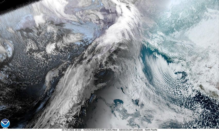
Well, the models definitely led us astray on the low pressure area’s movement yesterday and last night. As you gathered this morning, it remained stationary until this morning when it started drifting further offshore, pulling the showers west with it. It also appeared to be weakening which may have been a reflection of dryer air spilling in from the gorge area. The models now show that the low will indeed race southward towards California today and tonight, leaving us with mostly clear skies tonight as the shower chance diminishes. We could see winds becoming more northerly 8-12 gusting to 35, that with the overnight low of 19, could give us single digit windchills.
Tomorrow is our dry day with sunny skies, winds easterly 5-10, the high near 40, mostly clear skies tomorrow night, lows not quite as cold, near 23.

Saturday starts out mostly sunny, the snow level lifting to around 800-1000’. The light east winds will shift in the afternoon, becoming more southwesterly ahead of another approaching trough of low pressure that brings an increasing chance of rain starting that evening with rain likely later Saturday night. Highs near 47, lows near 33 so there is a chance of rain or snow, or a mix in the early morning hours. Obviously the Coast Range will be all snow above around 1000’.

The trough and front will keep Sunday and Monday rainy with highs near 47 but with the low temperatures expected to fall close to freezing, forecasting the snow level at night thru the early morning hours, this far out, is challenging.

Another trough moves in by Tuesday so the rainy forecast changes little Tuesday into Wednesday so more rainy days with snowy nights possible, the highs near 46, lows still around 30-33.

Featured Video

Slide Contribute SUBSCRIBE

Tillamook Weather

Tides

Tillamook County Pioneer Podcast Series

Tillamook Church Search

Cloverdale Baptist Church
Nestucca Valley Presbyterian
Tillamook Ecumenical Service

Archives

  • Home
  • EULA Privacy Policy
  • Contact
  • Opt-out preferences
  • Search...
Share on facebook
Facebook
Share on pinterest
Pinterest
Share on twitter
Twitter
Share on linkedin
Linkedin
Catherine

Recent Posts

  • NEHALEM BAY STATE PARK TO OPEN DAY-USE AREAS, BOAT LAUNCH MAY 23, CAMPGROUND REMAINS CLOSED

    May 14, 2025
  • MANZANITA FARMERS MARKET OPENS FRIDAY MAY 16TH!!

    May 14, 2025
  • Vote NO on Increasing Taxes in Tillamook County

    May 14, 2025
©2025 | Theme by SuperbThemes

Manage Cookie Consent
To provide the best experiences, we use technologies like cookies to store and/or access device information. Consenting to these technologies will allow us to process data such as browsing behavior or unique IDs on this site. Not consenting or withdrawing consent, may adversely affect certain features and functions.
Functional Always active
The technical storage or access is strictly necessary for the legitimate purpose of enabling the use of a specific service explicitly requested by the subscriber or user, or for the sole purpose of carrying out the transmission of a communication over an electronic communications network.
Preferences
The technical storage or access is necessary for the legitimate purpose of storing preferences that are not requested by the subscriber or user.
Statistics
The technical storage or access that is used exclusively for statistical purposes. The technical storage or access that is used exclusively for anonymous statistical purposes. Without a subpoena, voluntary compliance on the part of your Internet Service Provider, or additional records from a third party, information stored or retrieved for this purpose alone cannot usually be used to identify you.
Marketing
The technical storage or access is required to create user profiles to send advertising, or to track the user on a website or across several websites for similar marketing purposes.
Manage options Manage services Manage {vendor_count} vendors Read more about these purposes
View preferences
{title} {title} {title}