Menu
  • Home
  • Feature
    • Breaking News
    • Arts
    • Astrology
    • Business
    • Community
    • Employment
    • Event Stories
    • From the Pioneer
    • Government
    • Letters to the Editor
    • Non Profit News
    • Obituary
    • Public Safety
    • Podcast Interview Articles
    • Pioneer Pulse Podcast: Politics, Palette, and Planet – the Playlist
  • Guest Column
    • Perspectives
    • Don Backman Photos
    • Ardent Gourmet
    • Kitchen Maven
    • I’ve been thinking
    • Jim Heffernan
    • The Littoral Life
    • Neal Lemery
    • View From Here
    • Virginia Carrell Prowell
    • Words of Wisdom
  • Weather
  • Post Submission
  • Things to do
    • Calendar
    • Tillamook County Parks
    • Tillamook County Hikes
    • Whale Watching
    • Tillamook County Library
    • SOS Community Calendar
  • About
    • Contribute
    • Advertise
    • Subscribe
    • Opt-out preferences
  • Search...
Menu

GORDON’S UPDATE: Winter Storm Weekend Edition 1/14/24 –

Posted on January 14, 2024 by Editor

By Gordon McCraw, Meteorologist for the Tillamook County Pioneer

Tillamook’s Sunday Forecast: You asked, so here it is…Tillamook, your temperature at 8:55am this morning was 28 degrees at the airport, and with mostly sunny skies, the afternoon temperature should climb to near 39, whoa, break out the shorts! EDITOR’S NOTE: Some areas might make it above freezing, but not for long and any thawing will be minimal, and think layer of water on top of ice … VERY SLICK, hazardous road conditions. And it will be re-freezing late afternoon, early evening.
The winds will still be easterly 5-10 but becoming more northerly this afternoon. Some stratus clouds roll in tonight, winds easterly 4-8, the low drops back down to near 24. As the winds are easing some, the windchill will not be bitterly cold, just very cold.
The high pressure ridge that is bringing us the sunny weather will give you a mostly sunny day again tomorrow, the east winds becoming 10-15 gusting to near 20, the high again near 38. A partly cloudy night in store for tomorrow night, east winds 5-10, the lows again drops to near 24.
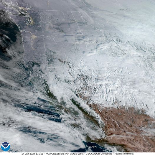
By Tuesday, we have another rainy system moving in so look for increasing winds and rain through Tuesday night into Wednesday with more rain likely the rest of the week, but at least it is warmer rain!
If you have plans for the valley on Tuesday, Know Before You Go – www.tripcheck.com as they could still be below freezing which means they could see more snow or sleet until the warmer air with the system pushes the cold air out that night!

Slide Slide Slide Slide Slide Slide Slide Slide Subscribe Contribute

Ads

Featured Video

Tillamook Weather

Tides

Tillamook County Pioneer Podcast Series

Tillamook Church Search

Cloverdale Baptist Church
Nestucca Valley Presbyterian
Tillamook Ecumenical Service

Archives

  • Home
  • EULA Privacy Policy
  • Contact
  • Opt-out preferences
  • Search...
Share on facebook
Facebook
Share on pinterest
Pinterest
Share on twitter
Twitter
Share on linkedin
Linkedin
Catherine

Recent Posts

  • ROCKAWAY BEACH READIES FOR JULY 4TH FESTIVITIES - HONORS VOLUNTEER OF YEAR & PARADE GRAND MARSHAL

    June 30, 2025
  • NEWS UPDATE FROM STATE REPRESENTATIVE DAVID GOMBERG: It's a Session Wrap!

    June 30, 2025
  • GORDON'S WEEKLY WEATHER UPDATE 6/30/25: Back to Normal Summer Weather This Week - Fair, Dry & Mild; Holiday Weekend Weather Looks Good

    June 30, 2025
©2025 | Theme by SuperbThemes

Manage Cookie Consent
To provide the best experiences, we use technologies like cookies to store and/or access device information. Consenting to these technologies will allow us to process data such as browsing behavior or unique IDs on this site. Not consenting or withdrawing consent, may adversely affect certain features and functions.
Functional Always active
The technical storage or access is strictly necessary for the legitimate purpose of enabling the use of a specific service explicitly requested by the subscriber or user, or for the sole purpose of carrying out the transmission of a communication over an electronic communications network.
Preferences
The technical storage or access is necessary for the legitimate purpose of storing preferences that are not requested by the subscriber or user.
Statistics
The technical storage or access that is used exclusively for statistical purposes. The technical storage or access that is used exclusively for anonymous statistical purposes. Without a subpoena, voluntary compliance on the part of your Internet Service Provider, or additional records from a third party, information stored or retrieved for this purpose alone cannot usually be used to identify you.
Marketing
The technical storage or access is required to create user profiles to send advertising, or to track the user on a website or across several websites for similar marketing purposes.
Manage options Manage services Manage {vendor_count} vendors Read more about these purposes
View preferences
{title} {title} {title}