








By Gordon McCraw, Meteorologist for the Tillamook County Pioneer
Well Tillamook, it looks like we will stay on the cooler side for pretty much the rest of the week. There’s a chance of rain thrown in toward the end of the week with some rain and maybe some winds likely over the weekend.
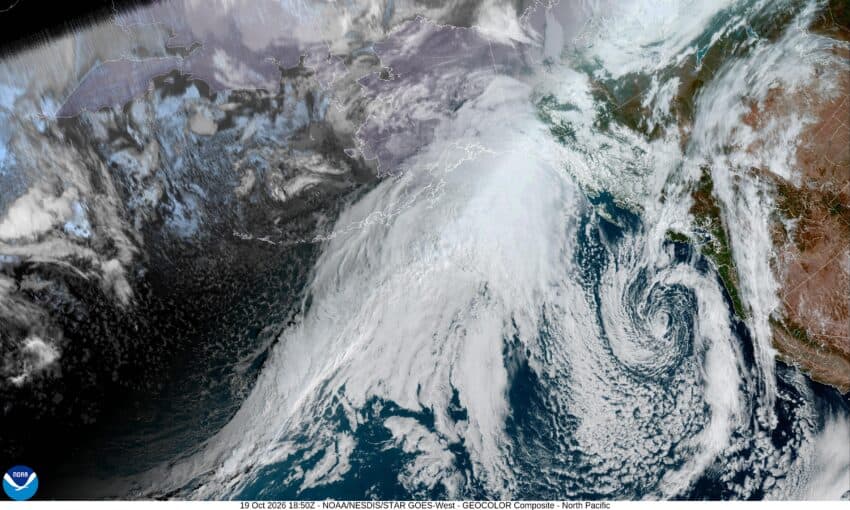
So, today we had a trough of low pressure pushing towards the coast that looks to bring increasing cloudiness tonight as the trough has a low pressure area develop well offsore, that drops south off the coast of California, pulling the rain with it. For us it means we see some clouds with calm winds, and the low temperature dropping to around 39.
Tomorrow, Tuesday, high pressure starts to build in which brings back the mostly sunny skies, some light northeasterly winds, and an afternoon high of 68. Tomorrow night looks partly cloudy with light east winds, the low drops to near 42.
We see sunny skies Wednesday with light winds still, the high up around 67, then it looks like a developing trough of low pressure will be dropping down from the northwest and pushing in some clouds, and we may see some patchy fog overnight, the low temperature near 40.
We see that patchy fog to start the day on Thursday, then with mostly cloudy afternoon skies, we add a slight chance of rain starting in that afternoon, the high temperature only near 56. We keep a chance of rain through around midnight, the low near 39.
The trough is off to the east on Friday, leaving us with mostly sunny skies, the high near 57, but the break is short as we see another system dropping down from the Gulf of Alaska that brings increasing cloudiness that night, the low drops to near 37.
As for the weekend, we’ll need to keep an eye on a developing system that some models suggest could develop into the seasons first Atmospheric River event that could bring some decent rain amounts along with gusty coastal winds. All this to say that, for now anyway, we can expect a chance of rain Saturday with rain likely by Saturday night into Sunday with Saturday night possibly looking windy as well. Temperature will remain in the mid to upper 50s for the highs and the lows down in the low 40s.
I may give another forecast later this week when the picture, and forecast, becomes a little clearer.
