










By Gordon McCraw, Meteorologist for the Tillamook County Pioneer
Here we are into the first week of October already. First, let’s review a few of the numbers for September. The warmest day in September was on the 17th when we hit 80 degrees, the coldest was on the 19th when it dropped to 38 degrees. As far as how much rain, it looks like we saw about 3.53” of rain, the average is 3”, so we did better than average for the month. The numbers for October are, the average high is 63, the average low is 42. Now remember, the averages are all the daily numbers totaled up and divided by, in this case 31, so you can expect some daily temperature above and below those averages. As far as rain, the average there is just under 7” for the month.
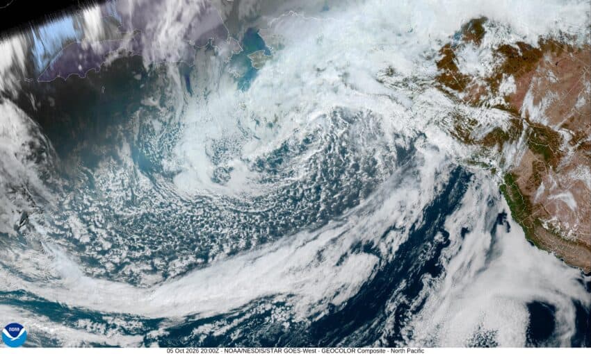
So now we have a high pressure ridge over the area that is bringing us some warmer weather, though it is also bringing us a thicker marine layer with morning fog. This will change the second half of the week due to an approaching disturbance bringing us a slight chance of rain on Thursday.
Today was a repeat of the clouds and fog bringing us a misty start with a few sun breaks in the afternoon but tonight looks to be another cloudy foggy night with calm winds and a low temperature of 50.
The sun returns tomorrow after the clouds and fog burn back, the winds becoming northwesterly 5-10, the high near 69. Good news for tomorrow night, it looks like we stay mostly clear, the winds die down, and the low drops to near 48.
Wednesday will be sunny for a change as that ridge builds even stronger, the afternoon winds not as strong, becoming northerly 4-8, and the afternoon high creeps up near 73. We can expect mostly clear skies Wednesday night, the low near 53.
While we see sunny skies Thursday with an afternoon high near 75, we can expect increasing clouds that night with that approaching disturbance, the low near 53.
So, we have a mix of clouds and sun Friday, the high is only near 66, then we see a slight chance of some light rain Friday night, the low near 47.
Look for improving conditions over the weekend as the trough slides on off to the east. We are looking at cooler daytime temperatures though with the highs up near 63, and the nighttime lows near 42.
And speaking of low temperatures, your trivia fact for the day, did you know that the coldest official recorded temperature on earth was from a Russian station in Antarctica. It got down to minus 128.6 degrees Fahrenheit there, way too cold for this southern lad.
And with that cold fact I will say, stay warm and I will be back next week.
