



By Gordon McCraw, Meteorologist for the Tillamook County Pioneer
And the train of weather systems just keep on coming. The weather this weekend gave us around one and a quarter inches of rain, and though we started out dry this morning, we saw some showers and breezy conditions today associated with another fast moving front pushing through. There is still a chance of a few showers tonight with southerly winds 5-10, the low tonight near 48.
Another disturbance brings in more rain after around midnight tonight that persists through midmorning tomorrow, the winds becoming southerly 15-20 gusting to 25 in the afternoon tomorrow, the high near 62. Cloudy and breezy tomorrow night with a 50/50 shot of more rain, the winds southerly 15-20 gusting to 30, the overnight low near 54.
With a ridge of high pressure building on Veteran’s Day, it looks like we see a dry day for a change, and with southerly winds 8-12 gusting to 18, the afternoon temperature gets up to near 66. Mostly cloudy skies that night with light winds, the low near 51.
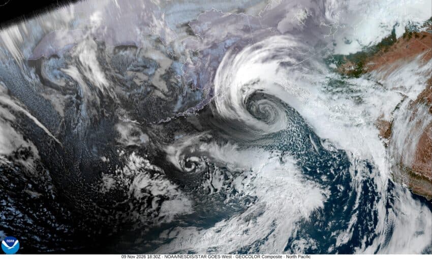
Thursday we are watching a trough of low pressure setting up residence over the eastern Pacific that will bring a series of fronts across the area. This means we have an increasing chance of rain Thursday afternoon, the high near 63, then some rain and breezy conditions are likely Thursday night, followed by post-frontal showers with a slight chance of thunderstorms in the early morning hours, the low near 48.
Friday, we see more showers and possible thunderstorms that morning, then it looks like we have a chance of seeing another atmosphere river event that pushes in more rain Friday afternoon, and this could be another windy event also that persist through Saturday into Sunday. High temperatures look to be in the mid 50s, and the lows in the mid to low 40s. And yes, this does mean we do need to keep an eye on the river levels as river flooding cannot be ruled out. Hopefully, we will get a clearer picture in upcoming model runs so stay tuned.
