By Gordon McCraw, Meteorologist for the Tillamook County Pioneer
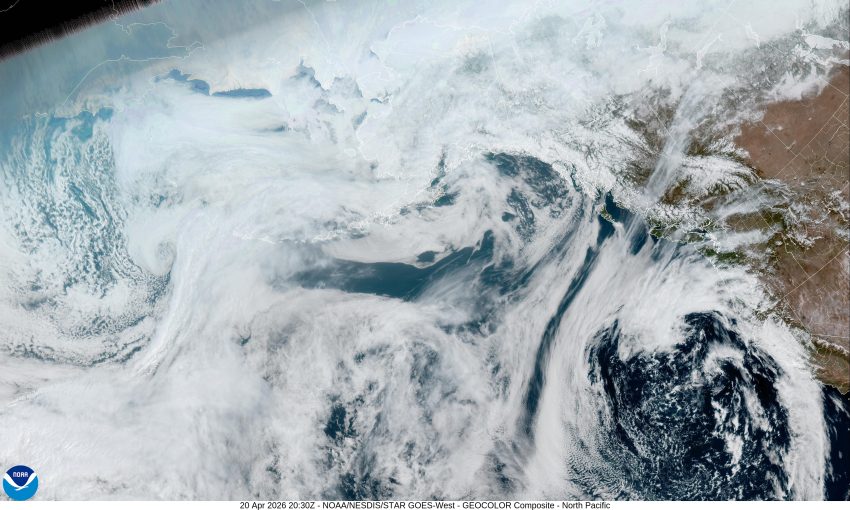
Well, after a fair and mild weekend, thanks to a high pressure ridge, it looks like we have increasing cloudiness associated with a large low pressure area that is now sitting off the coast of northern California that is causing the ridge to drift to the east. Tonight, we see more clouds along with an increasing chance of some mainly light rain rotating in from the south and southeast, with the best chance coming in the early morning hours. We can also expect some calm winds tonight with the overnight low only near 47.
We will likely see some light rain or rainshowers tomorrow, along with some light winds with that low still sitting off the northern California coast, the high near 57. The activity eases some tomorrow night though, the low near 45.
It looks like another area of moisture rotates up across the area Wednesday bringing an increased chance of light rain, the winds becoming southwesterly 5-10, Wednesday’s high temperature near 54. Then the low pressure area off California weakens and starts to move east and inland so the rain and rainshowers chance diminishes Wednesday night by around midnight, the low near 43.
It looks like a ridge will be building in from the west Thursday, which will start to dry things out and give us some warmer temperatures for the rest of the week. So starting Thursda,y we see mostly sunny skies, the high near 61, then sunny skies with the high up near 66 Friday, the lows with mostly clear nights near 44.
The weekend also looks nice with mostly sunny days and partly cloudy nights, the highs near 64, and the lows near 46.
Lastly, a quick look at the Climate Prediction Center’s extended forecast, that was issued yesterday, April 19, shows that the period of April 17th through May 3rd has an above average chance of being warmer than normal, with a chance of seeing below average rainfall for that period.