Menu
  • Home
  • Breaking News
  • Feature
    • Arts
    • Astrology
    • Business
    • Community
    • Employment
    • Event Stories
    • From the Pioneer
    • Government
    • Letters to the Editor
    • Non Profit News
    • Obituary
    • Public Safety
    • Podcast Interview Articles
    • Pioneer Pulse Podcast: Politics, Palette, and Planet – the Playlist
  • Weather
  • Guest Column
    • Perspectives
    • Don Backman Photos
    • Ardent Gourmet
    • Kitchen Maven
    • I’ve been thinking
    • Jim Heffernan
    • The Littoral Life
    • Neal Lemery
    • View From Here
    • Virginia Carrell Prowell
    • Words of Wisdom
  • Things to do
    • Calendar
    • Tillamook County Parks
    • Tillamook County Hikes
    • Whale Watching
    • Tillamook County Library
    • SOS Community Calendar
  • About
    • Contribute
    • Advertise
    • Subscribe
    • Opt-out preferences
  • Post Submission Test
  • Search...
Menu

TILLAMOOK COUNTY EMERGENCY MANAGEMENT: Gordon’s Update – 10/18/21 – Weather

Posted on October 18, 2021October 18, 2021 by Editor

By Gordon McCraw, Tillamook County Emergency Manager

Monday, October 18, 2021, 10:00am

Weather

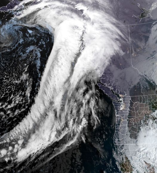
Keep you umbrella handy, except for today, it looks like rain or rainshowers are forecasted for the rest of the week and weekend. The rainmaker from yesterday continues to slide eastward as a weak ridge builds in today.  So, after any remaining patchy fog clears, today will be mostly sunny with westerly winds 4-8, highs near 57. Partly cloudy skies continue tonight, light east winds, lows near 40.

Tomorrow a trough of low pressure drops into the area so look for increasing clouds then a slight chance of rain starts in the evening with the rain moving in late tomorrow night with a front.  We start out with easterly winds 4-8, the high near 64, then the winds shift with the approaching front, becoming southerly 5-10, lows near 48.

Wednesday looks showery and breezy with winds southerly 14-18 gusting to 30, a little higher at the beaches, highs near 56, lows again near 48. By Thursday another front will have developed and moves into the region bringing another round of rain by the afternoon along with breezy winds.

Back to scattered showers behind the front Friday, highs near 57, lows near 47.  Saturday, we have another front bringing in more rain and a few of the models are suggesting a wind event.  Pretty far out to raise the flags just yet but worth watching. Sunday we will have transitioned back to scattered showers.

As far as any flooding potential with all the rain, while the river levels do climb, it looks like the rain will be spread out enough that flooding concerns are minimal.


Featured Video

Slide Contribute SUBSCRIBE

Tillamook Weather

Tides

Tillamook County Pioneer Podcast Series

Tillamook Church Search

Cloverdale Baptist Church
Nestucca Valley Presbyterian
Tillamook Ecumenical Service

Archives

  • Home
  • EULA Privacy Policy
  • Contact
  • Opt-out preferences
  • Search...
Share on facebook
Facebook
Share on pinterest
Pinterest
Share on twitter
Twitter
Share on linkedin
Linkedin
Catherine

Recent Posts

  • Grove avenue closed in Tillamook for maintenance

    May 10, 2025
  • Astoria Farmers Market new, outdoor location with parking, with great Riverwalk access

    May 10, 2025
  • WORDS OF WISDOM: Boycotts and Protests in our Community Garden

    May 9, 2025
©2025 | Theme by SuperbThemes

Manage Cookie Consent
To provide the best experiences, we use technologies like cookies to store and/or access device information. Consenting to these technologies will allow us to process data such as browsing behavior or unique IDs on this site. Not consenting or withdrawing consent, may adversely affect certain features and functions.
Functional Always active
The technical storage or access is strictly necessary for the legitimate purpose of enabling the use of a specific service explicitly requested by the subscriber or user, or for the sole purpose of carrying out the transmission of a communication over an electronic communications network.
Preferences
The technical storage or access is necessary for the legitimate purpose of storing preferences that are not requested by the subscriber or user.
Statistics
The technical storage or access that is used exclusively for statistical purposes. The technical storage or access that is used exclusively for anonymous statistical purposes. Without a subpoena, voluntary compliance on the part of your Internet Service Provider, or additional records from a third party, information stored or retrieved for this purpose alone cannot usually be used to identify you.
Marketing
The technical storage or access is required to create user profiles to send advertising, or to track the user on a website or across several websites for similar marketing purposes.
Manage options Manage services Manage {vendor_count} vendors Read more about these purposes
View preferences
{title} {title} {title}