By Gordon McCraw, Meteorologist for the Tillamook County Pioneer
Monday, February 13, 2023
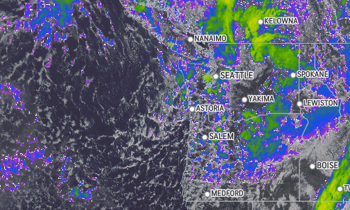
(Satellite image at Noon 2/13/23)
We had a cold front go thru this morning that pulled in some colder, unstable air aloft that caused some scattered showers, hail and isolated thunderstorms to move thru the area, as well as pushing the snow level down, giving the passes some snow. We have another disturbance dropping in this evening that gives us another shot of colder air that pushes the snow level down even further. Some of the models show a low pressure area developing that, depending on where it comes ashore, will be responsible for increasing the potential for low snow later tonight into tomorrow morning. One track pushes it in to our south and that would give us a better snow chance. Other models move it up the coast then inland late tonight or early tomorrow. This would warm things up with more southerly winds which would push the snow level higher, to around 500-1000’, giving the lowlands only rain or a rain, snow mix. Before I get into the meat and potatoes of the forecast, let me cover the potential Weather Advisories, Watches and Warnings. There is a Gale Warning and Hazardous Seas Warning for the Coastal Waters, a High Surf Advisory for the beaches, a Winter Weather Advisory west of the Coast Range, a Winter Storm Warning for the Coast Range, then another Winter Weather Advisory east of the Coast Range thru Portland before entering another Winter Storm Warning area in the Cascades.
Quite the list- go to weather.gov/Portland for additional updates and more information.
And the forecast, well, we are going with rain or a mix of rain/snowshowers tonight but becoming all snow in the early morning hours as the temperatures drop to or below freezing. Thunderstorms are still possible also. The snow level starts out at around 1000’ this evening then drops to near 200’, possibly lower after midnight. Winds northwesterly 10-15 gusting to 30 so there is a windchill factor to consider if you are outside after midnight, the low drops to around 34. The passes are looking at an additional 3-7” of snow above 500-1000’ overnight with up to a foot possible at the summit.
Tomorrow we are likely to see snowshowers thru around midmorning, then things start to dry up, and warm up, with the afternoon becoming mostly sunny, melting the low snow quickly, the winds northerly 5-10, highs near 46, the snow level lifting to around 1000’. The Coast Range could see another ½” or so of additional snow with the temperature climbing to around 36 at the summit.
Tomorrow night’s concern/hazard is the refreezing of the moisture on the ground. We will see increasing cloudiness with the winds becoming easterly 4-8. The low temperatures drop below freezing by around 9:00-10:00pm then the low bottoms out at around 27 in the early morning hours.
By Wednesday we see a ridge of high pressure building in over the region giving us partly sunny skies and light winds, the high near 48. Then we see increasing clouds Wednesday night ahead of the next approaching system the low near 32.
So, by Thursday morning we start having an increasing chance of rain with rain likely by around noonish. The good news is the snow level that morning is around 1500’ but climbing to 2000’ by the afternoon, the high near 48. Still a chance of rain that night, the low near 35. If you have travel plans for the Coast Range again, the snow level at night into the early morning hours drops down to or near the summit levels.
We keep a chance of rain Friday, the snow level between 2000-2500’, highs near 53, lows near 34, then for the weekend, it looks like a ridge tries to build in against a trough of low pressure meaning, we still have a chance of rain, but at least a little warmer, highs near 50, lows near 39, the snow level up above 3000’.
So, a few final thoughts on the weather for tonight and tomorrow. There is about a 30-40% chance of snow below 500’ tonight into tomorrow morning but that chance increases at 500’ so the snow will have greater impacts along Hwy 101 in places like Cascade Head and up north toward Neahkahnie Mountain, as well as other Highways like Hwy 22. Also, know that in areas where the heavier showers move across, they could see higher then expected accumulation. The final though is, even if the temperature profile is such that the lowlands only see rain, the temperatures and instability is such that small hail can be expected and, in some cases, temporarily cover the roads making them slick.