


By Gordon McCraw, Meteorologist for the Tillamook County Pioneer
Friday, July 10, 2026
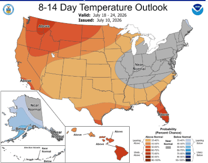
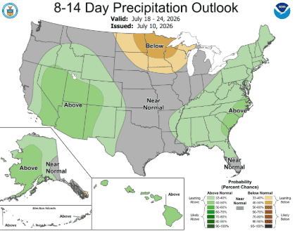
Hey, Tillamook, the Climate Prediction Centers Long Range and El Nino Forecasts were just updated, along with a new Oregon Drought Monitor Information release. I guess I’ll start with the Climate Center and their July 18th through 31st Long Range Forecast. As you might have guessed, they are suggesting Tillamook has a 50% chance of seeing above average temperatures for that period with the eastern halve of the state seeing a 60-70% chance. Since this is pretty much a relatively dry month anyway, they say there is an equal chance of seeing normal or average precipitation, in other words, not much.
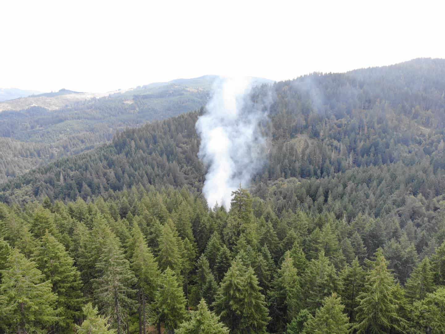
This takes me to the Drought Monitor that shows Tillamook and Clatsop counties being okay, but just to the east and south they are considered abnormally dry. As you head east of Tillamook and south of Lincoln counties, they are considered Moderately Dry. If you continue further east and south you see Severe Drought with some areas running from the southwest part of the state through the central and northeastern parts of the state, as well as a smaller section in the extreme southeastern part of the state, considered being in a Severe Drought. This would explain why there are currently 21 counties with a Drought Emergencdy Declaration, and why there are already 48 wildfires being fought in Oregon currently.
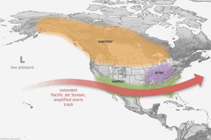
Next, the Climate Prediction Center issued another El Nino Discussion yesterday as well. It says that El Nino conditions have strengthened across the central and eastern equatorial Pacific, meaning the sea surface temperatures through those areas have increased. This has caused low-level westerly anomalies along with upper-level easterly winds anomalies in these areas. The Discussion says they expect El Nino conditions to continue to intensify through the end of 2026 on into the start of 2027. They say this could be a very strong El Nino event, making it one of the largest events since the 1950s. Remember though, and even they remind us, these events don’t necessarily lead to typical severe impacts everywhere, it just suggests they could. Their next Discussion isn’t scheduled until around the middle of August.
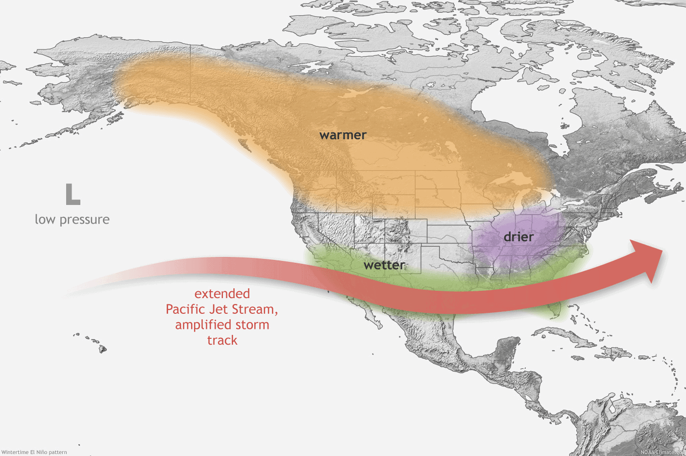
So, what does all this mean for us? Well, that you can expect a dry end to this week, on into the start of next week, and with the westerly onshore winds. Some fog and stratus could move into the area in the early morning hours off and on, through the middle of next week. Look for high temperatures in the mid to upper 60s the rest of tis week, warming into the upper 60s to near 70 for the start of next week, and of course, no rain.
