Menu
  • Home
  • Feature
    • Breaking News
    • Arts
    • Astrology
    • Business
    • Community
    • Employment
    • Event Stories
    • From the Pioneer
    • Government
    • Letters to the Editor
    • Non Profit News
    • Obituary
    • Public Safety
    • Podcast Interview Articles
    • Pioneer Pulse Podcast: Politics, Palette, and Planet – the Playlist
  • Guest Column
    • Perspectives
    • Don Backman Photos
    • Ardent Gourmet
    • Kitchen Maven
    • I’ve been thinking
    • Jim Heffernan
    • The Littoral Life
    • Neal Lemery
    • View From Here
    • Virginia Carrell Prowell
    • Words of Wisdom
  • Weather
  • Post Submission
  • Things to do
    • Calendar
    • Tillamook County Parks
    • Tillamook County Hikes
    • Whale Watching
    • Tillamook County Library
    • SOS Community Calendar
  • About
    • Contribute
    • Advertise
    • Subscribe
    • Opt-out preferences
  • Search...
Menu

GORDON’S UPDATE: Weather 1/16/24 – Warming, rain moving in this afternoon; “Normal” windy, rainy conditions rest of the week

Posted on January 16, 2024 by Editor

By Gordon McCraw, Meteorologist for the Tillamook County Pioneer

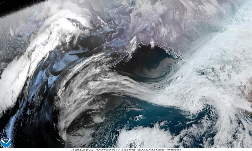
Another chilly morning Tillamook with your morning low temperature dropping down to near 25 degrees. The good news is…things should start warming back up after today to something you are more used to. The reason is that there is a warmer Pacific Front, and its associated low pressure area, moving up towards the area today. Fortunately, areas west of the Coast Range will warm up enough today, before the precipitation moves in, that they will see all rain, while areas inland across the Coast Range Passes will still be below freezing and will have yet another round of freezing rain that persists into the early morning hours tomorrow. This includes nearly all the valley.

So, the official forecast is for a cloudy day today with the rain pushing up into the area from the southwest this afternoon by around 2pm. The winds today becoming southeasterly 8-12, the afternoon high near 45. More rain expected tonight, the winds increasing to southeasterly 10-15 gusting to near 30, the low drops a couple degrees after the sun goes down, then warmer air starts to move in and the temperature starts to slowly rise again overnight, reaching 47 by sunrise. As far as the passes, they should also be improving in the early morning hours with the temperature finally climbing to above freezing at the summit a little before sunrise tomorrow.

After 4 days of very cold and icy weather, tomorrow returns to something more, “normal” for our area. The temperatures are all above freezing, the snow level is up over 5000’, and the coast is windy! We can expect more rain tomorrow with southwesterly winds 18-24 gusting to 30, the high up near 52, then rainy with breezy southerly winds 10-15 gusting to near 20 tomorrow night, the low only near 42. You will still need to be alert for icy conditions in the early morning hours across the summits as the nighttime temperatures in the Coast Range could still drop to near freezing.

Early Thursday we see another system approaching the coast from the west so we can expect another rainy day from the departing warm front, winds becoming easterly 8-12, the high near 51, still rainy with breezy southeasterly winds 14-18 gusting to near 25 overnight Thursday, the low near 40.

Friday the associated cold front still lingers offshore, so the rainy conditions persist, highs near 51, lows near 42. As for the weekend, it looks like another low pressure area will move up from the southwest into the British Columbia area, and this will finally drag the cold front, that had been stationary off the coast, though which brings us more rain with breezy winds Saturday and Sunday, highs near 53, lows near 45.

Slide Slide Slide Slide Slide Slide Slide Slide Subscribe Contribute

Ads

Featured Video

Tillamook Weather

Tides

Tillamook County Pioneer Podcast Series

Tillamook Church Search

Cloverdale Baptist Church
Nestucca Valley Presbyterian
Tillamook Ecumenical Service

Archives

  • Home
  • EULA Privacy Policy
  • Contact
  • Opt-out preferences
  • Search...
Share on facebook
Facebook
Share on pinterest
Pinterest
Share on twitter
Twitter
Share on linkedin
Linkedin
Catherine

Recent Posts

  • What Does Freedom Mean to You? WORDS OF WISDOM - On Freedom

    July 1, 2025
  • City of Rockaway Beach Monthly Update July 1, 2025

    July 1, 2025
  • TILLAMOOK COUNTY FIRE DEFENSE BOARD BURN BAN NOTIFICATION: COUNTY-WIDE BURN BAN EFFECTIVE JULY 15, 2025

    July 1, 2025
©2025 | Theme by SuperbThemes

Manage Cookie Consent
To provide the best experiences, we use technologies like cookies to store and/or access device information. Consenting to these technologies will allow us to process data such as browsing behavior or unique IDs on this site. Not consenting or withdrawing consent, may adversely affect certain features and functions.
Functional Always active
The technical storage or access is strictly necessary for the legitimate purpose of enabling the use of a specific service explicitly requested by the subscriber or user, or for the sole purpose of carrying out the transmission of a communication over an electronic communications network.
Preferences
The technical storage or access is necessary for the legitimate purpose of storing preferences that are not requested by the subscriber or user.
Statistics
The technical storage or access that is used exclusively for statistical purposes. The technical storage or access that is used exclusively for anonymous statistical purposes. Without a subpoena, voluntary compliance on the part of your Internet Service Provider, or additional records from a third party, information stored or retrieved for this purpose alone cannot usually be used to identify you.
Marketing
The technical storage or access is required to create user profiles to send advertising, or to track the user on a website or across several websites for similar marketing purposes.
Manage options Manage services Manage {vendor_count} vendors Read more about these purposes
View preferences
{title} {title} {title}