Menu
  • Home
  • Feature
    • Breaking News
    • Arts
    • Astrology
    • Business
    • Community
    • Employment
    • Event Stories
    • From the Pioneer
    • Government
    • Letters to the Editor
    • Non Profit News
    • Obituary
    • Public Safety
    • Podcast Interview Articles
    • Pioneer Pulse Podcast: Politics, Palette, and Planet – the Playlist
  • Guest Column
    • Perspectives
    • Don Backman Photos
    • Ardent Gourmet
    • Kitchen Maven
    • I’ve been thinking
    • Jim Heffernan
    • The Littoral Life
    • Neal Lemery
    • View From Here
    • Virginia Carrell Prowell
    • Words of Wisdom
  • Weather
  • Post Submission
  • Things to do
    • Calendar
    • Tillamook County Parks
    • Tillamook County Hikes
    • Whale Watching
    • Tillamook County Library
    • SOS Community Calendar
  • About
    • Contribute
    • Advertise
    • Subscribe
    • Opt-out preferences
  • Search...
Menu

GORDON’S UPDATE: Weather 1/24/24 – Showers, Rain Pattern Continues, January Looks to Go Out with Roar … Stay Tuned

Posted on January 24, 2024 by Editor

By Gordon McCraw, Meteorologist for the Tillamook County Pioneer

Well, we had a warm front move through overnight, besides the light rain, the real evidence of this is in the temperatures. At midnight, the temperature was 46 degrees, by 07:00am this morning, it had warmed up to 52 degrees. The rain then transitioned to post-frontal scattered showers that persist and add a slight chance of thunderstorms with daytime heating and some unstable air moves in overhead. The winds today are southerly 8-12 gusting to 20, the high into the mid 50s.

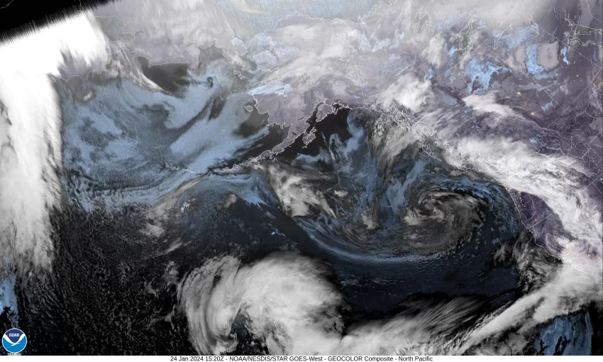
Tonight, we see a trough of low pressure moving towards the coast along with a low pressure area to the west of, and moving towards Vancouver Island as it weakens. All this spells more showers and possible thunderstorms for the Pacific Northwest with some breezy southerly winds 10-15 gusting to near 25, the low near 45. The thunderstorm threat does diminish by around midnight tonight.

With the trough still influencing our weather tomorrow we will see more showers with the breezy southerly winds 10-15 gusting to 25, the high up near 52. The shower activity becomes more scattered overnight, the winds easing, becoming southerly 5-10, lows dropping to near 45.

By early Friday morning we see more rain moving in ahead of another warm front that gives us some easterly winds 10-15 gusting to near 25, the high up near 55, rainy with winds becoming southerly 14-18 gusting to near 30 overnight Friday, the low down near 48.

Saturday brings more clouds, breezy winds, and rain with the system that will have likely tapped into a subtropical moisture source that could bring up to 2 to 2 ½”” of rain for the two day period from Friday through Saturday. Saturday’s high temperatures near 58, the lows near 52.

From Sunday on, the forecast gets a little more difficult as not all the models agree on some finer details that will drive the weather forecast and outcome. There will be a ridge to the east and a trough to the west that the models just can’t agree on. The belief is that there will be an atmospheric river with the area of heavier rain pointed to the north of our area, thanks to the ridge of high pressure. If the ridge weakens or moves eastward then the hose, as I call it, will drift southward and impact our area more by Tuesday and Wednesday, and this would obviously also impact our river levels. If the ridge builds or moves west, then we see improving conditions with less rain. For now, it is just something to watch to see which models win.

So, for now we say, Sunday on, look for cloudy and rainy conditions, breezy at times, highs in the low 60s and lows in the low 50s.

Slide Slide Slide Slide Slide Slide Slide Slide Subscribe Contribute

Ads

Featured Video

Tillamook Weather

Tides

Tillamook County Pioneer Podcast Series

Tillamook Church Search

Cloverdale Baptist Church
Nestucca Valley Presbyterian
Tillamook Ecumenical Service

Archives

  • Home
  • EULA Privacy Policy
  • Contact
  • Opt-out preferences
  • Search...
Share on facebook
Facebook
Share on pinterest
Pinterest
Share on twitter
Twitter
Share on linkedin
Linkedin
Catherine

Recent Posts

  • ROCKAWAY BEACH READIES FOR JULY 4TH FESTIVITIES - HONORS VOLUNTEER OF YEAR & PARADE GRAND MARSHAL

    June 30, 2025
  • NEWS UPDATE FROM STATE REPRESENTATIVE DAVID GOMBERG: It's a Session Wrap!

    June 30, 2025
  • GORDON'S WEEKLY WEATHER UPDATE 6/30/25: Back to Normal Summer Weather This Week - Fair, Dry & Mild; Holiday Weekend Weather Looks Good

    June 30, 2025
©2025 | Theme by SuperbThemes

Manage Cookie Consent
To provide the best experiences, we use technologies like cookies to store and/or access device information. Consenting to these technologies will allow us to process data such as browsing behavior or unique IDs on this site. Not consenting or withdrawing consent, may adversely affect certain features and functions.
Functional Always active
The technical storage or access is strictly necessary for the legitimate purpose of enabling the use of a specific service explicitly requested by the subscriber or user, or for the sole purpose of carrying out the transmission of a communication over an electronic communications network.
Preferences
The technical storage or access is necessary for the legitimate purpose of storing preferences that are not requested by the subscriber or user.
Statistics
The technical storage or access that is used exclusively for statistical purposes. The technical storage or access that is used exclusively for anonymous statistical purposes. Without a subpoena, voluntary compliance on the part of your Internet Service Provider, or additional records from a third party, information stored or retrieved for this purpose alone cannot usually be used to identify you.
Marketing
The technical storage or access is required to create user profiles to send advertising, or to track the user on a website or across several websites for similar marketing purposes.
Manage options Manage services Manage {vendor_count} vendors Read more about these purposes
View preferences
{title} {title} {title}