By Gordon McCraw, Meteorologist for the Tillamook County Pioneer
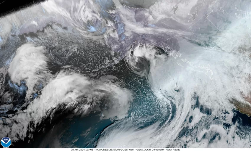
It looks like we will enjoy another week of a parade of weather system that will bring rain, winds, and colder weather to the area. Today we have a warm front spreading rain and warmer temperatures across the region. It is also pushing the snow level up over 5000’. So, for the Tillamook area today, you have the mainly light rain moving through with the winds becoming southerly 8-12 gusting to 20 this afternoon, and the high warming up to near 54.
After this, it appears that tonight we see some more rain, then after midnight some showers with possible thunderstorms, along with some very strong winds. The winds look to be southerly 20-30 gusting to 45-50 in town, and 35-45 gusting to 50-55 down at the beaches, the low only down to near 46. At this point the forecast even shows the valley seeing winds of somewhere between 35-50. There are no Advisories, Watches, or Warnings for the coast as I write this, other than the High Surf Warning that is in effect through Wednesday at 4PM. This will likely change later today though. It also looks like we can expect around 1 ½” to near 3” of rain during that 24 hour period. I have already been asked about power outages. With this level of winds, power outages are likely to occur…somewhere!
If you must go down to the beach tomorrow to see the winds and waves, know that there are numerous hazards expected, especially during the Warning times though 4PM Wednesday. All this wind will be driving some large waves towards the beach with breakers as high as 25-35’ and that will cause a high likelihood of very high surf and increase the chances of sneaker waves. These destructive waves can wash over the beaches, jetties, rocks and push logs high up the beaches. You can get swept off these rocks and logs on the beaches and you can get knocked off the jetties causing severe injuries or even death. With the higher runup expected at the beaches, severe beach erosion is possible and during high tide, damage can occur to coastal properties and buildings. You should be asking yourself, is that picture worth potentially being swept out to sea or severely injured when the wave surprises you and knocks you down?
So tomorrow the associated cold front, that should have plenty of moisture imbedded in it, will push through, and brings more showers with possible thunderstorms to the region. The winds now westerly 25-30 gusting to 45-50, and the snow level starts to drop down to near 2200’, the high temperature tomorrow only near 47 degrees. The shower and thunderstorm threat continues tomorrow night, the winds still westerly 20-30 gusting to 45, the low drops to near 36, and the snow level down near 2000’ so the higher Coast Range mountains will be seeing lots of accumulating snow and there is a likelihood that Tuesday the higher passes will be seeing snow and blowing snow by the early evening hours through tomorrow night when the temperature drops below freezing. There are actually a couple of models that suggest there could be a brief period of some low elevation snow tomorrow night into Wednesday morning. Something to watch for in case the other models start to lean in that direction. Rainfall totals for tomorrow in the range of 1-2”.
By Wednesday, we see a low pressure area passing across to the north, continuing the threat of showers with possible thunderstorms, winds not as strong but still breezy, westerly 15-20 gusting to 35, the high near 47. We see more showers and possible thunderstorms Wednesday night, the breezy northwesterly winds 14-18 gusting to 25, the snow level near 1900’. The higher passes will likely see a rain/snow mix.
Thursday is when some of the models start to show the potential for an Arctic Blast to drop down from Canada bringing cold, or real cold temperatures into the area, possibly the coldest air of the season. The issue is, the temperature spread between the models which makes the forecast difficult. The warmer models would present no low level snow while the coldest models would mean accumulating low level snow, possibly all the way to the beaches. So, for now we go with cloudy, rainy, and windy conditions for Thursday highs near 47, lows near 34. Then Friday, rain with a mix of snow possible, highs near 43, lows dropping to near 27. Saturday and Sunday is also rainy, and snowy, afternoon highs up near 41, nighttime lows near 28. This would spell accumulating snow in the Coast Range passes that will make travel more hazardous.
EDITOR’S NOTE – There are watches and warning out for across the state for blizzard conditions over the Cascades with adisories to not travel. If you plan to travel this week, be sure to check www.tripcheck.com.