Menu
  • Home
  • Breaking News
  • Feature
    • Arts
    • Astrology
    • Business
    • Community
    • Employment
    • Event Stories
    • From the Pioneer
    • Government
    • Letters to the Editor
    • Non Profit News
    • Obituary
    • Public Safety
    • Podcast Interview Articles
    • Pioneer Pulse Podcast: Politics, Palette, and Planet – the Playlist
  • Weather
  • Guest Column
    • Perspectives
    • Don Backman Photos
    • Ardent Gourmet
    • Kitchen Maven
    • I’ve been thinking
    • Jim Heffernan
    • The Littoral Life
    • Neal Lemery
    • View From Here
    • Virginia Carrell Prowell
    • Words of Wisdom
  • Things to do
    • Calendar
    • Tillamook County Parks
    • Tillamook County Hikes
    • Whale Watching
    • Tillamook County Library
    • SOS Community Calendar
  • About
    • Contribute
    • Advertise
    • Subscribe
    • Opt-out preferences
  • Post Submission Test
  • Search...
Menu

GORDON’S WEEKLY WEATHER UPDATE 11/11/24: Veterans Day Salute; Rain, Wind, Rain Showers, then Repeat …

Posted on November 11, 2024November 11, 2024 by Editor

By Gordon McCraw, Meteorologist for the Tillamook County Pioneer
Well, let me first say, Happy Veterans Day to all my fellow Service Members, and thank you for your service. For the younger folks, Veterans Day was initially called Armistice Day to recognize the end of WWI which was in 1918. It was renamed Veterans Day in 1954 to honor all military veterans. Being a holiday, I hope all veterans enjoy the day off!

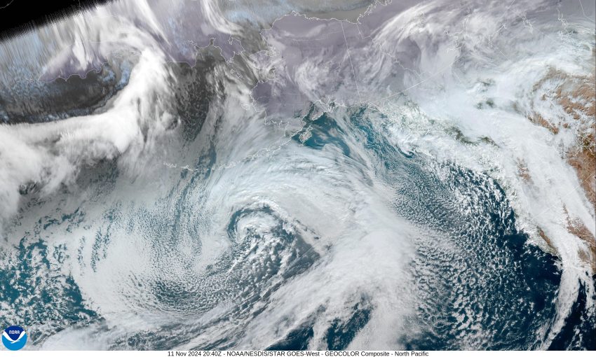
As for this Veteran, I am afraid the weather never takes a day off, so we had the first in a series of systems bring a decent amount of rain from yesterday evening through this morning. The coast also saw some gusty winds of 30-50 in a few spots. This all transitioned to post frontal showers for the afternoon, and being an unstable airmass, there was that chance of thunderstorms that continues to exist tonight. The thunderstorm threat eases by around midnight, still the breezy southwesterly winds 10-15 gusting to 25, tonight’s low temperature near 44.

Another exciting day tomorrow, we start out with more showers that will become more scattered, the winds are increasing to southerly 15-20 gusting to 25, again, higher at the beaches, the high near 55. Another system moves in tomorrow night, and we see increasing rain and winds, those winds becoming southerly 20-25 gusting to 40, gusting to near 50 down at the beaches. And not to leave the winds out, there is a High Wind Watch from tomorrow evening through early Wednesday morning for southerly winds possibly 30-40 gusting to 60 at the beaches. And not to leave the winds out, there is a High Wind Watch from Tuesday evening through early Wednesday morning for southerly winds possibly 30-40 gusting to 60 at the beaches.

Back to showers with possible thunderstorms Wednesday, the winds still elevated from the southwest 20-25 gusting to 35, highs near 56. Still more showers with possible thunderstorms Wednesday night, and still breezy, the low near 44.

As far as how much rain is expected for the area with this system, well, the best guess is 2 to 2 1/2” in town and 2-4″ in the Coast Range. This will drive the rivers up some more, and though the current river forecasts do reflect a flooding chance, the NWS folks say there is about a 15% chance the level could actually reach minor Flood Stage. There is also a chance of Tidal Overflow Flooding in the usual locations in the county during the astronomically high tides (King Tides) on Wednesday and Thursday. With prolonged periods of moderate rain, Urban and Small Stream Flooding is also possible.

So, for Thursday, the cool, showery weather, with the thunderstorm threat, will continue during the day Thursday as a trough of low pressure moves across, then moves east of us on Friday, so the shower chance eases Friday night but, more systems are expected to bring rain and rainshowers Saturday with rainy and breezy conditions for Sunday. I guess it’s that time of year!

And for any NWS Advisories, Watches or Warnings, there are a few: Offshore waters have a Storm Watch valid from 4pm tomorrow through Wednesday at 7am, and a Hazardous Seas Warning valid now through 4pm tomorrow. All this is causing a High Surf Advisory for the coast that is valid from midnight tonight to 4pm tomorrow. That is the list for now, subject to change as always.

Featured Video

Slide Contribute SUBSCRIBE

Tillamook Weather

Tides

Tillamook County Pioneer Podcast Series

Tillamook Church Search

Cloverdale Baptist Church
Nestucca Valley Presbyterian
Tillamook Ecumenical Service

Archives

  • Home
  • EULA Privacy Policy
  • Contact
  • Opt-out preferences
  • Search...
Share on facebook
Facebook
Share on pinterest
Pinterest
Share on twitter
Twitter
Share on linkedin
Linkedin
Catherine

Recent Posts

  • David's Chair Now Available at Rockaway Beach - Official Dedication, Blessing May 17th

    May 21, 2025
  • GORDON'S VOLCANO UPDATE 5/21/25: Volcano to Erupt West of Astoria THIS YEAR!

    May 21, 2025
  • A PERSONAL POINT OF PRIVILEGE: Hurry Up and Wait

    May 21, 2025
©2025 | Theme by SuperbThemes

Manage Cookie Consent
To provide the best experiences, we use technologies like cookies to store and/or access device information. Consenting to these technologies will allow us to process data such as browsing behavior or unique IDs on this site. Not consenting or withdrawing consent, may adversely affect certain features and functions.
Functional Always active
The technical storage or access is strictly necessary for the legitimate purpose of enabling the use of a specific service explicitly requested by the subscriber or user, or for the sole purpose of carrying out the transmission of a communication over an electronic communications network.
Preferences
The technical storage or access is necessary for the legitimate purpose of storing preferences that are not requested by the subscriber or user.
Statistics
The technical storage or access that is used exclusively for statistical purposes. The technical storage or access that is used exclusively for anonymous statistical purposes. Without a subpoena, voluntary compliance on the part of your Internet Service Provider, or additional records from a third party, information stored or retrieved for this purpose alone cannot usually be used to identify you.
Marketing
The technical storage or access is required to create user profiles to send advertising, or to track the user on a website or across several websites for similar marketing purposes.
Manage options Manage services Manage {vendor_count} vendors Read more about these purposes
View preferences
{title} {title} {title}