By Gordon McCraw, Meteorologist for the Tillamook County Pioneer
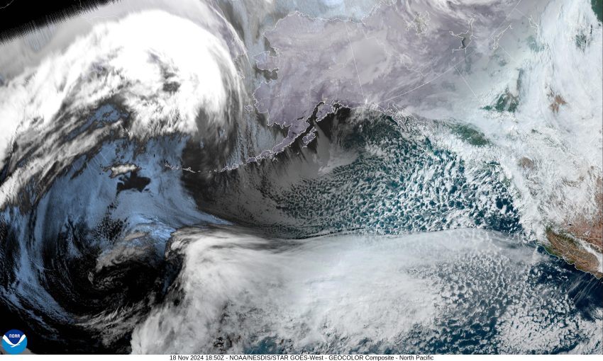
So, all weekend I have been monitoring the potential for an atmospheric river event developing over the area that would bring prolonged moderate rain, that could drive the rivers up to Flood Level. Good news for Tillamook County, while the likelihood of the atmospheric river event occurring increased, the models are coming into better agreement that the hose will be pointed to the south, towards southern Oregon and northern California, and their river forecasts are starting to reflect that change. I have also been monitoring the Tillamook County forecasts, which I am happy to report, are now trending lower, remaining below even Action Stage.
Back to the local forecast, today and tonight we will continue to see scattered showers with possible thunderstorms moving over the area. These are rotating under the parent low pressure area up off the coast of British Columbia. The winds this evening remain southwesterly 5-10 but becoming more southeasterly after midnight.
That low pressure area drifts southward tomorrow so we continue to see showers with possible thunderstorms. It does increase the winds, becoming southeasterly 8-12 in the morning but continuing to increase, becoming southeasterly 15-20 gusting to 30, the afternoon high temperature near 50. Tomorrow night looks rainy and windy with southerly winds 25-30 gusting to 45, but starts to ease some after around midnight, becoming southerly 15-20 gusting to 25-30. Tomorrow night looks to be the rainiest with the chance of seeing 1-2” of rain in town, 2-3” in the Coast Range. This will drive the rivers up on Wednesday but again, still not reaching Action Stage.
Back to showers with possible thunderstorms Wednesday as the hose shifts south, but the low pressure area continues to rotate somewhere west of Oregon or Washington. The models aren’t handling what happens next very well but for now, it appears the low spins off to the east, there could be another low developing to the south, west of California, that drifts northward and could bring another plume of moisture across the area Thursday and/or Friday.
As for the weekend, it appears another weaker system means more rain for Saturday and Sunday.
So, the big picture review, the latest models are painting a better picture for the Tillamook area, pushing the atmospheric river southward before it stalls over southern Oregon or northern California, leaving us wet, but not flooding, other than some Urban and Small Stream Flooding maybe tomorrow night. The only certainty about weather though, is the uncertainty, so I would suggest keeping a close eye on things, including the rivers, especially if you live in a flood prone area, over the next few days. The Atmospheric River is going to do whatever it wants to do, and I know it is hard to believe, but the models have been wrong before!
So, for now, the Advisories, Watches and Warnings are as follows:
– Hazardous Seas Warning until 7pm tonight
– Storm Warning from 10am tomorrow thru Wednesday at 4am.
– Beach Hazards Statement (Sneaker Waves) until 10pm tonight.
– High Wind Watch from tomorrow at 4pm thru Wednesday at 4am.
– Hydrological Outlook discussing the flooding potential
– Winter Weather Advisory for the Coast Range until 10pm tonight.
Obviously, all these are subject to change as conditions change. Stay alert and prepared for any unexpected changes that could significantly impact you. Stay tuned, I will send the Pioneer an update if warranted.