Menu
  • Home
  • Breaking News
  • Feature
    • Arts
    • Astrology
    • Business
    • Community
    • Employment
    • Event Stories
    • From the Pioneer
    • Government
    • Letters to the Editor
    • Non Profit News
    • Obituary
    • Public Safety
    • Podcast Interview Articles
    • Pioneer Pulse Podcast: Politics, Palette, and Planet – the Playlist
  • Weather
  • Guest Column
    • Perspectives
    • Don Backman Photos
    • Ardent Gourmet
    • Kitchen Maven
    • I’ve been thinking
    • Jim Heffernan
    • The Littoral Life
    • Neal Lemery
    • View From Here
    • Virginia Carrell Prowell
    • Words of Wisdom
  • Things to do
    • Calendar
    • Tillamook County Parks
    • Tillamook County Hikes
    • Whale Watching
    • Tillamook County Library
    • SOS Community Calendar
  • About
    • Contribute
    • Advertise
    • Subscribe
    • Opt-out preferences
  • Post Submission Test
  • Search...
Menu

GORDON’S WEEKLY WEATHER UPDATE 12/30/24: A year-end break, then the rain resumes – Happy New Year Y’All!

Posted on December 30, 2024 by Editor

By Gordon McCraw, Meteorologist for the Tillamook County Pioneer

So, if it looked like I disappeared over Christmas, I got a special gift from an unknown person, I had/have the flu, and a severe case at that. I am slowly coming back so you should see things returning to ahh, I think the word is normal? Other things that happened over the Christmas period were lots of rain. On Christmas Day we saw around 2.61” of rain in the Tillamook Area with several more days of between 1” and 1.5” of rain, then add to this on the 26th, Astoria recorded wind gusts of 64, Tillamook 59, and Pacific City 67. The winds caused a lot of work for TPUD and the rain caused a couple of the rivers to reach near bankfull a couple of times. Now the good news, the weather is slowing down, finally!

After a day with scattered showers, tonight we see a ridge of high pressure moving in. This will give us partly cloudy skies with calm winds which allow for some radiational cooling tonight, so the low looks to fall into the mid 30s. There is still a slight chance of a light shower sneaking in, especially near the Coast Range.

As another system approaches on Tuesday, the last day of 2024, we see increasing clouds, there is a chance of some widely scattered showers in the afternoon, the winds becoming southeasterly 4-8, highs near 48. The rain returns tomorrow night, still the light southeasterly winds, lows near 38.

Welcome to the first day of 2025 (Wednesday) that is highlighted by, yep, you guessed it, more rain from another front that will move through. The winds will only be southerly 4-8, the high near 51, the rain continues Wednesday night, lows near 42.

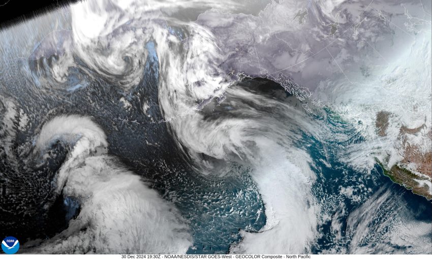
A look at the models for Thursday on shows us under a southwesterly flow with a ridge just to the east and a trough approaching from the west with a couple of low pressure areas thrown into the mix just to make the forecast more challenging. What all this means for us is, continued cloudy with more rain each day, including the weekend. High temperatures remain in the low to mid 50s, lows in the low to mid 40s.

I do see where the Climate Prediction Center is hinting that we could see warmer and drier weather in the 8 to 10 day forecast. I looked at the long range models myself and they appear to support this with a large high pressure area centered over the eastern Pacific with an associated ridge pushing up past Vancouver Island and this pattern appears to persist for that whole week. We’ll see …

Featured Video

Slide Contribute SUBSCRIBE

Tillamook Weather

Tides

Tillamook County Pioneer Podcast Series

Tillamook Church Search

Cloverdale Baptist Church
Nestucca Valley Presbyterian
Tillamook Ecumenical Service

Archives

  • Home
  • EULA Privacy Policy
  • Contact
  • Opt-out preferences
  • Search...
Share on facebook
Facebook
Share on pinterest
Pinterest
Share on twitter
Twitter
Share on linkedin
Linkedin
Catherine

Recent Posts

  • David's Chair Now Available at Rockaway Beach - Official Dedication, Blessing May 17th

    May 21, 2025
  • GORDON'S VOLCANO UPDATE 5/21/25: Volcano to Erupt West of Astoria THIS YEAR!

    May 21, 2025
  • A PERSONAL POINT OF PRIVILEGE: Hurry Up and Wait

    May 21, 2025
©2025 | Theme by SuperbThemes

Manage Cookie Consent
To provide the best experiences, we use technologies like cookies to store and/or access device information. Consenting to these technologies will allow us to process data such as browsing behavior or unique IDs on this site. Not consenting or withdrawing consent, may adversely affect certain features and functions.
Functional Always active
The technical storage or access is strictly necessary for the legitimate purpose of enabling the use of a specific service explicitly requested by the subscriber or user, or for the sole purpose of carrying out the transmission of a communication over an electronic communications network.
Preferences
The technical storage or access is necessary for the legitimate purpose of storing preferences that are not requested by the subscriber or user.
Statistics
The technical storage or access that is used exclusively for statistical purposes. The technical storage or access that is used exclusively for anonymous statistical purposes. Without a subpoena, voluntary compliance on the part of your Internet Service Provider, or additional records from a third party, information stored or retrieved for this purpose alone cannot usually be used to identify you.
Marketing
The technical storage or access is required to create user profiles to send advertising, or to track the user on a website or across several websites for similar marketing purposes.
Manage options Manage services Manage {vendor_count} vendors Read more about these purposes
View preferences
{title} {title} {title}