Menu
  • Home
  • Breaking News
  • Feature
    • Arts
    • Astrology
    • Business
    • Community
    • Employment
    • Event Stories
    • From the Pioneer
    • Government
    • Letters to the Editor
    • Non Profit News
    • Obituary
    • Public Safety
    • Podcast Interview Articles
    • Pioneer Pulse Podcast: Politics, Palette, and Planet – the Playlist
  • Weather
  • Guest Column
    • Perspectives
    • Don Backman Photos
    • Ardent Gourmet
    • Kitchen Maven
    • I’ve been thinking
    • Jim Heffernan
    • The Littoral Life
    • Neal Lemery
    • View From Here
    • Virginia Carrell Prowell
    • Words of Wisdom
  • Things to do
    • Calendar
    • Tillamook County Parks
    • Tillamook County Hikes
    • Whale Watching
    • Tillamook County Library
    • SOS Community Calendar
  • About
    • Contribute
    • Advertise
    • Subscribe
    • Opt-out preferences
  • Post Submission Test
  • Search...
Menu

GORDON’S WEEKLY WEATHER UPDATE 8/19/24: Chance of Showers

Posted on August 19, 2024 by Editor
www.tillamookcountypioneer.net

By Gordon McCraw, Meteorologist for the Tillamook County Pioneer
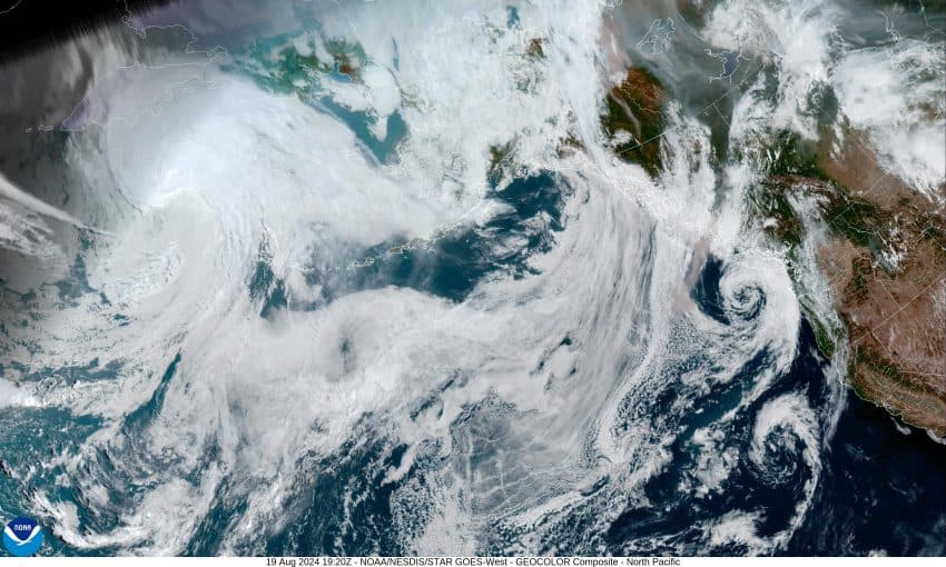
That low pressure area that gave us all the rain and thunderstorms over the weekend, is now meandering off the Washington/Vancouver Island coast, bringing rain and showers north of Astoria. It looks like this low will start to drift southeastward tonight a give us a chance of showers under mostly cloudy skies, after around midnight, with calm winds, patchy fog is also possible, the low tonight near 57.

The best chance of showers is early tomorrow morning as the low drifts inland across Washington, giving the area about a 50% chance of showers, the winds becoming southerly 4-8, the afternoon high near 68. The low continues to slowly move eastward tomorrow night with its associated trough extending southwestward across the area which will continue to give us a diminishing slight chance of showers tomorrow night in the southwesterly flow, the winds die off so patchy fog is again possible, lows near 56.

By Wednesday, the low has weakened and ejected well east as another low pressure area drops down the coast, off British Columbia towards Vancouver Island. This low will continue southward during the day and bring a return of some showers under continued mostly cloudy skies, the winds becoming southwesterly 5-10, highs near 66. We see more showers Wednesday night, with light southwesterly winds, the low near 54.

More showers are likely Thursday with the low pressure area lingering off the Oregon coast, highs near 64, still with the mostly cloudy skies, the low that night near 53. After that, the forecast gets a little harder to pin down as the models have a hard time with exactly what that low pressure area will do. It looks like it moves down the coast Friday which would give us a chance of showers, then Saturday it pushes into northern California before turning north and moving into central Oregon, so Saturday looks showery also, highs near 65, lows near 55.

By Sunday, the models have the low moving east into Idaho which would give us improving conditions with a weak ridge of high pressure moving across our area so we see partly sunny skies and dry on Sunday, the high up near 70, then partly cloudy skies Sunday night, lows near 56.

Featured Video

Slide Contribute SUBSCRIBE

Tillamook Weather

Tides

Tillamook County Pioneer Podcast Series

Tillamook Church Search

Cloverdale Baptist Church
Nestucca Valley Presbyterian
Tillamook Ecumenical Service

Archives

  • Home
  • EULA Privacy Policy
  • Contact
  • Opt-out preferences
  • Search...
Share on facebook
Facebook
Share on pinterest
Pinterest
Share on twitter
Twitter
Share on linkedin
Linkedin
Catherine

Recent Posts

  • David's Chair Now Available at Rockaway Beach - Official Dedication, Blessing May 17th

    May 21, 2025
  • GORDON'S VOLCANO UPDATE 5/21/25: Volcano to Erupt West of Astoria THIS YEAR!

    May 21, 2025
  • A PERSONAL POINT OF PRIVILEGE: Hurry Up and Wait

    May 21, 2025
©2025 | Theme by SuperbThemes

Manage Cookie Consent
To provide the best experiences, we use technologies like cookies to store and/or access device information. Consenting to these technologies will allow us to process data such as browsing behavior or unique IDs on this site. Not consenting or withdrawing consent, may adversely affect certain features and functions.
Functional Always active
The technical storage or access is strictly necessary for the legitimate purpose of enabling the use of a specific service explicitly requested by the subscriber or user, or for the sole purpose of carrying out the transmission of a communication over an electronic communications network.
Preferences
The technical storage or access is necessary for the legitimate purpose of storing preferences that are not requested by the subscriber or user.
Statistics
The technical storage or access that is used exclusively for statistical purposes. The technical storage or access that is used exclusively for anonymous statistical purposes. Without a subpoena, voluntary compliance on the part of your Internet Service Provider, or additional records from a third party, information stored or retrieved for this purpose alone cannot usually be used to identify you.
Marketing
The technical storage or access is required to create user profiles to send advertising, or to track the user on a website or across several websites for similar marketing purposes.
Manage options Manage services Manage {vendor_count} vendors Read more about these purposes
View preferences
{title} {title} {title}