Menu
  • Home
  • Breaking News
  • Feature
    • Arts
    • Astrology
    • Business
    • Community
    • Employment
    • Event Stories
    • From the Pioneer
    • Government
    • Letters to the Editor
    • Non Profit News
    • Obituary
    • Public Safety
    • Podcast Interview Articles
    • Pioneer Pulse Podcast: Politics, Palette, and Planet – the Playlist
  • Weather
  • Guest Column
    • Perspectives
    • Don Backman Photos
    • Ardent Gourmet
    • Kitchen Maven
    • I’ve been thinking
    • Jim Heffernan
    • The Littoral Life
    • Neal Lemery
    • View From Here
    • Virginia Carrell Prowell
    • Words of Wisdom
  • Things to do
    • Calendar
    • Tillamook County Parks
    • Tillamook County Hikes
    • Whale Watching
    • Tillamook County Library
    • SOS Community Calendar
  • About
    • Contribute
    • Advertise
    • Subscribe
    • Opt-out preferences
  • Post Submission Test
  • Search...
Menu

GORDON’S UPDATE: Weather 10/11/23; Cloudy forecast for Sat. 10/14 “Eclipse Day”

Posted on October 11, 2023 by Editor

By Gordon McCraw, Meteorologist for the Tillamook County Pioneer
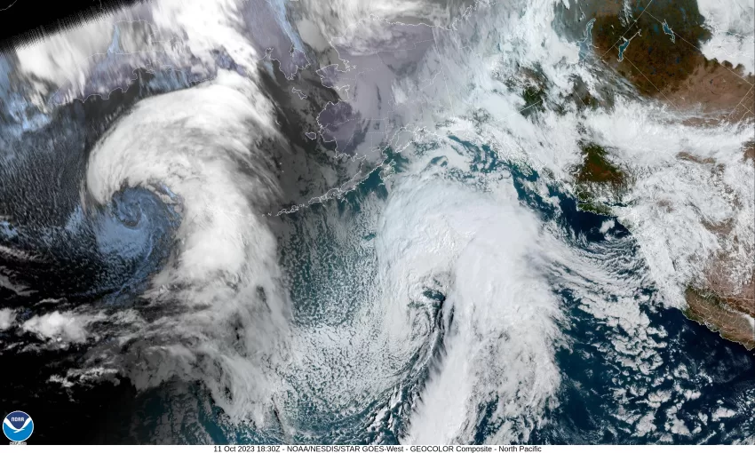
The low pressure area that has been triggering the showers and thunderstorms moved into central and northern Washington this morning but we continued to see showers rotating in, off the ocean, impacting our area. With the low moving inland, the thunderstorm threat diminished this afternoon, and now, we just see some weaker scattered showers coming in. The activity is starting to diminish this evening as a weak high pressure ridge is building in, capping the activity. Winds will become light and variable tonight and the low temperature drops to around 49.

Any remaining widely scattered light showers end tomorrow morning as the clouds diminish. There is a slight chance of some patchy morning fog then the winds become easterly 4-8, highs up near 67, then mostly cloudy skies return tomorrow night, the winds becoming easterly 10-15 gusting to 25, lows near 51.

By Friday the ridge weakens and shifts eastward as a trough of low pressure moves in and brings clouds and an increasing chance of rain starting that afternoon, the high near 66. That night looks cloudy and rainy with the winds more southerly, the low around 51.

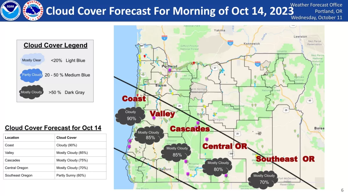
You might have heard that there’s another event on Saturday October 14th – an annular eclipse … and the forecast is for cloudy across much/most of the area on Saturday. We may see a short break, but there will be another trough moving in so Saturday remains cloudy and rainy with highs near 61 and lows near 52.

Sunday things become less clear as we see a ridge of high pressure building off to the east. Some of the models keep it far east enough not to impact our weather, meaning we continue to see more rain rotating in with a trough of low pressure. Some of the models show the ridge building in further west, this would keep the rain further west and north. Going with the model I usually use, the forecast is for cloudy and rainy conditions, highs near 64, lows near 53.

It looks like Monday and Tuesday we have another trough of low pressure moving in that would bring more rain and winds to the coast and Coast Range, highs remain in the mid 60s, lows in the low 50.

Featured Video

Slide Contribute SUBSCRIBE

Tillamook Weather

Tides

Tillamook County Pioneer Podcast Series

Tillamook Church Search

Cloverdale Baptist Church
Nestucca Valley Presbyterian
Tillamook Ecumenical Service

Archives

  • Home
  • EULA Privacy Policy
  • Contact
  • Opt-out preferences
  • Search...
Share on facebook
Facebook
Share on pinterest
Pinterest
Share on twitter
Twitter
Share on linkedin
Linkedin
Catherine

Recent Posts

  • NEHALEM BAY STATE PARK TO OPEN DAY-USE AREAS, BOAT LAUNCH MAY 23, CAMPGROUND REMAINS CLOSED

    May 14, 2025
  • MANZANITA FARMERS MARKET OPENS FRIDAY MAY 16TH!!

    May 14, 2025
  • Vote NO on Increasing Taxes in Tillamook County

    May 14, 2025
©2025 | Theme by SuperbThemes

Manage Cookie Consent
To provide the best experiences, we use technologies like cookies to store and/or access device information. Consenting to these technologies will allow us to process data such as browsing behavior or unique IDs on this site. Not consenting or withdrawing consent, may adversely affect certain features and functions.
Functional Always active
The technical storage or access is strictly necessary for the legitimate purpose of enabling the use of a specific service explicitly requested by the subscriber or user, or for the sole purpose of carrying out the transmission of a communication over an electronic communications network.
Preferences
The technical storage or access is necessary for the legitimate purpose of storing preferences that are not requested by the subscriber or user.
Statistics
The technical storage or access that is used exclusively for statistical purposes. The technical storage or access that is used exclusively for anonymous statistical purposes. Without a subpoena, voluntary compliance on the part of your Internet Service Provider, or additional records from a third party, information stored or retrieved for this purpose alone cannot usually be used to identify you.
Marketing
The technical storage or access is required to create user profiles to send advertising, or to track the user on a website or across several websites for similar marketing purposes.
Manage options Manage services Manage {vendor_count} vendors Read more about these purposes
View preferences
{title} {title} {title}